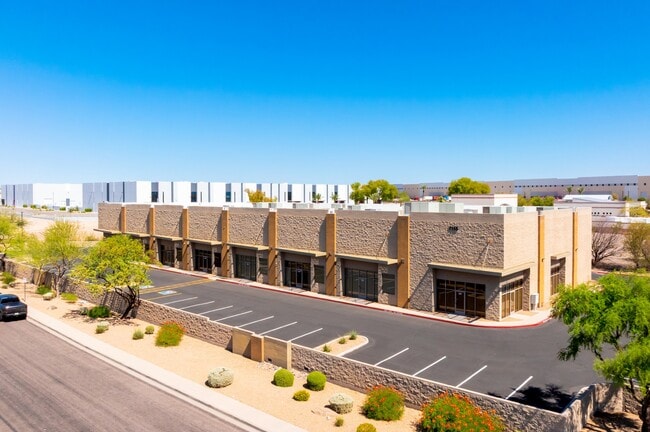
Property Record
7115 N 110Th Ave, Glendale, AZ 85307
Current Lease Availabilities
Property Detail
7115 N 110Th Ave
142-59-085
GLEN HARBOR BUSINESS LOT 20 CONDOMINIUM MCR 907-34 UNIT 6 (PLEASE NOTE: FOR LEGAL DESCRIPTION REFERENCES REGARDING THE PERCENTAGE OF OWNERSHIP OF THE COMMON AREA(S) PLEASE REFER TO THE RECORDED COVENANTS, CONDITIONS AND RESTRICTIONS (CCR) ASSOCIAED W
Warehouse
Maricopa
I-1
Arizona
C and X Area of minimal flood hazard, usually depicted on FIRMs as above the 500-year flood level.
20
2025
0.06 AC
2025
Glendale
092720
Phoenix
19,330 SF
Phoenix-Mesa-Chandler, AZ
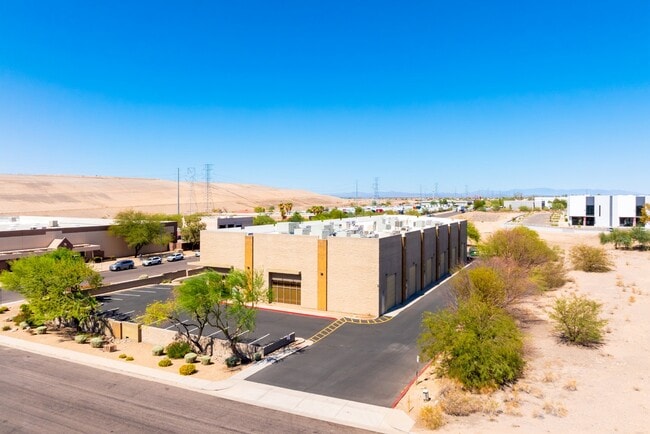
NEARBY LISTINGS FOR SALE OR LEASE
DEMOGRAPHICS near 7115 N 110Th Ave
1 mile
3 mile
5 mile
2025 Total Population
1,361
68,778
261,364
2030 Population
1,521
72,589
273,499
Pop Growth 2025-2030
+ 11.76%
+ 5.54%
+ 4.64%
Average Age
37
38
38
2025 Total Households
465
24,428
88,441
HH Growth 2025-2030
+ 11.40%
+ 5.51%
+ 4.86%
Median Household Inc
$86,590
$80,022
$77,148
Avg Household Size
2.90
2.70
2.80
2025 Avg HH Vehicles
2.00
2.00
2.00
Median Home Value
$420,000
$386,323
$371,726
Median Year Built
2002
1999
1996
Nearby Places
Map Layers
Map Styles
 Street
 Aerial
Layers
 Traffic
 Biking
Places
Listings with unknown addresses are not visible on the map
- Restaurants
- Banks
- Shops
- Fitness
- Groceries
PUBLIC TRANSPORTATION
AIRPORT
Phoenix Sky Harbor International
Drive
Walk
Distance
Phoenix Sky Harbor International
34 min
24.3 mi
Freight Ports
Port of San Diego
Drive
Walk
Distance
Port of San Diego
390 min
350.2 mi
Nearby Properties
Address
Land Use
TOTAL SIZE
Lot Size
Zoning
Address
Land Use
TOTAL SIZE
Lot Size
Zoning
1,449,251 SF
25.30 AC
A1
Address
Land Use
TOTAL SIZE
Lot Size
Zoning
303,419 SF
31.47 AC
Address
Land Use
TOTAL SIZE
Lot Size
Zoning
127,011 SF
30.62 AC
PAD
Address
Land Use
TOTAL SIZE
Lot Size
Zoning
0.68 AC
Address
Land Use
TOTAL SIZE
Lot Size
Zoning
630,367 SF
13.50 AC
PAD
Address
Land Use
TOTAL SIZE
Lot Size
Zoning
74,628 SF
2.74 AC
PAD
Address
Land Use
TOTAL SIZE
Lot Size
Zoning
52.99 AC
Address
Land Use
TOTAL SIZE
Lot Size
Zoning
13,861 SF
3.40 AC
PAD
Address
Land Use
TOTAL SIZE
Lot Size
Zoning
242,300 SF
41.79 AC
C-C
Address
Land Use
TOTAL SIZE
Lot Size
Zoning
443,840 SF
37.94 AC
PAD
Address
Land Use
TOTAL SIZE
Lot Size
Zoning
687,993 SF
48.80 AC
Address
Land Use
TOTAL SIZE
Lot Size
Zoning
844,524 SF
130.66 AC
LUKEAFB
Address
Land Use
TOTAL SIZE
Lot Size
Zoning
533,718 SF
36.10 AC
PAD
Address
Land Use
TOTAL SIZE
Lot Size
Zoning
258,097 SF
32.53 AC
AG
Address
Land Use
TOTAL SIZE
Lot Size
Zoning
660,838 SF
29.28 AC
C2
Address
Land Use
TOTAL SIZE
Lot Size
Zoning
603,148 SF
13.63 AC
PAD
Address
Land Use
TOTAL SIZE
Lot Size
Zoning
185,870 SF
125.41 AC
S1
Address
Land Use
TOTAL SIZE
Lot Size
Zoning
135,052 SF
5.52 AC
PAD
Address
Land Use
TOTAL SIZE
Lot Size
Zoning
531,110 SF
124.24 AC
I-1
Address
Land Use
TOTAL SIZE
Lot Size
Zoning
269,894 SF
22.73 AC
R3A
Address
Land Use
TOTAL SIZE
Lot Size
Zoning
342,527 SF
16.52 AC
PAD
Address
Land Use
TOTAL SIZE
Lot Size
Zoning
330,321 SF
3.85 AC
PAD
Address
Land Use
TOTAL SIZE
Lot Size
Zoning
637,538 SF
9.74 AC
Address
Land Use
TOTAL SIZE
Lot Size
Zoning
334,769 SF
12.01 AC
Address
Land Use
TOTAL SIZE
Lot Size
Zoning
4,742 SF
1.18 AC
PAD
Address
Land Use
TOTAL SIZE
Lot Size
Zoning
409,017 SF
14.30 AC
Address
Land Use
TOTAL SIZE
Lot Size
Zoning
291,028 SF
20.62 AC
Address
Land Use
TOTAL SIZE
Lot Size
Zoning
131,031 SF
26.44 AC
R-43
Address
Land Use
TOTAL SIZE
Lot Size
Zoning
327,311 SF
21.14 AC
RM-1
Address
Land Use
TOTAL SIZE
Lot Size
Zoning
321,976 SF
13 AC
R-43
The World's #1 Commercial Real Estate Marketplace
Connect with us
© 2026 CoStar Group
The information above has been obtained from sources believed reliable. While we do not doubt its accuracy we have not verified it and make no guarantee, warranty or representation about it. It is your responsibility to independently confirm its accuracy and completeness. Any projections, opinions, assumptions, or estimates used are for example only and do not represent the current or future performance of the property. The value of this transaction to you depends on tax and other factors which should be evaluated by your tax, financial, and legal advisors. You and your advisors should conduct a careful, independent investigation of the property to determine to your satisfaction the suitability of the property for your needs.