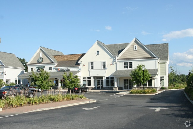
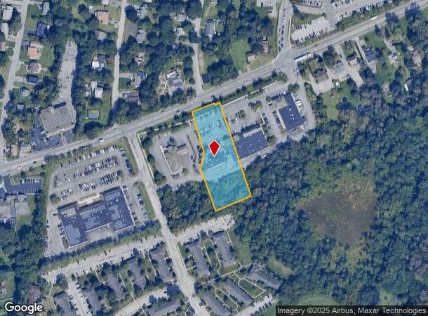
Property Record
712 Dutchess Tpke, Poughkeepsie, NY 12603
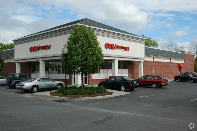
NEARBY LISTINGS FOR SALE OR LEASE
Property Detail
712 Dutchess Tpke
Dutchess County-Putnam County, NY
Design Properties Llc 04 Lt Su
134689-6261-01-363903-0000
1.37 AC (S) 22001 02055 2025 0478
Regionalshoppingcenterormallwithanchorstore
Dutchess
X
New York
36027C0359E
363
2025
1.37 AC
2024
Fishkill
140201
Westchester/So Connecticut
7,004 SF
DEMOGRAPHICS near 712 Dutchess Tpke
1 Mile
3 Mile
5 Mile
2024 Total Population
7,529
61,457
102,657
2029 Population
7,567
61,603
102,771
Pop Growth 2024-2029
+ 0.50%
+ 0.24%
+ 0.11%
Average Age
36
40
40
2024 Total Households
2,390
24,140
38,293
HH Growth 2024-2029
+ 0.75%
+ 0.32%
+ 0.17%
Median Household Inc
$55,970
$64,917
$77,051
Avg Household Size
2.30
2.30
2.40
2024 Avg HH Vehicles
2.00
2.00
2.00
Median Home Value
$224,435
$272,639
$304,434
Median Year Built
1969
1961
1965
Nearby Places
- Restaurants
- Banks
- Shops
- Fitness
- Groceries
PUBLIC TRANSPORTATION
COMMUTER RAIL
Poughkeepsie Station (Hudson Line - Metro-North Commuter Railroad Company (Metro-North))
DRIVE
WALK
Distance
Poughkeepsie Station (Hudson Line - Metro-North Commuter Railroad Company (Metro-North))
7 min
3.6 mi
AIRPORT
New York Stewart International
DRIVE
WALK
Distance
New York Stewart International
40 min
26.9 mi
Nearby Properties
Address
Land Use
TOTAL SIZE
Lot Size
Zoning
Address
Land Use
TOTAL SIZE
Lot Size
Zoning
640,854 SF
21.22 AC
H-M
Address
Land Use
TOTAL SIZE
Lot Size
Zoning
1,279,884 SF
255.89 AC
IN
Address
Land Use
TOTAL SIZE
Lot Size
Zoning
539,228 SF
62.57 AC
IN
Address
Land Use
TOTAL SIZE
Lot Size
Zoning
314,927 SF
24.59 AC
IN
Address
Land Use
TOTAL SIZE
Lot Size
Zoning
488,904 SF
12.90 AC
R-3
Address
Land Use
TOTAL SIZE
Lot Size
Zoning
127,976 SF
6.57 AC
OR
Address
Land Use
TOTAL SIZE
Lot Size
Zoning
3 AC
R-D
Address
Land Use
TOTAL SIZE
Lot Size
Zoning
108,096 SF
2.50 AC
C-2
Address
Land Use
TOTAL SIZE
Lot Size
Zoning
105,762 SF
2.41 AC
H-M
Address
Land Use
TOTAL SIZE
Lot Size
Zoning
12,638 SF
159.73 AC
R2A
Address
Land Use
TOTAL SIZE
Lot Size
Zoning
5.29 AC
I-2
Address
Land Use
TOTAL SIZE
Lot Size
Zoning
296,400 SF
0.66 AC
C-2
Address
Land Use
TOTAL SIZE
Lot Size
Zoning
218,118 SF
13.15 AC
FC
Address
Land Use
TOTAL SIZE
Lot Size
Zoning
179,351 SF
18.34 AC
IN
Address
Land Use
TOTAL SIZE
Lot Size
Zoning
167,456 SF
18.50 AC
RM
Address
Land Use
TOTAL SIZE
Lot Size
Zoning
175,204 SF
4.50 AC
MHC
Address
Land Use
TOTAL SIZE
Lot Size
Zoning
119,832 SF
18.20 AC
RM
Address
Land Use
TOTAL SIZE
Lot Size
Zoning
2.53 AC
R-D
Address
Land Use
TOTAL SIZE
Lot Size
Zoning
121,040 SF
16.05 AC
OPD
Address
Land Use
TOTAL SIZE
Lot Size
Zoning
23,044 SF
12.60 AC
R-5
Address
Land Use
TOTAL SIZE
Lot Size
Zoning
82,739 SF
6.16 AC
IN
Address
Land Use
TOTAL SIZE
Lot Size
Zoning
32,864 SF
22.85 AC
RM
Address
Land Use
TOTAL SIZE
Lot Size
Zoning
30,420 SF
11.30 AC
R-2
Address
Land Use
TOTAL SIZE
Lot Size
Zoning
55,299 SF
1.45 AC
C-1
Address
Land Use
TOTAL SIZE
Lot Size
Zoning
179,206 SF
8.19 AC
R-4
Address
Land Use
TOTAL SIZE
Lot Size
Zoning
31,608 SF
57 AC
IN
Address
Land Use
TOTAL SIZE
Lot Size
Zoning
297,663 SF
4.45 AC
H-M
Address
Land Use
TOTAL SIZE
Lot Size
Zoning
56,477 SF
38.98 AC
IN
Address
Land Use
TOTAL SIZE
Lot Size
Zoning
6.24 AC
I
Address
Land Use
TOTAL SIZE
Lot Size
Zoning
115,817 SF
5.93 AC
R5
The World's #1 Commercial Real Estate Marketplace
Connect with us
© 2025 CoStar Group
The information above has been obtained from sources believed reliable. While we do not doubt its accuracy we have not verified it and make no guarantee, warranty or representation about it. It is your responsibility to independently confirm its accuracy and completeness. Any projections, opinions, assumptions, or estimates used are for example only and do not represent the current or future performance of the property. The value of this transaction to you depends on tax and other factors which should be evaluated by your tax, financial, and legal advisors. You and your advisors should conduct a careful, independent investigation of the property to determine to your satisfaction the suitability of the property for your needs.