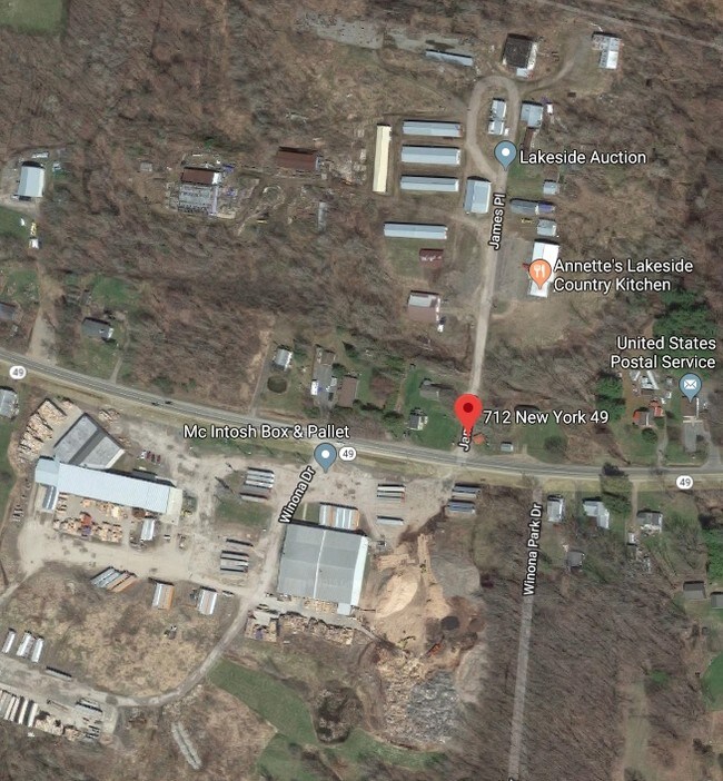
Property Record
712 State Route 49, Bernhards Bay, NY 13028
NEARBY LISTINGS FOR SALE OR LEASE
Property Detail
712 State Route 49
Syracuse, NY
Oswego
352689-311-008-0002-007-000-0000
New York
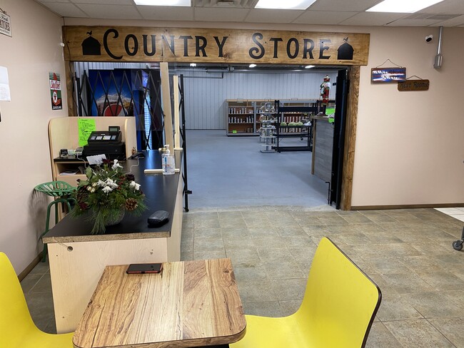
Warehouse
15.07 AC
X
Oswego County
36075C0702G
Syracuse
5,050 SF
DEMOGRAPHICS near 712 State Route 49
1 Mile
3 Mile
5 Mile
2024 Total Population
475
2,153
4,733
2029 Population
479
2,168
4,762
Pop Growth 2024-2029
+ 0.84%
+ 0.70%
+ 0.61%
Average Age
45
44
44
2024 Total Households
194
865
1,921
HH Growth 2024-2029
+ 0.52%
+ 0.69%
+ 0.62%
Median Household Inc
$69,473
$67,791
$69,426
Avg Household Size
2.50
2.50
2.50
2024 Avg HH Vehicles
3.00
2.00
2.00
Median Home Value
$129,651
$130,343
$137,218
Median Year Built
1974
1971
1971
Nearby Places
Map Layers
Map Styles
 Street
 Aerial
- Restaurants
- Banks
- Shops
- Fitness
- Groceries
PUBLIC TRANSPORTATION
AIRPORT
Syracuse Hancock International
DRIVE
WALK
Distance
Syracuse Hancock International
35 min
25.0 mi
Freight Ports
Albany, NY Port
DRIVE
WALK
Distance
Albany, NY Port
171 min
138.1 mi
SALE & LEASE HISTORY
LISTING DATE
SALE/LEASE

Mar 22, 2019
For Sale
Feb 10, 2021
For Sale
Nearby Properties
Address
Land Use
TOTAL SIZE
Lot Size
Zoning
Address
Land Use
TOTAL SIZE
Lot Size
Zoning
1,698 SF
883.53 AC
Address
Land Use
TOTAL SIZE
Lot Size
Zoning
2,344 SF
763.78 AC
0
Address
Land Use
TOTAL SIZE
Lot Size
Zoning
12,500 SF
27.52 AC
0
Address
Land Use
TOTAL SIZE
Lot Size
Zoning
Address
Land Use
TOTAL SIZE
Lot Size
Zoning
924 SF
3.31 AC
0
Address
Land Use
TOTAL SIZE
Lot Size
Zoning
5,984 SF
1.29 AC
Address
Land Use
TOTAL SIZE
Lot Size
Zoning
1.73 AC
01 - NOT Z
Address
Land Use
TOTAL SIZE
Lot Size
Zoning
3,770 SF
7.39 AC
Address
Land Use
TOTAL SIZE
Lot Size
Zoning
7,880 SF
12.20 AC
01 - NOT Z
Address
Land Use
TOTAL SIZE
Lot Size
Zoning
2,775 SF
1.01 AC
0
Address
Land Use
TOTAL SIZE
Lot Size
Zoning
3,680 SF
5 AC
0
Address
Land Use
TOTAL SIZE
Lot Size
Zoning
3,525 SF
1.93 AC
0
Address
Land Use
TOTAL SIZE
Lot Size
Zoning
2,448 SF
0.88 AC
0
Address
Land Use
TOTAL SIZE
Lot Size
Zoning
1,149 SF
7.72 AC
Address
Land Use
TOTAL SIZE
Lot Size
Zoning
2,186 SF
1.91 AC
0
Address
Land Use
TOTAL SIZE
Lot Size
Zoning
6,900 SF
0.61 AC
0
Address
Land Use
TOTAL SIZE
Lot Size
Zoning
8,124 SF
1.75 AC
Address
Land Use
TOTAL SIZE
Lot Size
Zoning
1,200 SF
1.70 AC
Address
Land Use
TOTAL SIZE
Lot Size
Zoning
2,354 SF
5.15 AC
0
Address
Land Use
TOTAL SIZE
Lot Size
Zoning
19.18 AC
0
Address
Land Use
TOTAL SIZE
Lot Size
Zoning
0.01 AC
Address
Land Use
TOTAL SIZE
Lot Size
Zoning
2,200 SF
1.30 AC
0
Address
Land Use
TOTAL SIZE
Lot Size
Zoning
3,563 SF
1.02 AC
0
Address
Land Use
TOTAL SIZE
Lot Size
Zoning
1 AC
0
Address
Land Use
TOTAL SIZE
Lot Size
Zoning
1,350 SF
1.67 AC
0
Address
Land Use
TOTAL SIZE
Lot Size
Zoning
4,465 SF
1.58 AC
0
Address
Land Use
TOTAL SIZE
Lot Size
Zoning
5,250 SF
0.60 AC
0
Address
Land Use
TOTAL SIZE
Lot Size
Zoning
2,200 SF
55.60 AC
Address
Land Use
TOTAL SIZE
Lot Size
Zoning
3,976 SF
0.82 AC
0
The World's #1 Commercial Real Estate Marketplace
Connect with us
© 2025 CoStar Group
The information above has been obtained from sources believed reliable. While we do not doubt its accuracy we have not verified it and make no guarantee, warranty or representation about it. It is your responsibility to independently confirm its accuracy and completeness. Any projections, opinions, assumptions, or estimates used are for example only and do not represent the current or future performance of the property. The value of this transaction to you depends on tax and other factors which should be evaluated by your tax, financial, and legal advisors. You and your advisors should conduct a careful, independent investigation of the property to determine to your satisfaction the suitability of the property for your needs.