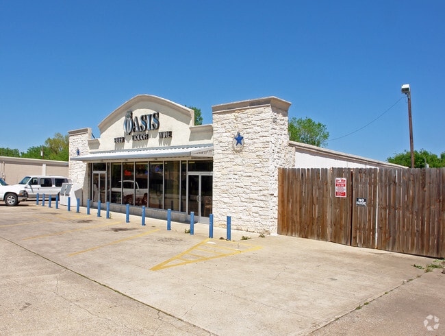
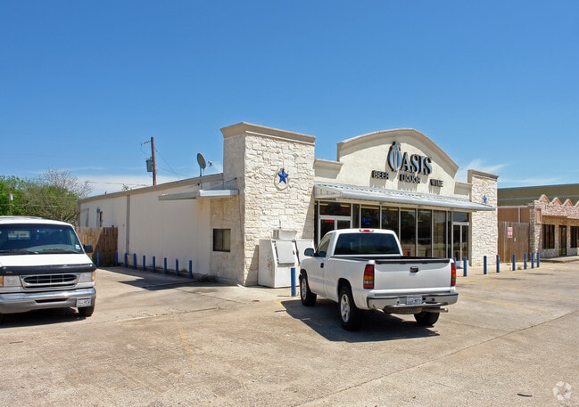
Property Record
7120 Main St, The Colony, TX 75056

Current Lease Availabilities
Property Detail
7120 Main St
Dallas-Fort Worth-Arlington, TX
GARZA LAKE ESTATES BLK 1 LOT 94,95,96,97,98(N 16.65)
R08002
Denton
Commercialnec
Texas
B and X Area of moderate flood hazard, usually the area between the limits of the 100-year and 500-year floods.
94,95
2024
0.35 AC
2025
West Frisco
021521
Dallas/Ft Worth
3,600 SF
NEARBY LISTINGS FOR SALE OR LEASE
DEMOGRAPHICS near 7120 Main St
1 mile
3 mile
5 mile
2024 Total Population
10,746
83,755
227,441
2029 Population
11,927
93,885
256,432
Pop Growth 2024-2029
+ 10.99%
+ 12.09%
+ 12.75%
Average Age
40
40
39
2024 Total Households
3,853
30,284
90,795
HH Growth 2024-2029
+ 11.32%
+ 12.39%
+ 13.25%
Median Household Inc
$121,500
$137,967
$118,943
Avg Household Size
2.70
2.70
2.50
2024 Avg HH Vehicles
2.00
2.00
2.00
Median Home Value
$297,166
$552,848
$603,601
Median Year Built
1981
2006
2009
Nearby Places
Map Layers
Map Styles
 Street
 Aerial
Transit
 Traffic
 Biking
Places
Listings with unknown addresses are not visible on the map
- Restaurants
- Banks
- Shops
- Fitness
- Groceries
PUBLIC TRANSPORTATION
COMMUTER RAIL
Drive
Walk
Distance
15 min
8.9 mi
Drive
Walk
Distance
16 min
9.8 mi
AIRPORT
Dallas-Fort Worth International
Drive
Walk
Distance
Dallas-Fort Worth International
26 min
20.1 mi
Dallas Love Field
Drive
Walk
Distance
Dallas Love Field
37 min
24.7 mi
Nearby Properties
Address
Land Use
TOTAL SIZE
Lot Size
Zoning
Address
Land Use
TOTAL SIZE
Lot Size
Zoning
325,000 SF
47.61 AC
Address
Land Use
TOTAL SIZE
Lot Size
Zoning
526,369 SF
45.84 AC
Address
Land Use
TOTAL SIZE
Lot Size
Zoning
598,569 SF
86.50 AC
Address
Land Use
TOTAL SIZE
Lot Size
Zoning
1,817,951 SF
82 AC
Address
Land Use
TOTAL SIZE
Lot Size
Zoning
448,915 SF
20.37 AC
Address
Land Use
TOTAL SIZE
Lot Size
Zoning
376,139 SF
3.58 AC
Address
Land Use
TOTAL SIZE
Lot Size
Zoning
371,385 SF
19.52 AC
Address
Land Use
TOTAL SIZE
Lot Size
Zoning
356,041 SF
18.46 AC
Address
Land Use
TOTAL SIZE
Lot Size
Zoning
346,269 SF
15.14 AC
Address
Land Use
TOTAL SIZE
Lot Size
Zoning
462,429 SF
5.70 AC
Address
Land Use
TOTAL SIZE
Lot Size
Zoning
291,446 SF
16.18 AC
Address
Land Use
TOTAL SIZE
Lot Size
Zoning
285,835 SF
15.61 AC
Address
Land Use
TOTAL SIZE
Lot Size
Zoning
317,190 SF
13.51 AC
Address
Land Use
TOTAL SIZE
Lot Size
Zoning
344,890 SF
23.63 AC
Address
Land Use
TOTAL SIZE
Lot Size
Zoning
267,413 SF
5.25 AC
Address
Land Use
TOTAL SIZE
Lot Size
Zoning
350,292 SF
7.75 AC
Address
Land Use
TOTAL SIZE
Lot Size
Zoning
323,736 SF
14.98 AC
Address
Land Use
TOTAL SIZE
Lot Size
Zoning
335,257 SF
12.83 AC
Address
Land Use
TOTAL SIZE
Lot Size
Zoning
638,645 SF
47.87 AC
Address
Land Use
TOTAL SIZE
Lot Size
Zoning
265,038 SF
12.56 AC
Address
Land Use
TOTAL SIZE
Lot Size
Zoning
298,494 SF
15.14 AC
Address
Land Use
TOTAL SIZE
Lot Size
Zoning
315,578 SF
16.53 AC
Address
Land Use
TOTAL SIZE
Lot Size
Zoning
378,980 SF
4.98 AC
Address
Land Use
TOTAL SIZE
Lot Size
Zoning
251,262 SF
13.97 AC
Address
Land Use
TOTAL SIZE
Lot Size
Zoning
310,913 SF
18.19 AC
2G
Address
Land Use
TOTAL SIZE
Lot Size
Zoning
314,068 SF
14.94 AC
Address
Land Use
TOTAL SIZE
Lot Size
Zoning
252,000 SF
7.01 AC
Address
Land Use
TOTAL SIZE
Lot Size
Zoning
536,530 SF
46.66 AC
Address
Land Use
TOTAL SIZE
Lot Size
Zoning
345,240 SF
23.87 AC
Address
Land Use
TOTAL SIZE
Lot Size
Zoning
330,039 SF
3.65 AC
The World's #1 Commercial Real Estate Marketplace
Connect with us
© 2026 CoStar Group
The information above has been obtained from sources believed reliable. While we do not doubt its accuracy we have not verified it and make no guarantee, warranty or representation about it. It is your responsibility to independently confirm its accuracy and completeness. Any projections, opinions, assumptions, or estimates used are for example only and do not represent the current or future performance of the property. The value of this transaction to you depends on tax and other factors which should be evaluated by your tax, financial, and legal advisors. You and your advisors should conduct a careful, independent investigation of the property to determine to your satisfaction the suitability of the property for your needs.