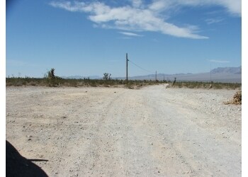
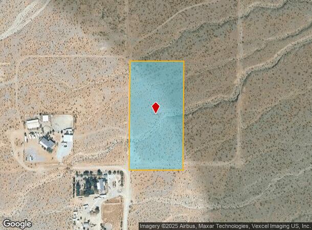
Property Record
7129 Durango St, Las Vegas, NV 89120

NEARBY LISTINGS FOR SALE OR LEASE
Property Detail
7129 Durango St
126-03-301-016
PT NE4 SW4 SEC 03 19 59
Vacantlandnec
Clark
X
Nevada
32003C1750E
5 AC
2024
Northwest Las Vegas
2025
Las Vegas
007500
Las Vegas-Henderson-Paradise, NV
DEMOGRAPHICS near 7129 Durango St
1 Mile
3 Mile
5 Mile
2024 Total Population
55
13,233
73,428
2029 Population
63
14,618
79,989
Pop Growth 2024-2029
+ 14.55%
+ 10.47%
+ 8.94%
Average Age
45
34
35
2024 Total Households
23
4,458
25,264
HH Growth 2024-2029
+ 13.04%
+ 10.50%
+ 8.92%
Median Household Inc
$99,999
$106,957
$91,181
Avg Household Size
2.30
3.00
2.90
2024 Avg HH Vehicles
2.00
2.00
2.00
Median Home Value
$750,000
$425,071
$409,039
Median Year Built
1992
2011
2008
Nearby Places
Map Layers
Map Styles
 Street
 Aerial
- Restaurants
- Banks
- Shops
- Fitness
- Groceries
PUBLIC TRANSPORTATION
AIRPORT
Harry Reid International
DRIVE
WALK
Distance
Harry Reid International
41 min
26.7 mi
Boulder City Municipal
DRIVE
WALK
Distance
Boulder City Municipal
61 min
46.6 mi
Nearby Properties
Address
Land Use
TOTAL SIZE
Lot Size
Zoning
Address
Land Use
TOTAL SIZE
Lot Size
Zoning
56,090 SF
5.48 AC
Address
Land Use
TOTAL SIZE
Lot Size
Zoning
29.50 AC
PD
Address
Land Use
TOTAL SIZE
Lot Size
Zoning
619.38 AC
RU
Address
Land Use
TOTAL SIZE
Lot Size
Zoning
11,223 SF
1.15 AC
Address
Land Use
TOTAL SIZE
Lot Size
Zoning
439.43 AC
RU
Address
Land Use
TOTAL SIZE
Lot Size
Zoning
41.53 AC
Address
Land Use
TOTAL SIZE
Lot Size
Zoning
4.54 AC
UPCD
Address
Land Use
TOTAL SIZE
Lot Size
Zoning
3.99 AC
H2
Address
Land Use
TOTAL SIZE
Lot Size
Zoning
5 AC
UPCD
Address
Land Use
TOTAL SIZE
Lot Size
Zoning
4.09 AC
UPCD
Address
Land Use
TOTAL SIZE
Lot Size
Zoning
4.36 AC
UPCD
Address
Land Use
TOTAL SIZE
Lot Size
Zoning
5 AC
UPCD
Address
Land Use
TOTAL SIZE
Lot Size
Zoning
2.48 AC
C1
Address
Land Use
TOTAL SIZE
Lot Size
Zoning
3.93 AC
UPCD
Address
Land Use
TOTAL SIZE
Lot Size
Zoning
3.54 AC
UPCD
The World's #1 Commercial Real Estate Marketplace
Connect with us
© 2026 CoStar Group
The information above has been obtained from sources believed reliable. While we do not doubt its accuracy we have not verified it and make no guarantee, warranty or representation about it. It is your responsibility to independently confirm its accuracy and completeness. Any projections, opinions, assumptions, or estimates used are for example only and do not represent the current or future performance of the property. The value of this transaction to you depends on tax and other factors which should be evaluated by your tax, financial, and legal advisors. You and your advisors should conduct a careful, independent investigation of the property to determine to your satisfaction the suitability of the property for your needs.