Property Record
7130 Spring Mdws W, Holland, OH 43528
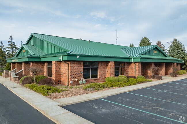


Property Detail
7130 Spring Mdws W
65-88329
SPRING MEADOWS WEST LOT 9 W 180 FT N 180 FT
Officebuilding
Lucas
19-C2
Ohio
B and X Area of moderate flood hazard, usually the area between the limits of the 100-year and 500-year floods.
9
0
0.75 AC
2025
South/Southwest
009104
Toledo
8,160 SF
Toledo, OH
NEARBY LISTINGS FOR SALE OR LEASE
DEMOGRAPHICS near 7130 Spring Mdws W
1 mile
3 mile
5 mile
2025 Total Population
5,086
46,276
116,906
2030 Population
4,982
45,737
115,446
Pop Growth 2025-2030
(2.04%)
(1.16%)
(1.25%)
Average Age
45
42
42
2025 Total Households
2,189
19,811
51,769
HH Growth 2025-2030
(1.96%)
(1.08%)
(1.20%)
Median Household Inc
$80,885
$72,370
$70,784
Avg Household Size
2.20
2.20
2.20
2025 Avg HH Vehicles
2.00
2.00
2.00
Median Home Value
$250,950
$251,317
$220,945
Median Year Built
1984
1983
1978
Nearby Places
Map Layers
Map Styles
 Street
 Aerial
Layers
 Traffic
 Biking
Places
Listings with unknown addresses are not visible on the map
- Restaurants
- Banks
- Shops
- Fitness
- Groceries
PUBLIC TRANSPORTATION
COMMUTER RAIL
Toledo (Capitol Limited - Amtrak, Lake Shore Limited - Amtrak)
Drive
Walk
Distance
Toledo (Capitol Limited - Amtrak, Lake Shore Limited - Amtrak)
16 min
9.3 mi
AIRPORT
Eugene F Kranz Toledo Express
Drive
Walk
Distance
Eugene F Kranz Toledo Express
21 min
9.9 mi
Freight Ports
Port of Toledo
Drive
Walk
Distance
Port of Toledo
29 min
15.4 mi
SALE & LEASE HISTORY
LISTING DATE
SALE/LEASE

Mar 09, 2022
For Sale
Jul 25, 2023
For Sale
Apr 19, 2022
For Lease
Apr 05, 2024
For Lease
Nearby Properties
Address
Land Use
TOTAL SIZE
Lot Size
Zoning
Address
Land Use
TOTAL SIZE
Lot Size
Zoning
329,064 SF
69.74 AC
10-RS6
Address
Land Use
TOTAL SIZE
Lot Size
Zoning
186,190 SF
14 AC
19-C2
Address
Land Use
TOTAL SIZE
Lot Size
Zoning
196,149 SF
18.69 AC
10-RD6
Address
Land Use
TOTAL SIZE
Lot Size
Zoning
35.94 AC
17-C3
Address
Land Use
TOTAL SIZE
Lot Size
Zoning
211,140 SF
28.92 AC
10-IC
Address
Land Use
TOTAL SIZE
Lot Size
Zoning
138,607 SF
21.30 AC
10-RS12
Address
Land Use
TOTAL SIZE
Lot Size
Zoning
178,915 SF
13 AC
19-R3
Address
Land Use
TOTAL SIZE
Lot Size
Zoning
352,382 SF
62.93 AC
16-M1
Address
Land Use
TOTAL SIZE
Lot Size
Zoning
337,990 SF
17.75 AC
16-M1
Address
Land Use
TOTAL SIZE
Lot Size
Zoning
212,664 SF
21.43 AC
24-B3
Address
Land Use
TOTAL SIZE
Lot Size
Zoning
139,741 SF
30.48 AC
19-RA3
Address
Land Use
TOTAL SIZE
Lot Size
Zoning
203,839 SF
16.39 AC
24-SUP
Address
Land Use
TOTAL SIZE
Lot Size
Zoning
350,408 SF
20.83 AC
17-M2
Address
Land Use
TOTAL SIZE
Lot Size
Zoning
156,420 SF
12 AC
19-R3
Address
Land Use
TOTAL SIZE
Lot Size
Zoning
238,148 SF
18.20 AC
24-B3
Address
Land Use
TOTAL SIZE
Lot Size
Zoning
214,986 SF
17.55 AC
19-R1
Address
Land Use
TOTAL SIZE
Lot Size
Zoning
111,195 SF
13.64 AC
19-C2
Address
Land Use
TOTAL SIZE
Lot Size
Zoning
78,166 SF
2.08 AC
16-CM
Address
Land Use
TOTAL SIZE
Lot Size
Zoning
120,077 SF
9.53 AC
24-B3
Address
Land Use
TOTAL SIZE
Lot Size
Zoning
131,201 SF
10 AC
10-CUP
Address
Land Use
TOTAL SIZE
Lot Size
Zoning
126,732 SF
15 AC
10-CRSO
Address
Land Use
TOTAL SIZE
Lot Size
Zoning
58.33 AC
10-IL
Address
Land Use
TOTAL SIZE
Lot Size
Zoning
140,008 SF
10 AC
19-R3
Address
Land Use
TOTAL SIZE
Lot Size
Zoning
160,811 SF
10.83 AC
10-MX
Address
Land Use
TOTAL SIZE
Lot Size
Zoning
86,450 SF
6.33 AC
17-R3
Address
Land Use
TOTAL SIZE
Lot Size
Zoning
103,406 SF
7.55 AC
24-SUP
Address
Land Use
TOTAL SIZE
Lot Size
Zoning
60,805 SF
9.38 AC
10-RS12
Address
Land Use
TOTAL SIZE
Lot Size
Zoning
76,698 SF
7.70 AC
19-C2
Address
Land Use
TOTAL SIZE
Lot Size
Zoning
104,367 SF
10.51 AC
19-C2
Address
Land Use
TOTAL SIZE
Lot Size
Zoning
88,152 SF
11 AC
19-C2
The World's #1 Commercial Real Estate Marketplace
Connect with us
© 2026 CoStar Group
The information above has been obtained from sources believed reliable. While we do not doubt its accuracy we have not verified it and make no guarantee, warranty or representation about it. It is your responsibility to independently confirm its accuracy and completeness. Any projections, opinions, assumptions, or estimates used are for example only and do not represent the current or future performance of the property. The value of this transaction to you depends on tax and other factors which should be evaluated by your tax, financial, and legal advisors. You and your advisors should conduct a careful, independent investigation of the property to determine to your satisfaction the suitability of the property for your needs.