Property Record
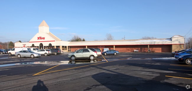
7134 Rochester Rd, Lockport, NY 14094


NEARBY LISTINGS FOR SALE OR LEASE
Property Detail
7134 Rochester Rd
110-001-0002-062-001-BB
QUALITY
Supermarket
Niagara
X
New York
36063C0242E
62.001
2025
4.10 AC
2024
Outlying Niagara County
023402
Buffalo/Niagara Falls
49,549 SF
Buffalo-Cheektowaga-Niagara Falls, NY
DEMOGRAPHICS near 7134 Rochester Rd
1 Mile
3 Mile
5 Mile
2024 Total Population
1,187
22,023
41,391
2029 Population
1,174
21,640
40,773
Pop Growth 2024-2029
(1.10%)
(1.74%)
(1.49%)
Average Age
47
42
42
2024 Total Households
502
9,694
17,962
HH Growth 2024-2029
(1.20%)
(1.75%)
(1.49%)
Median Household Inc
$91,964
$62,348
$62,026
Avg Household Size
2.30
2.20
2.20
2024 Avg HH Vehicles
2.00
2.00
2.00
Median Home Value
$176,078
$154,430
$148,487
Median Year Built
1974
1952
1962
Nearby Places
Map Layers
Map Styles
 Street
 Aerial
- Restaurants
- Banks
- Shops
- Fitness
- Groceries
PUBLIC TRANSPORTATION
AIRPORT
Niagara Falls International
DRIVE
WALK
Distance
Niagara Falls International
27 min
18.9 mi
Buffalo Niagara International
DRIVE
WALK
Distance
Buffalo Niagara International
28 min
20.2 mi
Nearby Properties
Address
Land Use
TOTAL SIZE
Lot Size
Zoning
Address
Land Use
TOTAL SIZE
Lot Size
Zoning
Address
Land Use
TOTAL SIZE
Lot Size
Zoning
90.60 AC
AR
Address
Land Use
TOTAL SIZE
Lot Size
Zoning
660 SF
0.99 AC
R3
Address
Land Use
TOTAL SIZE
Lot Size
Zoning
111,617 SF
16.83 AC
RA
Address
Land Use
TOTAL SIZE
Lot Size
Zoning
108,630 SF
0.77 AC
B2
Address
Land Use
TOTAL SIZE
Lot Size
Zoning
760 SF
7.82 AC
R1
Address
Land Use
TOTAL SIZE
Lot Size
Zoning
67,111 SF
3.22 AC
B2
Address
Land Use
TOTAL SIZE
Lot Size
Zoning
Address
Land Use
TOTAL SIZE
Lot Size
Zoning
24,103 SF
74.12 AC
Address
Land Use
TOTAL SIZE
Lot Size
Zoning
16,282 SF
4.90 AC
R3
Address
Land Use
TOTAL SIZE
Lot Size
Zoning
62,310 SF
6.39 AC
R3
Address
Land Use
TOTAL SIZE
Lot Size
Zoning
7,692 SF
3.82 AC
R3
Address
Land Use
TOTAL SIZE
Lot Size
Zoning
8,160 SF
4.22 AC
R3
Address
Land Use
TOTAL SIZE
Lot Size
Zoning
81,875 SF
8.67 AC
RA
Address
Land Use
TOTAL SIZE
Lot Size
Zoning
154,300 SF
5.93 AC
RA
Address
Land Use
TOTAL SIZE
Lot Size
Zoning
16,380 SF
3.68 AC
R3
Address
Land Use
TOTAL SIZE
Lot Size
Zoning
72.75 AC
R-1
Address
Land Use
TOTAL SIZE
Lot Size
Zoning
4,948 SF
6.30 AC
R1
Address
Land Use
TOTAL SIZE
Lot Size
Zoning
16,368 SF
44 AC
AR
Address
Land Use
TOTAL SIZE
Lot Size
Zoning
62,491 SF
10.74 AC
RA
Address
Land Use
TOTAL SIZE
Lot Size
Zoning
29,649 SF
2.94 AC
07 - MIXED
Address
Land Use
TOTAL SIZE
Lot Size
Zoning
14,940 SF
5.36 AC
R3
Address
Land Use
TOTAL SIZE
Lot Size
Zoning
13,846 SF
5.14 AC
R1
Address
Land Use
TOTAL SIZE
Lot Size
Zoning
06 - INDUS
Address
Land Use
TOTAL SIZE
Lot Size
Zoning
93,053 SF
0.82 AC
B2
Address
Land Use
TOTAL SIZE
Lot Size
Zoning
66,472 SF
0.89 AC
R3
Address
Land Use
TOTAL SIZE
Lot Size
Zoning
11,317 SF
1.30 AC
Address
Land Use
TOTAL SIZE
Lot Size
Zoning
58,339 SF
5.70 AC
Address
Land Use
TOTAL SIZE
Lot Size
Zoning
4,100 SF
2.76 AC
R3
Address
Land Use
TOTAL SIZE
Lot Size
Zoning
40,564 SF
2.20 AC
B2
The World's #1 Commercial Real Estate Marketplace
Connect with us
© 2026 CoStar Group
The information above has been obtained from sources believed reliable. While we do not doubt its accuracy we have not verified it and make no guarantee, warranty or representation about it. It is your responsibility to independently confirm its accuracy and completeness. Any projections, opinions, assumptions, or estimates used are for example only and do not represent the current or future performance of the property. The value of this transaction to you depends on tax and other factors which should be evaluated by your tax, financial, and legal advisors. You and your advisors should conduct a careful, independent investigation of the property to determine to your satisfaction the suitability of the property for your needs.