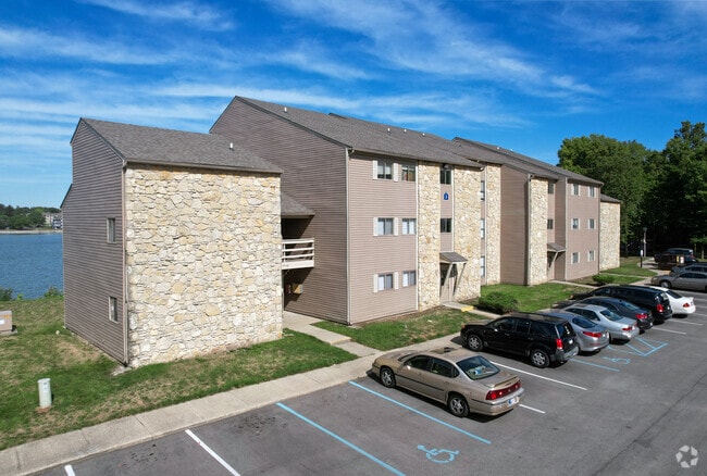
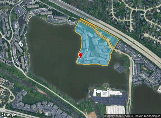
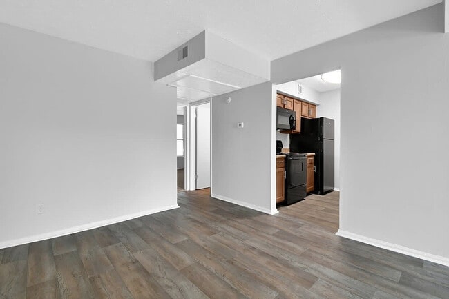
Property Record
7135 Islander Dr, Indianapolis, IN 46214
NEARBY LISTINGS FOR SALE OR LEASE
Property Detail
7135 Islander Dr
49-05-23-101-006.000-900
RLY 1151.8FTFT TO BEG 15.71AC
Apartment
Marion
AE
Indiana
18097C0116F
15.71 AC
2023
Key Meadows
2024
Indianapolis
340112
Indianapolis-Carmel-Anderson, IN
2,842 SF
DEMOGRAPHICS near 7135 Islander Dr
1 Mile
3 Mile
5 Mile
2024 Total Population
13,804
97,735
212,191
2029 Population
13,484
96,212
213,188
Pop Growth 2024-2029
(2.32%)
(1.56%)
+ 0.47%
Average Age
34
36
36
2024 Total Households
6,329
39,821
82,642
HH Growth 2024-2029
(2.34%)
(1.69%)
+ 0.22%
Median Household Inc
$45,669
$53,183
$56,477
Avg Household Size
2.10
2.40
2.50
2024 Avg HH Vehicles
1.00
2.00
2.00
Median Home Value
$152,057
$156,434
$165,532
Median Year Built
1982
1977
1979
Nearby Places
Map Layers
Map Styles
 Street
 Aerial
- Restaurants
- Banks
- Shops
- Fitness
- Groceries
PUBLIC TRANSPORTATION
COMMUTER RAIL
Indianapolis (Cardinal - Amtrak)
DRIVE
WALK
Distance
Indianapolis (Cardinal - Amtrak)
18 min
9.8 mi
AIRPORT
Indianapolis International
DRIVE
WALK
Distance
Indianapolis International
25 min
12.6 mi
Freight Ports
Port of Toledo
DRIVE
WALK
Distance
Port of Toledo
281 min
230.5 mi
SALE & LEASE HISTORY
LISTING DATE
SALE/LEASE

Dec 05, 2016
For Sale
Nearby Properties
Address
Land Use
TOTAL SIZE
Lot Size
Zoning
Address
Land Use
TOTAL SIZE
Lot Size
Zoning
80,249 SF
71.96 AC
ZO01
Address
Land Use
TOTAL SIZE
Lot Size
Zoning
5,280 SF
97.87 AC
ZO01
Address
Land Use
TOTAL SIZE
Lot Size
Zoning
4,515 SF
23.95 AC
ZO01
Address
Land Use
TOTAL SIZE
Lot Size
Zoning
5,820 SF
32.03 AC
ZO01
Address
Land Use
TOTAL SIZE
Lot Size
Zoning
415,877 SF
55.83 AC
ZO01
Address
Land Use
TOTAL SIZE
Lot Size
Zoning
3,827 SF
24.15 AC
ZO01
Address
Land Use
TOTAL SIZE
Lot Size
Zoning
3,348 SF
32.01 AC
ZO01
Address
Land Use
TOTAL SIZE
Lot Size
Zoning
27,327 SF
15 AC
Address
Land Use
TOTAL SIZE
Lot Size
Zoning
1,904 SF
47.31 AC
ZO01
Address
Land Use
TOTAL SIZE
Lot Size
Zoning
19,314 SF
32.88 AC
ZO01
Address
Land Use
TOTAL SIZE
Lot Size
Zoning
3,214 SF
14.29 AC
ZO01
Address
Land Use
TOTAL SIZE
Lot Size
Zoning
3,381 SF
30.61 AC
ZO01
Address
Land Use
TOTAL SIZE
Lot Size
Zoning
3,878 SF
17.76 AC
Address
Land Use
TOTAL SIZE
Lot Size
Zoning
494 SF
36.18 AC
ZO01
Address
Land Use
TOTAL SIZE
Lot Size
Zoning
438,643 SF
43.63 AC
ZO01
Address
Land Use
TOTAL SIZE
Lot Size
Zoning
5,554 SF
23.52 AC
ZO01
Address
Land Use
TOTAL SIZE
Lot Size
Zoning
7,364 SF
9.20 AC
Address
Land Use
TOTAL SIZE
Lot Size
Zoning
Address
Land Use
TOTAL SIZE
Lot Size
Zoning
3,618 SF
31.13 AC
ZO01
Address
Land Use
TOTAL SIZE
Lot Size
Zoning
30,545 SF
3.41 AC
ZO01
Address
Land Use
TOTAL SIZE
Lot Size
Zoning
3,706 SF
30.57 AC
ZO01
Address
Land Use
TOTAL SIZE
Lot Size
Zoning
7,082 SF
19.18 AC
ZO01
Address
Land Use
TOTAL SIZE
Lot Size
Zoning
1,868 SF
14.50 AC
ZO01
Address
Land Use
TOTAL SIZE
Lot Size
Zoning
4,734 SF
30.98 AC
ZO01
Address
Land Use
TOTAL SIZE
Lot Size
Zoning
73,528 SF
80 AC
ZO01
Address
Land Use
TOTAL SIZE
Lot Size
Zoning
1,700 SF
40.37 AC
ZO01
Address
Land Use
TOTAL SIZE
Lot Size
Zoning
2,288 SF
21.42 AC
Address
Land Use
TOTAL SIZE
Lot Size
Zoning
3,802 SF
12.25 AC
Address
Land Use
TOTAL SIZE
Lot Size
Zoning
106,651 SF
11.35 AC
ZO01
Address
Land Use
TOTAL SIZE
Lot Size
Zoning
57,100 SF
18.13 AC
The World's #1 Commercial Real Estate Marketplace
Connect with us
© 2025 CoStar Group
The information above has been obtained from sources believed reliable. While we do not doubt its accuracy we have not verified it and make no guarantee, warranty or representation about it. It is your responsibility to independently confirm its accuracy and completeness. Any projections, opinions, assumptions, or estimates used are for example only and do not represent the current or future performance of the property. The value of this transaction to you depends on tax and other factors which should be evaluated by your tax, financial, and legal advisors. You and your advisors should conduct a careful, independent investigation of the property to determine to your satisfaction the suitability of the property for your needs.