Property Record
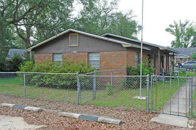
7137 Pearson Rd, Pensacola, FL 32526

NEARBY LISTINGS FOR SALE OR LEASE
Property Detail
7137 Pearson Rd
Pensacola-Ferry Pass-Brent, FL
Subdivision Number: 2002
10-2S-31-2002-000-006
BEG AT SE COR OF MYRTLE GROVE WEST UNIT NO 1 PB 7 P 41 OF GOV LT 2 OF SEC N 0 DEG 30 MIN W 215 FT N 44 DEG 30 MIN E 35 36/100 FT N 0 DEG 30 MIN W 60 FT N 89 DEG 30 MIN E 200 FT FOR POB CONT SAME COURSE 50 FT N 0 DEG 30 MIN W 120 FT S 89 DEG 30 MIN W
Multifamilydwelling
Escambia
X
Florida
12033C0360G
2
2023
0.15 AC
2024
West Pensacola
003307
Pensacola
1,375 SF
DEMOGRAPHICS near 7137 Pearson Rd
1 Mile
3 Mile
5 Mile
2024 Total Population
7,728
56,906
116,464
2029 Population
7,807
57,667
119,116
Pop Growth 2024-2029
+ 1.02%
+ 1.34%
+ 2.28%
Average Age
39
38
39
2024 Total Households
3,042
22,171
45,260
HH Growth 2024-2029
+ 1.12%
+ 1.26%
+ 2.28%
Median Household Inc
$52,671
$48,073
$43,252
Avg Household Size
2.50
2.40
2.40
2024 Avg HH Vehicles
2.00
2.00
2.00
Median Home Value
$141,906
$137,790
$143,792
Median Year Built
1975
1977
1976
Nearby Places
Map Layers
Map Styles
 Street
 Aerial
- Restaurants
- Banks
- Shops
- Fitness
- Groceries
PUBLIC TRANSPORTATION
AIRPORT
Pensacola International
DRIVE
WALK
Distance
Pensacola International
20 min
9.2 mi
Freight Ports
Port of Mobile
DRIVE
WALK
Distance
Port of Mobile
67 min
54.8 mi
Nearby Properties
Address
Land Use
TOTAL SIZE
Lot Size
Zoning
Address
Land Use
TOTAL SIZE
Lot Size
Zoning
6,950 SF
584.36 AC
PUB
Address
Land Use
TOTAL SIZE
Lot Size
Zoning
288,114 SF
17.89 AC
HC/LI
Address
Land Use
TOTAL SIZE
Lot Size
Zoning
250,232 SF
19.24 AC
HDR
Address
Land Use
TOTAL SIZE
Lot Size
Zoning
207,331 SF
24.09 AC
HDR
Address
Land Use
TOTAL SIZE
Lot Size
Zoning
334,324 SF
55.06 AC
PUB
Address
Land Use
TOTAL SIZE
Lot Size
Zoning
169,346 SF
15.21 AC
HDR
Address
Land Use
TOTAL SIZE
Lot Size
Zoning
158,233 SF
9.15 AC
HDMU
Address
Land Use
TOTAL SIZE
Lot Size
Zoning
133,096 SF
10.32 AC
HDR
Address
Land Use
TOTAL SIZE
Lot Size
Zoning
99,147 SF
5.89 AC
HDMU
Address
Land Use
TOTAL SIZE
Lot Size
Zoning
116,020 SF
4.71 AC
MDR
Address
Land Use
TOTAL SIZE
Lot Size
Zoning
197,958 SF
26.08 AC
COM
Address
Land Use
TOTAL SIZE
Lot Size
Zoning
129,532 SF
10.84 AC
COM
Address
Land Use
TOTAL SIZE
Lot Size
Zoning
103,671 SF
13.96 AC
HDMU
Address
Land Use
TOTAL SIZE
Lot Size
Zoning
138,048 SF
22.64 AC
HC/LI
Address
Land Use
TOTAL SIZE
Lot Size
Zoning
124,146 SF
5.79 AC
HDMU
Address
Land Use
TOTAL SIZE
Lot Size
Zoning
223,987 SF
36.60 AC
MDR
Address
Land Use
TOTAL SIZE
Lot Size
Zoning
371,425 SF
24.78 AC
HC/LI
Address
Land Use
TOTAL SIZE
Lot Size
Zoning
81,874 SF
7.09 AC
HDMU
Address
Land Use
TOTAL SIZE
Lot Size
Zoning
61,788 SF
8.60 AC
HDR
Address
Land Use
TOTAL SIZE
Lot Size
Zoning
64,870 SF
5.35 AC
HDMU
Address
Land Use
TOTAL SIZE
Lot Size
Zoning
3,926 SF
57.46 AC
HDMU
Address
Land Use
TOTAL SIZE
Lot Size
Zoning
84,005 SF
7.93 AC
COM
Address
Land Use
TOTAL SIZE
Lot Size
Zoning
65,355 SF
6.27 AC
COM
Address
Land Use
TOTAL SIZE
Lot Size
Zoning
78,174 SF
4.52 AC
HDMU
Address
Land Use
TOTAL SIZE
Lot Size
Zoning
105,225 SF
2.72 AC
HC/LI
Address
Land Use
TOTAL SIZE
Lot Size
Zoning
90,932 SF
7.37 AC
HDMU,MDR
Address
Land Use
TOTAL SIZE
Lot Size
Zoning
163,774 SF
28.55 AC
HDR
Address
Land Use
TOTAL SIZE
Lot Size
Zoning
98,372 SF
16.95 AC
COM
Address
Land Use
TOTAL SIZE
Lot Size
Zoning
57,501 SF
7.47 AC
HDR
Address
Land Use
TOTAL SIZE
Lot Size
Zoning
46,512 SF
3.99 AC
HDMU
The World's #1 Commercial Real Estate Marketplace
Connect with us
© 2025 CoStar Group
The information above has been obtained from sources believed reliable. While we do not doubt its accuracy we have not verified it and make no guarantee, warranty or representation about it. It is your responsibility to independently confirm its accuracy and completeness. Any projections, opinions, assumptions, or estimates used are for example only and do not represent the current or future performance of the property. The value of this transaction to you depends on tax and other factors which should be evaluated by your tax, financial, and legal advisors. You and your advisors should conduct a careful, independent investigation of the property to determine to your satisfaction the suitability of the property for your needs.