Property Record
714 W Interstate Service Rd, Graham, NC 27253

Save to a Folder
{{folder.Name}}
{{folder.ListingIds.length}} Properties
{{folder.ListingIds.length}} Property
Create a New Folder
Property Detail
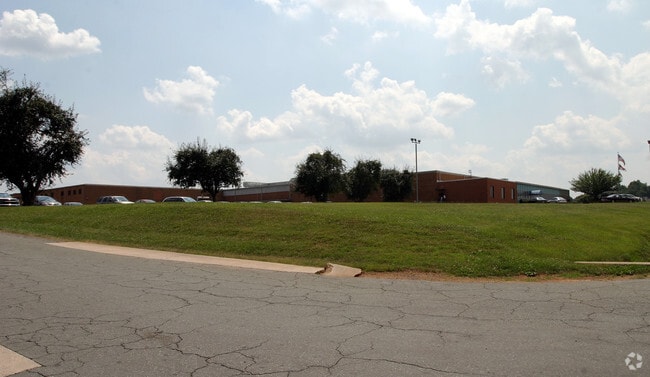
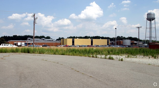
714 W Interstate Service Rd
133547
KAYSER ROTH LOT 1 6-10-18A
Manufacturinglight
Alamance
I1
North Carolina
AE The base floodplain where base flood elevations are provided. AE Zones are now used on new format FIRMs instead of A1-A30 Zones.
1
2025
52.87 AC
2025
SW Alamance County
0209013004
Greensboro/Winston-Salem
84,881 SF
Burlington, NC
NEARBY LISTINGS FOR SALE OR LEASE
DEMOGRAPHICS near 714 W Interstate Service Rd
1 mile
3 mile
5 mile
2025 Total Population
4,692
46,677
90,634
2030 Population
4,918
49,067
95,615
Pop Growth 2025-2030
+ 4.82%
+ 5.12%
+ 5.50%
Average Age
40
40
40
2025 Total Households
1,879
19,368
37,020
HH Growth 2025-2030
+ 5.00%
+ 5.31%
+ 5.64%
Median Household Inc
$55,737
$54,360
$58,568
Avg Household Size
2.40
2.30
2.40
2025 Avg HH Vehicles
2.00
2.00
2.00
Median Home Value
$185,964
$206,547
$231,214
Median Year Built
1969
1973
1978
Nearby Places
Map Layers
Map Styles
 Street
 Aerial
Layers
 Traffic
 Biking
Places
Listings with unknown addresses are not visible on the map
- Restaurants
- Banks
- Shops
- Fitness
- Groceries
PUBLIC TRANSPORTATION
COMMUTER RAIL
Burlington Amtrak Station (Carolinian - Amtrak, Piedmont - Amtrak)
Drive
Walk
Distance
Burlington Amtrak Station (Carolinian - Amtrak, Piedmont - Amtrak)
9 min
3.8 mi
AIRPORT
Piedmont Triad International
Drive
Walk
Distance
Piedmont Triad International
48 min
33.1 mi
Freight Ports
Virginia Port Authority - Richmond
Drive
Walk
Distance
Virginia Port Authority - Richmond
203 min
176.1 mi
Nearby Properties
Address
Land Use
TOTAL SIZE
Lot Size
Zoning
Address
Land Use
TOTAL SIZE
Lot Size
Zoning
2,315 SF
55.43 AC
I 1
Address
Land Use
TOTAL SIZE
Lot Size
Zoning
27,803 SF
13.10 AC
B 2
Address
Land Use
TOTAL SIZE
Lot Size
Zoning
48,136 SF
14.57 AC
B 2
Address
Land Use
TOTAL SIZE
Lot Size
Zoning
37,502 SF
17.48 AC
CR
Address
Land Use
TOTAL SIZE
Lot Size
Zoning
10,744 SF
24.60 AC
MF A
Address
Land Use
TOTAL SIZE
Lot Size
Zoning
27,803 SF
11.53 AC
Address
Land Use
TOTAL SIZE
Lot Size
Zoning
12,600 SF
44.61 AC
Address
Land Use
TOTAL SIZE
Lot Size
Zoning
40,220 SF
12.45 AC
MF A
Address
Land Use
TOTAL SIZE
Lot Size
Zoning
72,164 SF
73.50 AC
Address
Land Use
TOTAL SIZE
Lot Size
Zoning
714,245 SF
109.43 AC
I 1
Address
Land Use
TOTAL SIZE
Lot Size
Zoning
80,865 SF
76.02 AC
I 1A
Address
Land Use
TOTAL SIZE
Lot Size
Zoning
110,612 SF
1 AC
B 3
Address
Land Use
TOTAL SIZE
Lot Size
Zoning
10,368 SF
11.35 AC
R MF
Address
Land Use
TOTAL SIZE
Lot Size
Zoning
51,994 SF
42.20 AC
OI
Address
Land Use
TOTAL SIZE
Lot Size
Zoning
9,672 SF
10.77 AC
MF A
Address
Land Use
TOTAL SIZE
Lot Size
Zoning
23,992 SF
25.66 AC
R 9
Address
Land Use
TOTAL SIZE
Lot Size
Zoning
19,872 SF
9.80 AC
Address
Land Use
TOTAL SIZE
Lot Size
Zoning
71,962 SF
5.98 AC
O I
Address
Land Use
TOTAL SIZE
Lot Size
Zoning
216,968 SF
25.50 AC
CB
Address
Land Use
TOTAL SIZE
Lot Size
Zoning
40,440 SF
23.57 AC
R 9
Address
Land Use
TOTAL SIZE
Lot Size
Zoning
101,469 SF
4.28 AC
CR
Address
Land Use
TOTAL SIZE
Lot Size
Zoning
31,920 SF
4.59 AC
R MF
Address
Land Use
TOTAL SIZE
Lot Size
Zoning
7,192 SF
14.08 AC
RMF
Address
Land Use
TOTAL SIZE
Lot Size
Zoning
17,073 SF
7.59 AC
R 9
Address
Land Use
TOTAL SIZE
Lot Size
Zoning
15,512 SF
6.54 AC
MF A
Address
Land Use
TOTAL SIZE
Lot Size
Zoning
9,008 SF
6.23 AC
R MF
Address
Land Use
TOTAL SIZE
Lot Size
Zoning
65,480 SF
11.09 AC
B 2
Address
Land Use
TOTAL SIZE
Lot Size
Zoning
2,923 SF
10.13 AC
Address
Land Use
TOTAL SIZE
Lot Size
Zoning
158,339 SF
16.34 AC
The World's #1 Commercial Real Estate Marketplace
Connect with us
© 2026 CoStar Group
The information above has been obtained from sources believed reliable. While we do not doubt its accuracy we have not verified it and make no guarantee, warranty or representation about it. It is your responsibility to independently confirm its accuracy and completeness. Any projections, opinions, assumptions, or estimates used are for example only and do not represent the current or future performance of the property. The value of this transaction to you depends on tax and other factors which should be evaluated by your tax, financial, and legal advisors. You and your advisors should conduct a careful, independent investigation of the property to determine to your satisfaction the suitability of the property for your needs.