Property Record
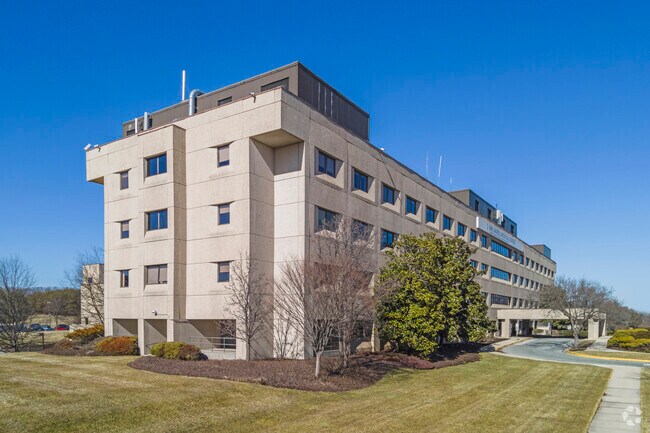
7300 Van Dusen Rd, Laurel, MD 20707


Property Detail
7300 Van Dusen Rd
10-1086404
OWNERSHIP PAR B-1 HOSPITAL
Hospitalpublic
Prince Georges
RR
Maryland
B and X Area of moderate flood hazard, usually the area between the limits of the 100-year and 500-year floods.
44 AC
2024
Laurel
2025
Washington, DC
800212
Washington-Arlington-Alexandria, DC-VA-MD-WV
393,970 SF
NEARBY LISTINGS FOR SALE OR LEASE
-
-
View all Laurel listings for sale on LoopNet.com
DEMOGRAPHICS near 7300 Van Dusen Rd
1 mile
3 mile
5 mile
2024 Total Population
13,837
91,625
199,358
2029 Population
14,064
93,183
202,600
Pop Growth 2024-2029
+ 1.64%
+ 1.70%
+ 1.63%
Average Age
41
39
39
2024 Total Households
5,460
33,975
72,235
HH Growth 2024-2029
+ 1.43%
+ 1.68%
+ 1.65%
Median Household Inc
$117,699
$100,298
$106,457
Avg Household Size
2.50
2.60
2.70
2024 Avg HH Vehicles
2.00
2.00
2.00
Median Home Value
$429,607
$432,640
$463,024
Median Year Built
1994
1984
1985
Nearby Places
Map Layers
Map Styles
 Street
 Aerial
Transit
 Traffic
 Biking
Places
Listings with unknown addresses are not visible on the map
- Restaurants
- Banks
- Shops
- Fitness
- Groceries
PUBLIC TRANSPORTATION
COMMUTER RAIL
Muirkirk Marc Sb (CAMDEN - WASHINGTON - Maryland Transit Administration)
Drive
Walk
Distance
Muirkirk Marc Sb (CAMDEN - WASHINGTON - Maryland Transit Administration)
6 min
2.6 mi
Laurel Marc Sb (CAMDEN - WASHINGTON - Maryland Transit Administration)
Drive
Walk
Distance
Laurel Marc Sb (CAMDEN - WASHINGTON - Maryland Transit Administration)
8 min
3.1 mi
AIRPORT
Baltimore/Washington International Thurgood Marshall
Drive
Walk
Distance
Baltimore/Washington International Thurgood Marshall
29 min
20.8 mi
Ronald Reagan Washington Ntl
Drive
Walk
Distance
Ronald Reagan Washington Ntl
41 min
22.8 mi
Freight Ports
Port of Baltimore
Drive
Walk
Distance
Port of Baltimore
33 min
23.6 mi
Nearby Properties
Address
Land Use
TOTAL SIZE
Lot Size
Zoning
Address
Land Use
TOTAL SIZE
Lot Size
Zoning
218,406 SF
26.80 AC
LAUR
Address
Land Use
TOTAL SIZE
Lot Size
Zoning
399,715 SF
23.04 AC
LAUR
Address
Land Use
TOTAL SIZE
Lot Size
Zoning
791,089 SF
10.69 AC
LAUR
Address
Land Use
TOTAL SIZE
Lot Size
Zoning
531,312 SF
25.70 AC
R30
Address
Land Use
TOTAL SIZE
Lot Size
Zoning
657,100 SF
7.39 AC
LAUR
Address
Land Use
TOTAL SIZE
Lot Size
Zoning
514,064 SF
7.37 AC
NAC
Address
Land Use
TOTAL SIZE
Lot Size
Zoning
390,986 SF
16.87 AC
LAUR
Address
Land Use
TOTAL SIZE
Lot Size
Zoning
564,165 SF
35.85 AC
RMF12
Address
Land Use
TOTAL SIZE
Lot Size
Zoning
559,944 SF
11.89 AC
IE
Address
Land Use
TOTAL SIZE
Lot Size
Zoning
104,067 SF
25.29 AC
RMF20
Address
Land Use
TOTAL SIZE
Lot Size
Zoning
165,236 SF
5.24 AC
LAUR
Address
Land Use
TOTAL SIZE
Lot Size
Zoning
379,264 SF
23.08 AC
LAUR
Address
Land Use
TOTAL SIZE
Lot Size
Zoning
158,316 SF
20.30 AC
LAUR
Address
Land Use
TOTAL SIZE
Lot Size
Zoning
16,016 SF
19.95 AC
RA15
Address
Land Use
TOTAL SIZE
Lot Size
Zoning
302,887 SF
24.96 AC
LAUR
Address
Land Use
TOTAL SIZE
Lot Size
Zoning
16.36 AC
RMF20
Address
Land Use
TOTAL SIZE
Lot Size
Zoning
149,990 SF
10.41 AC
PEC
Address
Land Use
TOTAL SIZE
Lot Size
Zoning
149,990 SF
9.70 AC
PEC
Address
Land Use
TOTAL SIZE
Lot Size
Zoning
235,616 SF
12.81 AC
R30
Address
Land Use
TOTAL SIZE
Lot Size
Zoning
15.70 AC
RMF20
Address
Land Use
TOTAL SIZE
Lot Size
Zoning
456,896 SF
8.96 AC
R20
Address
Land Use
TOTAL SIZE
Lot Size
Zoning
11.20 AC
RMF20
Address
Land Use
TOTAL SIZE
Lot Size
Zoning
10.52 AC
RMF20
Address
Land Use
TOTAL SIZE
Lot Size
Zoning
63,896 SF
229.19 AC
W1B
Address
Land Use
TOTAL SIZE
Lot Size
Zoning
9.14 AC
LAUR
Address
Land Use
TOTAL SIZE
Lot Size
Zoning
37,872 SF
10.29 AC
RMF20
Address
Land Use
TOTAL SIZE
Lot Size
Zoning
253,396 SF
5.96 AC
LAUR
Address
Land Use
TOTAL SIZE
Lot Size
Zoning
142,372 SF
13.88 AC
LAUR
Address
Land Use
TOTAL SIZE
Lot Size
Zoning
362,438 SF
39.95 AC
IE
The World's #1 Commercial Real Estate Marketplace
Connect with us
© 2026 CoStar Group
The information above has been obtained from sources believed reliable. While we do not doubt its accuracy we have not verified it and make no guarantee, warranty or representation about it. It is your responsibility to independently confirm its accuracy and completeness. Any projections, opinions, assumptions, or estimates used are for example only and do not represent the current or future performance of the property. The value of this transaction to you depends on tax and other factors which should be evaluated by your tax, financial, and legal advisors. You and your advisors should conduct a careful, independent investigation of the property to determine to your satisfaction the suitability of the property for your needs.