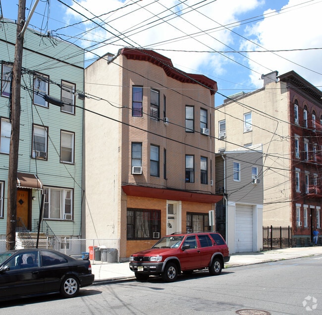
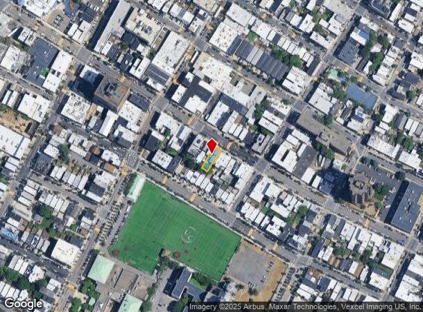
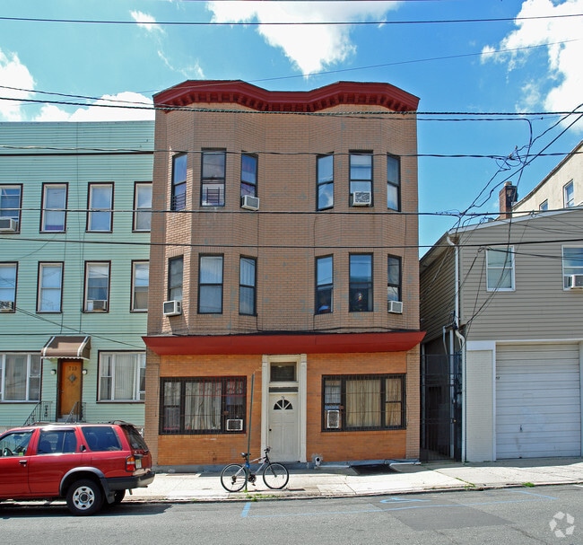
Property Record
715 22Nd St, Union City, NJ 07087
NEARBY LISTINGS FOR SALE OR LEASE
Property Detail
715 22Nd St
10-00116-0000-00011
Hudson
Apartment
New Jersey
X
11
34003C0268H
0.07 AC
2024
North Hudson County
2025
Northern New Jersey
017000
New York-Jersey City-White Plains, NY-NJ
DEMOGRAPHICS near 715 22Nd St
1 Mile
3 Mile
5 Mile
2024 Total Population
78,188
609,231
1,746,221
2029 Population
74,979
579,060
1,641,381
Pop Growth 2024-2029
(4.10%)
(4.95%)
(6.00%)
Average Age
39
40
40
2024 Total Households
28,691
280,489
831,537
HH Growth 2024-2029
(4.46%)
(5.44%)
(6.35%)
Median Household Inc
$65,256
$94,947
$101,760
Avg Household Size
2.60
2.10
2.00
2024 Avg HH Vehicles
1.00
1.00
.00
Median Home Value
$454,001
$732,101
$863,777
Median Year Built
1957
1966
1959
Nearby Places
Map Layers
Map Styles
 Street
 Aerial
- Restaurants
- Banks
- Shops
- Fitness
- Groceries
PUBLIC TRANSPORTATION
COMMUTER RAIL
Hoboken (Hoboken-33rd Street - Port Authority Trans-Hudson (PATH), Hoboken-World Trade Center - Port Authority Trans-Hudson (PATH))
DRIVE
WALK
Distance
Hoboken (Hoboken-33rd Street - Port Authority Trans-Hudson (PATH), Hoboken-World Trade Center - Port Authority Trans-Hudson (PATH))
11 min
3.0 mi
Journal Square (Journal Square-33rd Street - Port Authority Trans-Hudson (PATH), Newark Penn Station-World Trade Center - Port Authority Trans-Hudson (PATH))
DRIVE
WALK
Distance
Journal Square (Journal Square-33rd Street - Port Authority Trans-Hudson (PATH), Newark Penn Station-World Trade Center - Port Authority Trans-Hudson (PATH))
9 min
3.1 mi
AIRPORT
Newark Liberty International
DRIVE
WALK
Distance
Newark Liberty International
14 min
10.9 mi
LaGuardia
DRIVE
WALK
Distance
LaGuardia
29 min
12.8 mi
John F Kennedy International
DRIVE
WALK
Distance
John F Kennedy International
37 min
20.8 mi
Freight Ports
NY - Red Hook Container Terminal
DRIVE
WALK
Distance
NY - Red Hook Container Terminal
24 min
9.5 mi
SALE & LEASE HISTORY
LISTING DATE
SALE/LEASE

Oct 02, 2024
For Sale
Mar 06, 2024
For Sale
Nearby Properties
Address
Land Use
TOTAL SIZE
Lot Size
Zoning
Address
Land Use
TOTAL SIZE
Lot Size
Zoning
4,060,596 SF
22.09 AC
M2-3
Address
Land Use
TOTAL SIZE
Lot Size
Zoning
2,245,112 SF
2.02 AC
C6-6
Address
Land Use
TOTAL SIZE
Lot Size
Zoning
2,521,850 SF
1.59 AC
C6-4
Address
Land Use
TOTAL SIZE
Lot Size
Zoning
1,445,092 SF
3.10 AC
C6-4
Address
Land Use
TOTAL SIZE
Lot Size
Zoning
2,221,336 SF
1.55 AC
C6-4
Address
Land Use
TOTAL SIZE
Lot Size
Zoning
2,636,182 SF
2.35 AC
C65.5
Address
Land Use
TOTAL SIZE
Lot Size
Zoning
9.33 AC
C-1
Address
Land Use
TOTAL SIZE
Lot Size
Zoning
2,161,994 SF
3.79 AC
M1-5
Address
Land Use
TOTAL SIZE
Lot Size
Zoning
2,360,627 SF
2.08 AC
C6-7
Address
Land Use
TOTAL SIZE
Lot Size
Zoning
1,642,675 SF
1.05 AC
C6-7
Address
Land Use
TOTAL SIZE
Lot Size
Zoning
1,984,228 SF
1.95 AC
C65.5
Address
Land Use
TOTAL SIZE
Lot Size
Zoning
1,048,620 SF
5.67 AC
C6-4
Address
Land Use
TOTAL SIZE
Lot Size
Zoning
1,962,900 SF
1.89 AC
C66.5
Address
Land Use
TOTAL SIZE
Lot Size
Zoning
1,946,157 SF
1.49 AC
C6-4
Address
Land Use
TOTAL SIZE
Lot Size
Zoning
2,535,958 SF
2.94 AC
C6-4
Address
Land Use
TOTAL SIZE
Lot Size
Zoning
1,178,640 SF
0.92 AC
C6-4
Address
Land Use
TOTAL SIZE
Lot Size
Zoning
1,751,641 SF
1.84 AC
C6-4
Address
Land Use
TOTAL SIZE
Lot Size
Zoning
6,877 SF
27.74 AC
UD
Address
Land Use
TOTAL SIZE
Lot Size
Zoning
1,613,847 SF
1.84 AC
C66.5
Address
Land Use
TOTAL SIZE
Lot Size
Zoning
1,596,521 SF
1.34 AC
C6-4
Address
Land Use
TOTAL SIZE
Lot Size
Zoning
1,805,894 SF
1.42 AC
C6-4
Address
Land Use
TOTAL SIZE
Lot Size
Zoning
264,420 SF
7.26 AC
C4-7
Address
Land Use
TOTAL SIZE
Lot Size
Zoning
431,963 SF
C67T
Address
Land Use
TOTAL SIZE
Lot Size
Zoning
1,009,855 SF
4.90 AC
C6-3
Address
Land Use
TOTAL SIZE
Lot Size
Zoning
1,448,897 SF
1.56 AC
C6-6
Address
Land Use
TOTAL SIZE
Lot Size
Zoning
1,649,604 SF
1.51 AC
C67T
Address
Land Use
TOTAL SIZE
Lot Size
Zoning
1,606,528 SF
1.84 AC
C6-6
Address
Land Use
TOTAL SIZE
Lot Size
Zoning
1,009,855 SF
3.25 AC
C6-3
Address
Land Use
TOTAL SIZE
Lot Size
Zoning
366,455 SF
3.23 AC
R
Address
Land Use
TOTAL SIZE
Lot Size
Zoning
1,642,441 SF
3.26 AC
C52.5
The World's #1 Commercial Real Estate Marketplace
Connect with us
© 2025 CoStar Group
The information above has been obtained from sources believed reliable. While we do not doubt its accuracy we have not verified it and make no guarantee, warranty or representation about it. It is your responsibility to independently confirm its accuracy and completeness. Any projections, opinions, assumptions, or estimates used are for example only and do not represent the current or future performance of the property. The value of this transaction to you depends on tax and other factors which should be evaluated by your tax, financial, and legal advisors. You and your advisors should conduct a careful, independent investigation of the property to determine to your satisfaction the suitability of the property for your needs.