Property Record
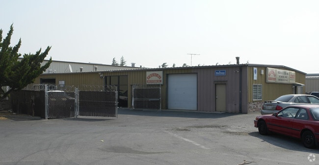
715 Fulton Shipyard Rd, Antioch, CA 94509


NEARBY LISTINGS FOR SALE OR LEASE
Property Detail
715 Fulton Shipyard Rd
065-040-021-1
Parcel Map
Lightindustrial
PCL MAP 41 PG 3 PCL 2
X
Contra Costa
06095C0718F
California
2024
0.28 AC
2025
Antioch/Pittsburg
306004
East Bay/Oakland
5,000 SF
Oakland-Hayward-Berkeley, CA
DEMOGRAPHICS near 715 Fulton Shipyard Rd
1 Mile
3 Mile
5 Mile
2024 Total Population
13,327
74,993
168,547
2029 Population
13,214
74,691
168,418
Pop Growth 2024-2029
(0.85%)
(0.40%)
(0.08%)
Average Age
37
38
38
2024 Total Households
4,369
24,214
52,646
HH Growth 2024-2029
(0.89%)
(0.46%)
(0.12%)
Median Household Inc
$57,826
$72,489
$86,329
Avg Household Size
2.90
3.00
3.10
2024 Avg HH Vehicles
2.00
2.00
2.00
Median Home Value
$404,444
$498,628
$564,357
Median Year Built
1960
1977
1985
Nearby Places
Map Layers
Map Styles
 Street
 Aerial
- Restaurants
- Banks
- Shops
- Fitness
- Groceries
PUBLIC TRANSPORTATION
COMMUTER RAIL
DRIVE
WALK
Distance
4 min
1.4 mi
AIRPORT
Stockton Metro
DRIVE
WALK
Distance
Stockton Metro
61 min
40.6 mi
Metro Oakland International
DRIVE
WALK
Distance
Metro Oakland International
61 min
45.5 mi
Freight Ports
Port of Oakland
DRIVE
WALK
Distance
Port of Oakland
49 min
38.2 mi
Nearby Properties
Address
Land Use
TOTAL SIZE
Lot Size
Zoning
Address
Land Use
TOTAL SIZE
Lot Size
Zoning
109,536 SF
24.93 AC
Address
Land Use
TOTAL SIZE
Lot Size
Zoning
24,286 SF
13.89 AC
Address
Land Use
TOTAL SIZE
Lot Size
Zoning
198,470 SF
13.49 AC
Address
Land Use
TOTAL SIZE
Lot Size
Zoning
246.20 AC
Address
Land Use
TOTAL SIZE
Lot Size
Zoning
3,472 SF
11.68 AC
Address
Land Use
TOTAL SIZE
Lot Size
Zoning
479,414 SF
30.53 AC
Address
Land Use
TOTAL SIZE
Lot Size
Zoning
28,078 SF
6.46 AC
Address
Land Use
TOTAL SIZE
Lot Size
Zoning
38.31 AC
Address
Land Use
TOTAL SIZE
Lot Size
Zoning
228,334 SF
30.34 AC
HI
Address
Land Use
TOTAL SIZE
Lot Size
Zoning
145,503 SF
25.05 AC
Address
Land Use
TOTAL SIZE
Lot Size
Zoning
497,235 SF
26.26 AC
Address
Land Use
TOTAL SIZE
Lot Size
Zoning
443,591 SF
23.43 AC
Address
Land Use
TOTAL SIZE
Lot Size
Zoning
2,352 SF
7.29 AC
Address
Land Use
TOTAL SIZE
Lot Size
Zoning
161,131 SF
15.97 AC
Address
Land Use
TOTAL SIZE
Lot Size
Zoning
6,284 SF
5.75 AC
Address
Land Use
TOTAL SIZE
Lot Size
Zoning
47,307 SF
6.70 AC
Address
Land Use
TOTAL SIZE
Lot Size
Zoning
25.31 AC
Address
Land Use
TOTAL SIZE
Lot Size
Zoning
4,240 SF
11.04 AC
Address
Land Use
TOTAL SIZE
Lot Size
Zoning
2.06 AC
Address
Land Use
TOTAL SIZE
Lot Size
Zoning
91,344 SF
4.79 AC
R4
Address
Land Use
TOTAL SIZE
Lot Size
Zoning
5,584 SF
10.47 AC
Address
Land Use
TOTAL SIZE
Lot Size
Zoning
75,119 SF
3.26 AC
Address
Land Use
TOTAL SIZE
Lot Size
Zoning
137,208 SF
10.37 AC
Address
Land Use
TOTAL SIZE
Lot Size
Zoning
62,140 SF
3.27 AC
Address
Land Use
TOTAL SIZE
Lot Size
Zoning
6,594 SF
2.94 AC
R1
Address
Land Use
TOTAL SIZE
Lot Size
Zoning
45,433 SF
5.71 AC
Address
Land Use
TOTAL SIZE
Lot Size
Zoning
82,077 SF
4.64 AC
Address
Land Use
TOTAL SIZE
Lot Size
Zoning
12.21 AC
Address
Land Use
TOTAL SIZE
Lot Size
Zoning
159,218 SF
3.68 AC
Address
Land Use
TOTAL SIZE
Lot Size
Zoning
239,730 SF
12.59 AC
The World's #1 Commercial Real Estate Marketplace
Connect with us
© 2025 CoStar Group
The information above has been obtained from sources believed reliable. While we do not doubt its accuracy we have not verified it and make no guarantee, warranty or representation about it. It is your responsibility to independently confirm its accuracy and completeness. Any projections, opinions, assumptions, or estimates used are for example only and do not represent the current or future performance of the property. The value of this transaction to you depends on tax and other factors which should be evaluated by your tax, financial, and legal advisors. You and your advisors should conduct a careful, independent investigation of the property to determine to your satisfaction the suitability of the property for your needs.