Property Record
715 W Taylor Rd, Turlock, CA 95382


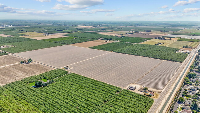
Property Detail
715 W Taylor Rd
045-59-05
MOBILE HOMES
Agriculturalland
STANISLAUS
A240
California
B and X Area of moderate flood hazard, usually the area between the limits of the 100-year and 500-year floods.
65&71
2025
78.30 AC
2025
Turlock/SW Stanislaus
003909
Stockton/Modesto
1,224 SF
Modesto, CA
NEARBY LISTINGS FOR SALE OR LEASE
DEMOGRAPHICS near 715 W Taylor Rd
1 mile
3 mile
5 mile
2025 Total Population
7,774
58,692
102,885
2030 Population
7,825
59,536
104,064
Pop Growth 2025-2030
+ 0.66%
+ 1.44%
+ 1.15%
Average Age
37
38
38
2025 Total Households
2,430
20,181
33,792
HH Growth 2025-2030
+ 0.62%
+ 1.58%
+ 1.24%
Median Household Inc
$108,019
$88,083
$86,768
Avg Household Size
3.00
2.80
2.90
2025 Avg HH Vehicles
2.00
2.00
2.00
Median Home Value
$588,268
$488,341
$479,978
Median Year Built
1999
1987
1983
Nearby Places
Map Layers
Map Styles
 Street
 Aerial
Layers
 Traffic
 Biking
Places
Listings with unknown addresses are not visible on the map
- Restaurants
- Banks
- Shops
- Fitness
- Groceries
Nearby Properties
Address
Land Use
TOTAL SIZE
Lot Size
Zoning
Address
Land Use
TOTAL SIZE
Lot Size
Zoning
281,904 SF
17.84 AC
Address
Land Use
TOTAL SIZE
Lot Size
Zoning
224,984 SF
9.63 AC
R3
Address
Land Use
TOTAL SIZE
Lot Size
Zoning
349,309 SF
21.87 AC
Address
Land Use
TOTAL SIZE
Lot Size
Zoning
144,172 SF
15.75 AC
TURCT
Address
Land Use
TOTAL SIZE
Lot Size
Zoning
264,573 SF
9.47 AC
TURPD
Address
Land Use
TOTAL SIZE
Lot Size
Zoning
144,510 SF
12.04 AC
Address
Land Use
TOTAL SIZE
Lot Size
Zoning
111,617 SF
10.10 AC
Address
Land Use
TOTAL SIZE
Lot Size
Zoning
149,310 SF
8.45 AC
Address
Land Use
TOTAL SIZE
Lot Size
Zoning
184,158 SF
9.08 AC
PD21
Address
Land Use
TOTAL SIZE
Lot Size
Zoning
302,449 SF
17.57 AC
Address
Land Use
TOTAL SIZE
Lot Size
Zoning
103,011 SF
7.90 AC
Address
Land Use
TOTAL SIZE
Lot Size
Zoning
52,304 SF
5.10 AC
Address
Land Use
TOTAL SIZE
Lot Size
Zoning
118,812 SF
10.19 AC
PD
Address
Land Use
TOTAL SIZE
Lot Size
Zoning
88,787 SF
4.88 AC
TURCH
Address
Land Use
TOTAL SIZE
Lot Size
Zoning
68,015 SF
4.45 AC
CO
Address
Land Use
TOTAL SIZE
Lot Size
Zoning
55,955 SF
3.76 AC
TURRL
Address
Land Use
TOTAL SIZE
Lot Size
Zoning
37,500 SF
3.87 AC
Address
Land Use
TOTAL SIZE
Lot Size
Zoning
111,357 SF
4.33 AC
TURCH
Address
Land Use
TOTAL SIZE
Lot Size
Zoning
135,768 SF
9.34 AC
CH
Address
Land Use
TOTAL SIZE
Lot Size
Zoning
88,253 SF
8.78 AC
TURCC
Address
Land Use
TOTAL SIZE
Lot Size
Zoning
105,700 SF
12 AC
TURCH
Address
Land Use
TOTAL SIZE
Lot Size
Zoning
50,700 SF
4.91 AC
TURCC
Address
Land Use
TOTAL SIZE
Lot Size
Zoning
44,860 SF
2.93 AC
Address
Land Use
TOTAL SIZE
Lot Size
Zoning
60,225 SF
5.63 AC
TURCC
Address
Land Use
TOTAL SIZE
Lot Size
Zoning
124,591 SF
12.99 AC
Address
Land Use
TOTAL SIZE
Lot Size
Zoning
128,993 SF
9.86 AC
TURCH
Address
Land Use
TOTAL SIZE
Lot Size
Zoning
120,762 SF
9.39 AC
Address
Land Use
TOTAL SIZE
Lot Size
Zoning
55,241 SF
4.94 AC
CC
Address
Land Use
TOTAL SIZE
Lot Size
Zoning
110,184 SF
6.60 AC
Address
Land Use
TOTAL SIZE
Lot Size
Zoning
35,593 SF
3.08 AC
0
The World's #1 Commercial Real Estate Marketplace
Connect with us
© 2026 CoStar Group
The information above has been obtained from sources believed reliable. While we do not doubt its accuracy we have not verified it and make no guarantee, warranty or representation about it. It is your responsibility to independently confirm its accuracy and completeness. Any projections, opinions, assumptions, or estimates used are for example only and do not represent the current or future performance of the property. The value of this transaction to you depends on tax and other factors which should be evaluated by your tax, financial, and legal advisors. You and your advisors should conduct a careful, independent investigation of the property to determine to your satisfaction the suitability of the property for your needs.