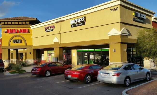
Property Record
7150 S Durango Dr, Las Vegas, NV 89113


Current Lease Availabilities
Property Detail
7150 S Durango Dr
176-04-413-005
DURANGO WARM SPRINGS PLAT BOOK 139 PAGE 49 PT LOT 1
Storebuilding
Clark
C2
Nevada
B and X Area of moderate flood hazard, usually the area between the limits of the 100-year and 500-year floods.
1
2026
1.99 AC
2026
Southwest Las Vegas
002976
Las Vegas
16,002 SF
Las Vegas-Henderson-North Las Vegas, NV
NEARBY LISTINGS FOR SALE OR LEASE
DEMOGRAPHICS near 7150 S Durango Dr
1 mile
3 mile
5 mile
2025 Total Population
18,461
149,396
339,477
2030 Population
19,501
158,903
359,085
Pop Growth 2025-2030
+ 5.63%
+ 6.36%
+ 5.78%
Average Age
38
38
39
2025 Total Households
7,516
55,777
127,270
HH Growth 2025-2030
+ 5.63%
+ 6.40%
+ 5.75%
Median Household Inc
$77,395
$95,633
$88,631
Avg Household Size
2.40
2.70
2.60
2025 Avg HH Vehicles
2.00
2.00
2.00
Median Home Value
$460,495
$489,675
$469,910
Median Year Built
2006
2007
2004
Nearby Places
Map Layers
Map Styles
 Street
 Aerial
Transit
 Traffic
 Biking
Places
Listings with unknown addresses are not visible on the map
- Restaurants
- Banks
- Shops
- Fitness
- Groceries
PUBLIC TRANSPORTATION
AIRPORT
Harry Reid International
Drive
Walk
Distance
Harry Reid International
14 min
9.9 mi
Boulder City Municipal
Drive
Walk
Distance
Boulder City Municipal
39 min
29.6 mi
Freight Ports
Port of Long Beach
Drive
Walk
Distance
Port of Long Beach
315 min
281.5 mi
Nearby Properties
Address
Land Use
TOTAL SIZE
Lot Size
Zoning
Address
Land Use
TOTAL SIZE
Lot Size
Zoning
552,417 SF
49.39 AC
H1
Address
Land Use
TOTAL SIZE
Lot Size
Zoning
205,752 SF
36.24 AC
C1
Address
Land Use
TOTAL SIZE
Lot Size
Zoning
174,108 SF
52.16 AC
RU
Address
Land Use
TOTAL SIZE
Lot Size
Zoning
760,651 SF
41.25 AC
Address
Land Use
TOTAL SIZE
Lot Size
Zoning
29.59 AC
CP
Address
Land Use
TOTAL SIZE
Lot Size
Zoning
Address
Land Use
TOTAL SIZE
Lot Size
Zoning
349,295 SF
25.97 AC
Address
Land Use
TOTAL SIZE
Lot Size
Zoning
8,754 SF
17.14 AC
C2
Address
Land Use
TOTAL SIZE
Lot Size
Zoning
9,279 SF
24.36 AC
Address
Land Use
TOTAL SIZE
Lot Size
Zoning
504,632 SF
6.25 AC
Address
Land Use
TOTAL SIZE
Lot Size
Zoning
6,142 SF
13.96 AC
C2
Address
Land Use
TOTAL SIZE
Lot Size
Zoning
151,243 SF
22.93 AC
Address
Land Use
TOTAL SIZE
Lot Size
Zoning
401,023 SF
17.61 AC
R-3
Address
Land Use
TOTAL SIZE
Lot Size
Zoning
35.55 AC
PF
Address
Land Use
TOTAL SIZE
Lot Size
Zoning
12,349 SF
12.50 AC
Address
Land Use
TOTAL SIZE
Lot Size
Zoning
18.62 AC
PF
Address
Land Use
TOTAL SIZE
Lot Size
Zoning
374,101 SF
31.11 AC
Address
Land Use
TOTAL SIZE
Lot Size
Zoning
396,742 SF
17.10 AC
Address
Land Use
TOTAL SIZE
Lot Size
Zoning
115,488 SF
6.41 AC
Address
Land Use
TOTAL SIZE
Lot Size
Zoning
3,398 SF
13.56 AC
Address
Land Use
TOTAL SIZE
Lot Size
Zoning
10,869 SF
14.77 AC
Address
Land Use
TOTAL SIZE
Lot Size
Zoning
1,961 SF
4.34 AC
Address
Land Use
TOTAL SIZE
Lot Size
Zoning
398,545 SF
20.40 AC
Address
Land Use
TOTAL SIZE
Lot Size
Zoning
9.34 AC
Address
Land Use
TOTAL SIZE
Lot Size
Zoning
5,374 SF
12.36 AC
Address
Land Use
TOTAL SIZE
Lot Size
Zoning
4,199 SF
12.11 AC
RE
Address
Land Use
TOTAL SIZE
Lot Size
Zoning
107.39 AC
RE
Address
Land Use
TOTAL SIZE
Lot Size
Zoning
220,718 SF
3.99 AC
C2
Address
Land Use
TOTAL SIZE
Lot Size
Zoning
478,844 SF
35.21 AC
MD
Address
Land Use
TOTAL SIZE
Lot Size
Zoning
43,264 SF
3.56 AC
The World's #1 Commercial Real Estate Marketplace
Connect with us
© 2026 CoStar Group
The information above has been obtained from sources believed reliable. While we do not doubt its accuracy we have not verified it and make no guarantee, warranty or representation about it. It is your responsibility to independently confirm its accuracy and completeness. Any projections, opinions, assumptions, or estimates used are for example only and do not represent the current or future performance of the property. The value of this transaction to you depends on tax and other factors which should be evaluated by your tax, financial, and legal advisors. You and your advisors should conduct a careful, independent investigation of the property to determine to your satisfaction the suitability of the property for your needs.