Property Record
7153 Forthun Rd, Baxter, MN 56425


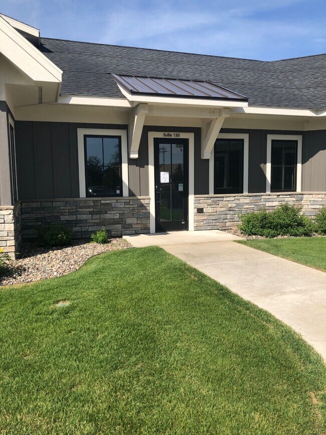
Property Detail
7153 Forthun Rd
Brainerd, MN
LOT 1 BLOCK 1 & ALSO INCL PHASE 3 SHANANDOAH OFFICE PARK PT OF OUTLOT C DESC: COMM AT NW COR OF SD O
034220010010009
Crow Wing
Officebuilding
Minnesota
AE The base floodplain where base flood elevations are provided. AE Zones are now used on new format FIRMs instead of A1-A30 Zones.
1
2024
2.11 AC
2025
Minnesota Central Area
951304
Other Market Areas
9,561 SF
NEARBY LISTINGS FOR SALE OR LEASE
DEMOGRAPHICS near 7153 Forthun Rd
1 mile
3 mile
5 mile
2024 Total Population
1,776
15,437
24,963
2029 Population
1,768
15,201
24,590
Pop Growth 2024-2029
(0.45%)
(1.53%)
(1.49%)
Average Age
41
41
40
2024 Total Households
763
6,337
10,059
HH Growth 2024-2029
(0.39%)
(1.72%)
(1.65%)
Median Household Inc
$58,636
$64,247
$66,778
Avg Household Size
2.20
2.30
2.30
2024 Avg HH Vehicles
2.00
2.00
2.00
Median Home Value
$298,360
$286,467
$279,864
Median Year Built
2002
1985
1985
Nearby Places
Map Layers
Map Styles
 Street
 Aerial
Transit
 Traffic
 Biking
Places
Listings with unknown addresses are not visible on the map
- Restaurants
- Banks
- Shops
- Fitness
- Groceries
SALE & LEASE HISTORY
LISTING DATE
SALE/LEASE

Feb 12, 2020
For Lease
Nearby Properties
Address
Land Use
TOTAL SIZE
Lot Size
Zoning
Address
Land Use
TOTAL SIZE
Lot Size
Zoning
320,708 SF
35.89 AC
Address
Land Use
TOTAL SIZE
Lot Size
Zoning
3,829 SF
1.04 AC
Address
Land Use
TOTAL SIZE
Lot Size
Zoning
344,274 SF
163.56 AC
Address
Land Use
TOTAL SIZE
Lot Size
Zoning
186,000 SF
8.71 AC
Address
Land Use
TOTAL SIZE
Lot Size
Zoning
229,123 SF
11.84 AC
Address
Land Use
TOTAL SIZE
Lot Size
Zoning
128,295 SF
2.08 AC
Address
Land Use
TOTAL SIZE
Lot Size
Zoning
110,624 SF
5.62 AC
Address
Land Use
TOTAL SIZE
Lot Size
Zoning
33,460 SF
94.30 AC
Address
Land Use
TOTAL SIZE
Lot Size
Zoning
91,464 SF
4.83 AC
Address
Land Use
TOTAL SIZE
Lot Size
Zoning
63,251 SF
8.27 AC
Address
Land Use
TOTAL SIZE
Lot Size
Zoning
50,741 SF
13.48 AC
Address
Land Use
TOTAL SIZE
Lot Size
Zoning
113,024 SF
2.96 AC
Address
Land Use
TOTAL SIZE
Lot Size
Zoning
83,078 SF
9.71 AC
Address
Land Use
TOTAL SIZE
Lot Size
Zoning
90,147 SF
12.93 AC
Address
Land Use
TOTAL SIZE
Lot Size
Zoning
55,953 SF
14.52 AC
Address
Land Use
TOTAL SIZE
Lot Size
Zoning
69,515 SF
2.14 AC
Address
Land Use
TOTAL SIZE
Lot Size
Zoning
68,675 SF
3.12 AC
Address
Land Use
TOTAL SIZE
Lot Size
Zoning
68,675 SF
3.06 AC
Address
Land Use
TOTAL SIZE
Lot Size
Zoning
65,502 SF
4.39 AC
Address
Land Use
TOTAL SIZE
Lot Size
Zoning
147,137 SF
16.34 AC
Address
Land Use
TOTAL SIZE
Lot Size
Zoning
54,164 SF
5.65 AC
Address
Land Use
TOTAL SIZE
Lot Size
Zoning
270,176 SF
17.13 AC
Address
Land Use
TOTAL SIZE
Lot Size
Zoning
209,815 SF
22.30 AC
Address
Land Use
TOTAL SIZE
Lot Size
Zoning
64,187 SF
3.47 AC
Address
Land Use
TOTAL SIZE
Lot Size
Zoning
87,007 SF
4.98 AC
Address
Land Use
TOTAL SIZE
Lot Size
Zoning
79,048 SF
5.33 AC
Address
Land Use
TOTAL SIZE
Lot Size
Zoning
66,967 SF
2.95 AC
Address
Land Use
TOTAL SIZE
Lot Size
Zoning
167,226 SF
24.08 AC
Address
Land Use
TOTAL SIZE
Lot Size
Zoning
30,819 SF
9.36 AC
Address
Land Use
TOTAL SIZE
Lot Size
Zoning
38,487 SF
2.78 AC
The World's #1 Commercial Real Estate Marketplace
Connect with us
© 2026 CoStar Group
The information above has been obtained from sources believed reliable. While we do not doubt its accuracy we have not verified it and make no guarantee, warranty or representation about it. It is your responsibility to independently confirm its accuracy and completeness. Any projections, opinions, assumptions, or estimates used are for example only and do not represent the current or future performance of the property. The value of this transaction to you depends on tax and other factors which should be evaluated by your tax, financial, and legal advisors. You and your advisors should conduct a careful, independent investigation of the property to determine to your satisfaction the suitability of the property for your needs.