Property Record
716 S Main St, Landis, NC 28088
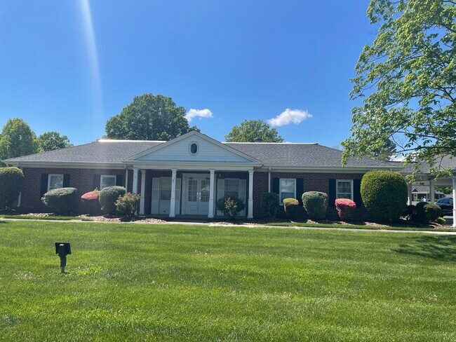

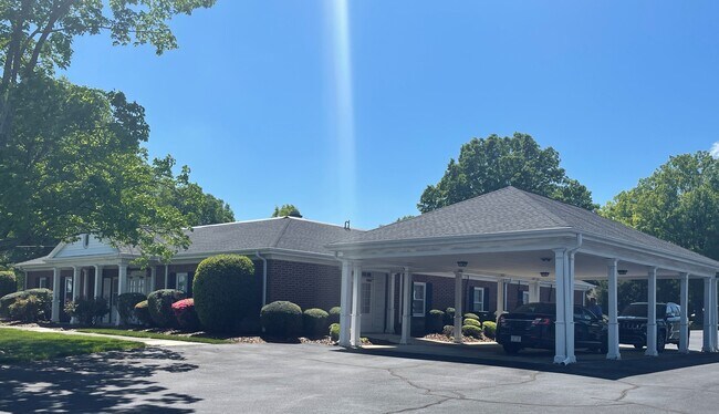
Property Detail
716 S Main St
157-027
L4 & L7-8 BC L. A. CORRIHER ADDITION TO LANDIS
Officebuilding
Rowan
B and X Area of moderate flood hazard, usually the area between the limits of the 100-year and 500-year floods.
North Carolina
2025
0.84 AC
2025
Rowan County
051600
Charlotte
5,444 SF
Charlotte-Concord-Gastonia, NC-SC
NEARBY LISTINGS FOR SALE OR LEASE
-
-
View all Landis listings for sale on LoopNet.com
DEMOGRAPHICS near 716 S Main St
1 mile
3 mile
5 mile
2025 Total Population
4,381
27,103
64,925
2030 Population
4,609
28,498
68,874
Pop Growth 2025-2030
+ 5.20%
+ 5.15%
+ 6.08%
Average Age
40
40
40
2025 Total Households
1,741
10,689
25,478
HH Growth 2025-2030
+ 5.34%
+ 5.27%
+ 6.24%
Median Household Inc
$58,565
$64,644
$60,292
Avg Household Size
2.50
2.50
2.50
2025 Avg HH Vehicles
2.00
2.00
2.00
Median Home Value
$285,555
$253,330
$255,348
Median Year Built
1976
1975
1978
Nearby Places
Map Layers
Map Styles
 Street
 Aerial
Layers
 Traffic
 Biking
Places
Listings with unknown addresses are not visible on the map
- Restaurants
- Banks
- Shops
- Fitness
- Groceries
PUBLIC TRANSPORTATION
COMMUTER RAIL
Kannapolis Station (Piedmont - North Carolina by Train (NC Train))
Drive
Walk
Distance
Kannapolis Station (Piedmont - North Carolina by Train (NC Train))
7 min
3.6 mi
AIRPORT
Concord-Padgett Regional
Drive
Walk
Distance
Concord-Padgett Regional
26 min
16.2 mi
Charlotte/Douglas International
Drive
Walk
Distance
Charlotte/Douglas International
52 min
36.4 mi
Freight Ports
Port of Wilmington
Drive
Walk
Distance
Port of Wilmington
267 min
205.5 mi
SALE & LEASE HISTORY
LISTING DATE
SALE/LEASE

Apr 19, 2021
For Sale
The World's #1 Commercial Real Estate Marketplace
Connect with us
© 2026 CoStar Group
The information above has been obtained from sources believed reliable. While we do not doubt its accuracy we have not verified it and make no guarantee, warranty or representation about it. It is your responsibility to independently confirm its accuracy and completeness. Any projections, opinions, assumptions, or estimates used are for example only and do not represent the current or future performance of the property. The value of this transaction to you depends on tax and other factors which should be evaluated by your tax, financial, and legal advisors. You and your advisors should conduct a careful, independent investigation of the property to determine to your satisfaction the suitability of the property for your needs.