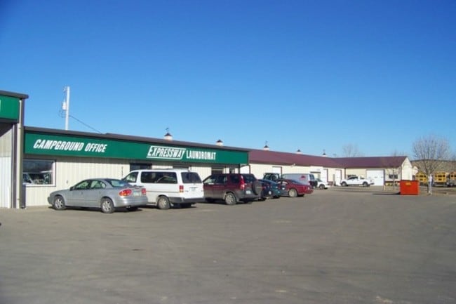
Property Record
717 27Th St Se, Minot, ND 58701

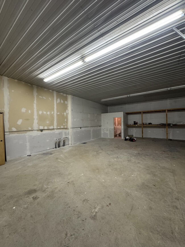


Current Lease Availabilities
NEARBY LISTINGS FOR SALE OR LEASE
Property Detail
717 27Th St Se
Other Market Areas
Less Evensons Addition
Minot, ND
SUB: MI20F13 LOT: 1 MINOT PARTNER'S 2ND ADDITION LOTS 1 & 2 LOT 1
MI20F130000010
Ward
Realpropertynec
North Dakota
2024
1-2
2024
2.11 AC
010200
Northeast Minot
6,500 SF
DEMOGRAPHICS near 717 27Th St Se
1 Mile
3 Mile
5 Mile
2024 Total Population
2,285
27,814
52,248
2029 Population
2,277
27,433
51,472
Pop Growth 2024-2029
(0.35%)
(1.37%)
(1.49%)
Average Age
34
38
38
2024 Total Households
919
11,866
22,349
HH Growth 2024-2029
(0.33%)
(1.44%)
(1.53%)
Median Household Inc
$58,671
$66,162
$69,637
Avg Household Size
2.40
2.20
2.20
2024 Avg HH Vehicles
2.00
2.00
2.00
Median Home Value
$188,838
$219,969
$237,308
Median Year Built
1973
1977
1983
Nearby Places
Map Layers
Map Styles
 Street
 Aerial
- Restaurants
- Banks
- Shops
- Fitness
- Groceries
PUBLIC TRANSPORTATION
COMMUTER RAIL
Minot Amtrak Station (Empire Builder - Amtrak)
DRIVE
WALK
Distance
Minot Amtrak Station (Empire Builder - Amtrak)
5 min
2.6 mi
AIRPORT
Minot International
DRIVE
WALK
Distance
Minot International
10 min
3.9 mi
Freight Ports
Port Milwaukee
DRIVE
WALK
Distance
Port Milwaukee
947 min
873.6 mi
Nearby Properties
Address
Land Use
TOTAL SIZE
Lot Size
Zoning
Address
Land Use
TOTAL SIZE
Lot Size
Zoning
41,710 SF
2.45 AC
Address
Land Use
TOTAL SIZE
Lot Size
Zoning
13.96 AC
Address
Land Use
TOTAL SIZE
Lot Size
Zoning
4,000 SF
59.25 AC
Address
Land Use
TOTAL SIZE
Lot Size
Zoning
45,052 SF
3.78 AC
Address
Land Use
TOTAL SIZE
Lot Size
Zoning
46,496 SF
2.41 AC
Address
Land Use
TOTAL SIZE
Lot Size
Zoning
27,064 SF
5.23 AC
Address
Land Use
TOTAL SIZE
Lot Size
Zoning
24,471 SF
1.54 AC
Address
Land Use
TOTAL SIZE
Lot Size
Zoning
800 SF
4 AC
Address
Land Use
TOTAL SIZE
Lot Size
Zoning
18,600 SF
5.03 AC
Address
Land Use
TOTAL SIZE
Lot Size
Zoning
161.15 AC
Address
Land Use
TOTAL SIZE
Lot Size
Zoning
14,112 SF
1.71 AC
Address
Land Use
TOTAL SIZE
Lot Size
Zoning
20.25 AC
Address
Land Use
TOTAL SIZE
Lot Size
Zoning
4,460 SF
44.39 AC
Address
Land Use
TOTAL SIZE
Lot Size
Zoning
24,110 SF
5.83 AC
Address
Land Use
TOTAL SIZE
Lot Size
Zoning
36,158 SF
Address
Land Use
TOTAL SIZE
Lot Size
Zoning
28,600 SF
1.41 AC
Address
Land Use
TOTAL SIZE
Lot Size
Zoning
6,120 SF
0.53 AC
Address
Land Use
TOTAL SIZE
Lot Size
Zoning
19,520 SF
1.03 AC
Address
Land Use
TOTAL SIZE
Lot Size
Zoning
6,930 SF
0.51 AC
Address
Land Use
TOTAL SIZE
Lot Size
Zoning
12,000 SF
2 AC
Address
Land Use
TOTAL SIZE
Lot Size
Zoning
121 AC
Address
Land Use
TOTAL SIZE
Lot Size
Zoning
10,770 SF
1.09 AC
Address
Land Use
TOTAL SIZE
Lot Size
Zoning
5,400 SF
0.46 AC
Address
Land Use
TOTAL SIZE
Lot Size
Zoning
6,532 SF
0.05 AC
Address
Land Use
TOTAL SIZE
Lot Size
Zoning
34,584 SF
1.39 AC
Address
Land Use
TOTAL SIZE
Lot Size
Zoning
40.12 AC
Address
Land Use
TOTAL SIZE
Lot Size
Zoning
20,839 SF
7.28 AC
Address
Land Use
TOTAL SIZE
Lot Size
Zoning
10,575 SF
0.16 AC
Address
Land Use
TOTAL SIZE
Lot Size
Zoning
12,400 SF
0.67 AC
The World's #1 Commercial Real Estate Marketplace
Connect with us
© 2026 CoStar Group
The information above has been obtained from sources believed reliable. While we do not doubt its accuracy we have not verified it and make no guarantee, warranty or representation about it. It is your responsibility to independently confirm its accuracy and completeness. Any projections, opinions, assumptions, or estimates used are for example only and do not represent the current or future performance of the property. The value of this transaction to you depends on tax and other factors which should be evaluated by your tax, financial, and legal advisors. You and your advisors should conduct a careful, independent investigation of the property to determine to your satisfaction the suitability of the property for your needs.