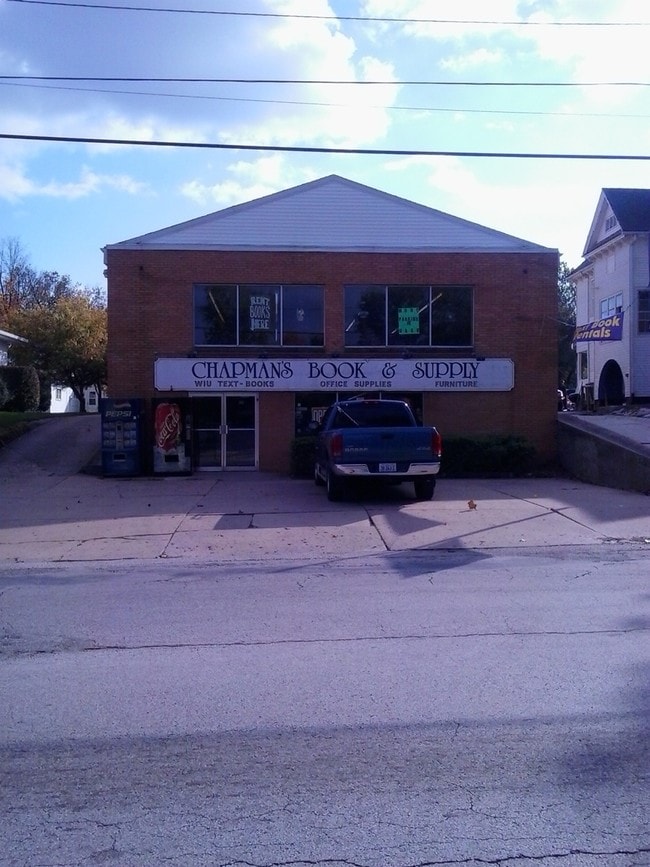
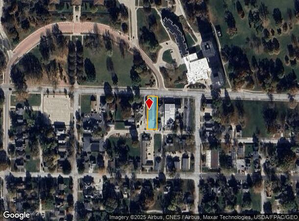
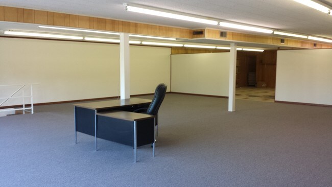
Property Record
717 W Adams St, Macomb, IL 61455
NEARBY LISTINGS FOR SALE OR LEASE
Property Detail
717 W Adams St
Macomb, IL
Eltings Sub
11-100-675-00
LOT 5 ELTINGS SUB
Storebuilding
Mcdonough
0
Illinois
2024
5
010402
0.27 AC
8,000 SF
Other Market Areas
DEMOGRAPHICS near 717 W Adams St
1 Mile
3 Mile
5 Mile
2024 Total Population
10,303
17,254
17,817
2029 Population
10,272
17,019
17,545
Pop Growth 2024-2029
(0.30%)
(1.36%)
(1.53%)
Average Age
33
38
38
2024 Total Households
3,985
7,178
7,410
HH Growth 2024-2029
(0.38%)
(1.64%)
(1.81%)
Median Household Inc
$27,043
$40,469
$41,441
Avg Household Size
1.90
2.00
2.00
2024 Avg HH Vehicles
1.00
1.00
2.00
Median Home Value
$95,781
$105,050
$108,220
Median Year Built
1972
1972
1972
Nearby Places
Map Layers
Map Styles
 Street
 Aerial
- Restaurants
- Banks
- Shops
- Fitness
- Groceries
PUBLIC TRANSPORTATION
COMMUTER RAIL
Macomb Amtrak Station (Carl Sandburg - Amtrak, Illinois Zephyr - Amtrak)
DRIVE
WALK
Distance
Macomb Amtrak Station (Carl Sandburg - Amtrak, Illinois Zephyr - Amtrak)
1 min
12 min
0.7 mi
Freight Ports
Port Milwaukee
DRIVE
WALK
Distance
Port Milwaukee
323 min
286.1 mi
SALE & LEASE HISTORY
LISTING DATE
SALE/LEASE

Sep 25, 2016
For Lease
Mar 30, 2017
For Sale
Mar 12, 2018
For Sale
Jan 28, 2018
For Sale
Dec 02, 2017
For Lease
Nearby Properties
Address
Land Use
TOTAL SIZE
Lot Size
Zoning
Address
Land Use
TOTAL SIZE
Lot Size
Zoning
Address
Land Use
TOTAL SIZE
Lot Size
Zoning
31.18 AC
Address
Land Use
TOTAL SIZE
Lot Size
Zoning
48.33 AC
Address
Land Use
TOTAL SIZE
Lot Size
Zoning
38,024 SF
5.35 AC
Address
Land Use
TOTAL SIZE
Lot Size
Zoning
55,785 SF
9.87 AC
Address
Land Use
TOTAL SIZE
Lot Size
Zoning
10,800 SF
3.85 AC
Address
Land Use
TOTAL SIZE
Lot Size
Zoning
91,908 SF
19.46 AC
Address
Land Use
TOTAL SIZE
Lot Size
Zoning
4.05 AC
Address
Land Use
TOTAL SIZE
Lot Size
Zoning
83,040 SF
1.01 AC
Address
Land Use
TOTAL SIZE
Lot Size
Zoning
13,523 SF
2.78 AC
Address
Land Use
TOTAL SIZE
Lot Size
Zoning
7.65 AC
Address
Land Use
TOTAL SIZE
Lot Size
Zoning
1.59 AC
Address
Land Use
TOTAL SIZE
Lot Size
Zoning
27,160 SF
6.57 AC
Address
Land Use
TOTAL SIZE
Lot Size
Zoning
13,452 SF
Address
Land Use
TOTAL SIZE
Lot Size
Zoning
3,000 SF
6.36 AC
Address
Land Use
TOTAL SIZE
Lot Size
Zoning
48,025 SF
6.50 AC
Address
Land Use
TOTAL SIZE
Lot Size
Zoning
10,000 SF
0.61 AC
Address
Land Use
TOTAL SIZE
Lot Size
Zoning
31,835 SF
5.37 AC
Address
Land Use
TOTAL SIZE
Lot Size
Zoning
10,944 SF
3.52 AC
Address
Land Use
TOTAL SIZE
Lot Size
Zoning
37,547 SF
0.30 AC
Address
Land Use
TOTAL SIZE
Lot Size
Zoning
38,200 SF
0.56 AC
Address
Land Use
TOTAL SIZE
Lot Size
Zoning
56,152 SF
6.69 AC
Address
Land Use
TOTAL SIZE
Lot Size
Zoning
15,256 SF
1.97 AC
Address
Land Use
TOTAL SIZE
Lot Size
Zoning
14,084 SF
1.56 AC
Address
Land Use
TOTAL SIZE
Lot Size
Zoning
8,136 SF
3.60 AC
Address
Land Use
TOTAL SIZE
Lot Size
Zoning
9,840 SF
20.50 AC
Address
Land Use
TOTAL SIZE
Lot Size
Zoning
85,630 SF
5.13 AC
Address
Land Use
TOTAL SIZE
Lot Size
Zoning
27,946 SF
1.54 AC
The World's #1 Commercial Real Estate Marketplace
Connect with us
© 2025 CoStar Group
The information above has been obtained from sources believed reliable. While we do not doubt its accuracy we have not verified it and make no guarantee, warranty or representation about it. It is your responsibility to independently confirm its accuracy and completeness. Any projections, opinions, assumptions, or estimates used are for example only and do not represent the current or future performance of the property. The value of this transaction to you depends on tax and other factors which should be evaluated by your tax, financial, and legal advisors. You and your advisors should conduct a careful, independent investigation of the property to determine to your satisfaction the suitability of the property for your needs.