Property Record
7177 Airport Rd, Temple, TX 76502
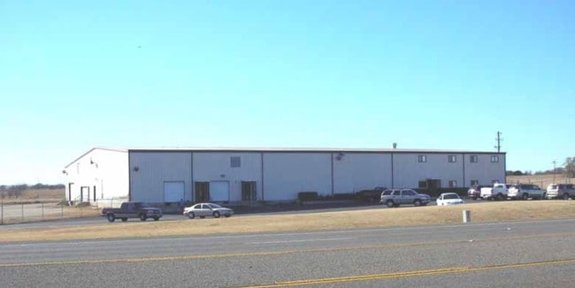

Property Detail
7177 Airport Rd
Killeen-Temple, TX
HONEYCUTT SUBDIVISION, BLOCK 001, LOT 1-4, PT 5-13, (S PT OF 5-13), ACRES 13.786
71469
Bell
Commercialnec
Texas
B and X Area of moderate flood hazard, usually the area between the limits of the 100-year and 500-year floods.
1-4
0
13.79 AC
2025
Temple
020302
Killeen/Temple/Fort Hood
32,684 SF
NEARBY LISTINGS FOR SALE OR LEASE
-
-
View all Temple listings for sale on LoopNet.com
DEMOGRAPHICS near 7177 Airport Rd
1 mile
3 mile
5 mile
2025 Total Population
2,212
28,389
69,248
2030 Population
2,468
30,561
73,996
Pop Growth 2025-2030
+ 11.57%
+ 7.65%
+ 6.86%
Average Age
35
35
38
2025 Total Households
745
10,304
27,093
HH Growth 2025-2030
+ 11.54%
+ 7.59%
+ 6.83%
Median Household Inc
$79,675
$85,462
$75,426
Avg Household Size
3.00
2.70
2.50
2025 Avg HH Vehicles
2.00
2.00
2.00
Median Home Value
$292,985
$277,721
$269,690
Median Year Built
2011
2007
1995
Nearby Places
Map Layers
Map Styles
 Street
 Aerial
Layers
 Traffic
 Biking
Places
Listings with unknown addresses are not visible on the map
- Restaurants
- Banks
- Shops
- Fitness
- Groceries
PUBLIC TRANSPORTATION
COMMUTER RAIL
Drive
Walk
Distance
9 min
5.0 mi
AIRPORT
Killeen Municipal
Drive
Walk
Distance
Killeen Municipal
33 min
24.4 mi
Robert Gray AAF
Drive
Walk
Distance
Robert Gray AAF
52 min
38.3 mi
Waco Regional
Drive
Walk
Distance
Waco Regional
61 min
45.8 mi
Nearby Properties
Address
Land Use
TOTAL SIZE
Lot Size
Zoning
Address
Land Use
TOTAL SIZE
Lot Size
Zoning
1 SF
14.43 AC
Address
Land Use
TOTAL SIZE
Lot Size
Zoning
109,343 SF
413.13 AC
LI
Address
Land Use
TOTAL SIZE
Lot Size
Zoning
214,028 SF
14.37 AC
Address
Land Use
TOTAL SIZE
Lot Size
Zoning
230,116 SF
12.79 AC
Address
Land Use
TOTAL SIZE
Lot Size
Zoning
81,419 SF
100.28 AC
Address
Land Use
TOTAL SIZE
Lot Size
Zoning
188,072 SF
9.51 AC
C
Address
Land Use
TOTAL SIZE
Lot Size
Zoning
Address
Land Use
TOTAL SIZE
Lot Size
Zoning
265,000 SF
15.41 AC
Address
Land Use
TOTAL SIZE
Lot Size
Zoning
41,630 SF
11.85 AC
Address
Land Use
TOTAL SIZE
Lot Size
Zoning
195,291 SF
36.30 AC
Address
Land Use
TOTAL SIZE
Lot Size
Zoning
261,265 SF
17.50 AC
C
Address
Land Use
TOTAL SIZE
Lot Size
Zoning
206,897 SF
12.51 AC
COMB
Address
Land Use
TOTAL SIZE
Lot Size
Zoning
165,357 SF
33.03 AC
Address
Land Use
TOTAL SIZE
Lot Size
Zoning
57,121 SF
54.72 AC
Address
Land Use
TOTAL SIZE
Lot Size
Zoning
155,262 SF
10 AC
MF2
Address
Land Use
TOTAL SIZE
Lot Size
Zoning
176,542 SF
11.50 AC
COMB
Address
Land Use
TOTAL SIZE
Lot Size
Zoning
91,983 SF
13.18 AC
Address
Land Use
TOTAL SIZE
Lot Size
Zoning
189,694 SF
20.78 AC
Address
Land Use
TOTAL SIZE
Lot Size
Zoning
189,694 SF
20.70 AC
Address
Land Use
TOTAL SIZE
Lot Size
Zoning
213,344 SF
47.24 AC
Address
Land Use
TOTAL SIZE
Lot Size
Zoning
199,544 SF
9.91 AC
Address
Land Use
TOTAL SIZE
Lot Size
Zoning
78,942 SF
15 AC
Address
Land Use
TOTAL SIZE
Lot Size
Zoning
2 SF
24.49 AC
Address
Land Use
TOTAL SIZE
Lot Size
Zoning
108,404 SF
37.10 AC
LI
Address
Land Use
TOTAL SIZE
Lot Size
Zoning
489,263 SF
340.15 AC
Address
Land Use
TOTAL SIZE
Lot Size
Zoning
69,689 SF
59.75 AC
Address
Land Use
TOTAL SIZE
Lot Size
Zoning
35,175 SF
30.95 AC
Address
Land Use
TOTAL SIZE
Lot Size
Zoning
57,410 SF
20 AC
LI
Address
Land Use
TOTAL SIZE
Lot Size
Zoning
87,600 SF
4 AC
Address
Land Use
TOTAL SIZE
Lot Size
Zoning
109,615 SF
6.80 AC
The World's #1 Commercial Real Estate Marketplace
Connect with us
© 2026 CoStar Group
The information above has been obtained from sources believed reliable. While we do not doubt its accuracy we have not verified it and make no guarantee, warranty or representation about it. It is your responsibility to independently confirm its accuracy and completeness. Any projections, opinions, assumptions, or estimates used are for example only and do not represent the current or future performance of the property. The value of this transaction to you depends on tax and other factors which should be evaluated by your tax, financial, and legal advisors. You and your advisors should conduct a careful, independent investigation of the property to determine to your satisfaction the suitability of the property for your needs.