Property Record
718 S Ankeny Blvd, Ankeny, IA 50023


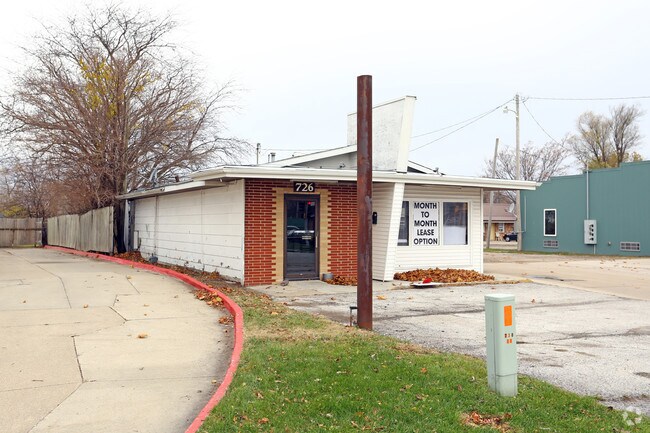
Property Detail
718 S Ankeny Blvd
181-00079000000
A TRI PC BNG W 42 F E 242 F ON S LN & S 39 F N 307 F ON E LN & W 150 F E 200 F S 147 F N 307 F & -EX E 50 F- S 181 F N 488 F E OF RY ROW NE 1/4 SE 1/4 SEC 23-80-24
Storebuilding
POLK
C-2
Iowa
B and X Area of moderate flood hazard, usually the area between the limits of the 100-year and 500-year floods.
2.37 AC
2024
Ankeny
2025
Des Moines
010205
Des Moines-West Des Moines, IA
2,608 SF
NEARBY LISTINGS FOR SALE OR LEASE
DEMOGRAPHICS near 718 S Ankeny Blvd
1 mile
3 mile
5 mile
2025 Total Population
10,353
67,319
86,753
2030 Population
10,753
70,761
91,220
Pop Growth 2025-2030
+ 3.86%
+ 5.11%
+ 5.15%
Average Age
38
37
37
2025 Total Households
4,188
26,384
33,253
HH Growth 2025-2030
+ 4.11%
+ 5.23%
+ 5.26%
Median Household Inc
$100,657
$105,503
$107,362
Avg Household Size
2.40
2.50
2.50
2025 Avg HH Vehicles
2.00
2.00
2.00
Median Home Value
$262,946
$335,937
$346,439
Median Year Built
1979
2003
2004
Nearby Places
Map Layers
Map Styles
 Street
 Aerial
Layers
 Traffic
 Biking
Places
Listings with unknown addresses are not visible on the map
- Restaurants
- Banks
- Shops
- Fitness
- Groceries
PUBLIC TRANSPORTATION
AIRPORT
Des Moines International
Drive
Walk
Distance
Des Moines International
30 min
16.6 mi
Nearby Properties
Address
Land Use
TOTAL SIZE
Lot Size
Zoning
Address
Land Use
TOTAL SIZE
Lot Size
Zoning
2,732,552 SF
443.35 AC
Address
Land Use
TOTAL SIZE
Lot Size
Zoning
723,056 SF
83.96 AC
M1
Address
Land Use
TOTAL SIZE
Lot Size
Zoning
519,216 SF
42.20 AC
Address
Land Use
TOTAL SIZE
Lot Size
Zoning
644,568 SF
29.90 AC
M-1
Address
Land Use
TOTAL SIZE
Lot Size
Zoning
463,530 SF
35.91 AC
M-1
Address
Land Use
TOTAL SIZE
Lot Size
Zoning
272,072 SF
11.70 AC
Address
Land Use
TOTAL SIZE
Lot Size
Zoning
350,150 SF
35.34 AC
Address
Land Use
TOTAL SIZE
Lot Size
Zoning
296,500 SF
24.36 AC
Address
Land Use
TOTAL SIZE
Lot Size
Zoning
644,942 SF
60.73 AC
M-1
Address
Land Use
TOTAL SIZE
Lot Size
Zoning
100,751 SF
12.67 AC
C-2
Address
Land Use
TOTAL SIZE
Lot Size
Zoning
263,250 SF
30.10 AC
M-1
Address
Land Use
TOTAL SIZE
Lot Size
Zoning
198,454 SF
12.04 AC
Address
Land Use
TOTAL SIZE
Lot Size
Zoning
254,801 SF
20.05 AC
Address
Land Use
TOTAL SIZE
Lot Size
Zoning
140,045 SF
9.29 AC
Address
Land Use
TOTAL SIZE
Lot Size
Zoning
200,860 SF
11.25 AC
Address
Land Use
TOTAL SIZE
Lot Size
Zoning
143,249 SF
7.19 AC
Address
Land Use
TOTAL SIZE
Lot Size
Zoning
200,220 SF
15.61 AC
Address
Land Use
TOTAL SIZE
Lot Size
Zoning
200,688 SF
20.26 AC
Address
Land Use
TOTAL SIZE
Lot Size
Zoning
90,381 SF
19.28 AC
R-3
Address
Land Use
TOTAL SIZE
Lot Size
Zoning
143,012 SF
1.75 AC
Address
Land Use
TOTAL SIZE
Lot Size
Zoning
170,692 SF
6.54 AC
Address
Land Use
TOTAL SIZE
Lot Size
Zoning
96,344 SF
13.39 AC
PUD
Address
Land Use
TOTAL SIZE
Lot Size
Zoning
63,664 SF
9.02 AC
Address
Land Use
TOTAL SIZE
Lot Size
Zoning
175,424 SF
8.01 AC
Address
Land Use
TOTAL SIZE
Lot Size
Zoning
162,384 SF
11.16 AC
R-3
Address
Land Use
TOTAL SIZE
Lot Size
Zoning
211,986 SF
20.98 AC
Address
Land Use
TOTAL SIZE
Lot Size
Zoning
144,992 SF
6.03 AC
Address
Land Use
TOTAL SIZE
Lot Size
Zoning
174,602 SF
15.47 AC
Address
Land Use
TOTAL SIZE
Lot Size
Zoning
116,213 SF
11.01 AC
C2
Address
Land Use
TOTAL SIZE
Lot Size
Zoning
122,066 SF
5.27 AC
The World's #1 Commercial Real Estate Marketplace
Connect with us
© 2026 CoStar Group
The information above has been obtained from sources believed reliable. While we do not doubt its accuracy we have not verified it and make no guarantee, warranty or representation about it. It is your responsibility to independently confirm its accuracy and completeness. Any projections, opinions, assumptions, or estimates used are for example only and do not represent the current or future performance of the property. The value of this transaction to you depends on tax and other factors which should be evaluated by your tax, financial, and legal advisors. You and your advisors should conduct a careful, independent investigation of the property to determine to your satisfaction the suitability of the property for your needs.