Property Record
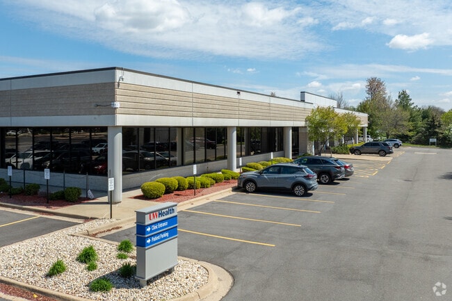
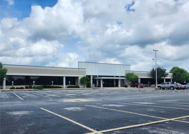
7180 Spring Brook Rd, Rockford, IL 61114

Current Lease Availabilities
Property Detail
7180 Spring Brook Rd
12-11-101-024
RALSTON FARM NO 5 PT NW1/4 SEC 11-44-2LOT 62
Officebuilding
Winnebago
C1
Illinois
B and X Area of moderate flood hazard, usually the area between the limits of the 100-year and 500-year floods.
62
2024
9.10 AC
2024
I-39 Corr/Winnebago Cnty
000512
Chicago
85,500 SF
Rockford, IL
NEARBY LISTINGS FOR SALE OR LEASE
DEMOGRAPHICS near 7180 Spring Brook Rd
1 mile
3 mile
5 mile
2025 Total Population
3,700
40,035
105,802
2030 Population
3,648
40,144
105,946
Pop Growth 2025-2030
(1.41%)
+ 0.27%
+ 0.14%
Average Age
45
44
43
2025 Total Households
1,581
17,277
43,966
HH Growth 2025-2030
(1.52%)
+ 0.33%
+ 0.16%
Median Household Inc
$89,592
$81,333
$73,254
Avg Household Size
2.30
2.30
2.30
2025 Avg HH Vehicles
2.00
2.00
2.00
Median Home Value
$201,253
$196,888
$175,482
Median Year Built
1993
1989
1976
Nearby Places
Map Layers
Map Styles
 Street
 Aerial
Layers
 Traffic
 Biking
Places
Listings with unknown addresses are not visible on the map
- Restaurants
- Banks
- Shops
- Fitness
- Groceries
PUBLIC TRANSPORTATION
AIRPORT
Chicago/Rockford International
Drive
Walk
Distance
Chicago/Rockford International
29 min
18.2 mi
Nearby Properties
Address
Land Use
TOTAL SIZE
Lot Size
Zoning
Address
Land Use
TOTAL SIZE
Lot Size
Zoning
189,000 SF
56.75 AC
IL - INDUS
Address
Land Use
TOTAL SIZE
Lot Size
Zoning
177,667 SF
22.14 AC
C3
Address
Land Use
TOTAL SIZE
Lot Size
Zoning
Address
Land Use
TOTAL SIZE
Lot Size
Zoning
Address
Land Use
TOTAL SIZE
Lot Size
Zoning
Address
Land Use
TOTAL SIZE
Lot Size
Zoning
218,420 SF
33.07 AC
C3
Address
Land Use
TOTAL SIZE
Lot Size
Zoning
212,200 SF
21 AC
C3
Address
Land Use
TOTAL SIZE
Lot Size
Zoning
69,864 SF
9.39 AC
C3
Address
Land Use
TOTAL SIZE
Lot Size
Zoning
195,672 SF
10.63 AC
C3
Address
Land Use
TOTAL SIZE
Lot Size
Zoning
213,659 SF
18 AC
IL
Address
Land Use
TOTAL SIZE
Lot Size
Zoning
10.01 AC
Address
Land Use
TOTAL SIZE
Lot Size
Zoning
134,779 SF
9.93 AC
C2
Address
Land Use
TOTAL SIZE
Lot Size
Zoning
182,391 SF
17.90 AC
R3
Address
Land Use
TOTAL SIZE
Lot Size
Zoning
114,176 SF
4.94 AC
R4
Address
Land Use
TOTAL SIZE
Lot Size
Zoning
151,523 SF
16.05 AC
CR
Address
Land Use
TOTAL SIZE
Lot Size
Zoning
79,055 SF
10.89 AC
R4
Address
Land Use
TOTAL SIZE
Lot Size
Zoning
65,541 SF
24.36 AC
C3
Address
Land Use
TOTAL SIZE
Lot Size
Zoning
110,218 SF
8.12 AC
C2
Address
Land Use
TOTAL SIZE
Lot Size
Zoning
160,288 SF
5.70 AC
C3
Address
Land Use
TOTAL SIZE
Lot Size
Zoning
67,360 SF
5.91 AC
C2
Address
Land Use
TOTAL SIZE
Lot Size
Zoning
141,752 SF
12.10 AC
C2
Address
Land Use
TOTAL SIZE
Lot Size
Zoning
19,406 SF
10.13 AC
R4
Address
Land Use
TOTAL SIZE
Lot Size
Zoning
128,736 SF
14.64 AC
C2
Address
Land Use
TOTAL SIZE
Lot Size
Zoning
142,140 SF
13.44 AC
C2
Address
Land Use
TOTAL SIZE
Lot Size
Zoning
71,799 SF
4.51 AC
C1
Address
Land Use
TOTAL SIZE
Lot Size
Zoning
63,492 SF
4.92 AC
C1
Address
Land Use
TOTAL SIZE
Lot Size
Zoning
81,248 SF
10.20 AC
Address
Land Use
TOTAL SIZE
Lot Size
Zoning
79,147 SF
5.08 AC
R3
Address
Land Use
TOTAL SIZE
Lot Size
Zoning
210,007 SF
15.86 AC
C2
Address
Land Use
TOTAL SIZE
Lot Size
Zoning
89,350 SF
9.17 AC
C2
The World's #1 Commercial Real Estate Marketplace
Connect with us
© 2026 CoStar Group
The information above has been obtained from sources believed reliable. While we do not doubt its accuracy we have not verified it and make no guarantee, warranty or representation about it. It is your responsibility to independently confirm its accuracy and completeness. Any projections, opinions, assumptions, or estimates used are for example only and do not represent the current or future performance of the property. The value of this transaction to you depends on tax and other factors which should be evaluated by your tax, financial, and legal advisors. You and your advisors should conduct a careful, independent investigation of the property to determine to your satisfaction the suitability of the property for your needs.