Property Record
7185 Nw 77Th Ter, Miami, FL 33166


NEARBY LISTINGS FOR SALE OR LEASE
Property Detail
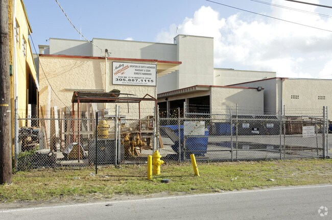
7185 Nw 77Th Ter
Miami-Miami Beach-Kendall, FL
Fla Fruit Land Co Sub
22-3011-002-1232
11 53 40 .241 AC FLA FRUIT LAND CO SUB PB 2-17 E75FT OF W325FT OF N140FT OF TR 60 LOT SIZE 10498 SQUARE FEET OR 13848-146 1088 1
Lumberyard
Miami/Dade
AH
Florida
12086C0277L
6
2024
0.24 AC
2025
Miami Airport East
980500
South Florida
4,950 SF
DEMOGRAPHICS near 7185 Nw 77Th Ter
1 Mile
3 Mile
5 Mile
2024 Total Population
16,117
173,759
398,287
2029 Population
15,594
168,939
388,225
Pop Growth 2024-2029
(3.25%)
(2.77%)
(2.53%)
Average Age
44
44
42
2024 Total Households
5,453
59,542
133,164
HH Growth 2024-2029
(3.89%)
(3.19%)
(2.89%)
Median Household Inc
$34,218
$44,491
$52,862
Avg Household Size
2.70
2.80
2.90
2024 Avg HH Vehicles
2.00
2.00
2.00
Median Home Value
$305,725
$335,411
$341,739
Median Year Built
1971
1974
1980
Nearby Places
Map Layers
Map Styles
 Street
 Aerial
- Restaurants
- Banks
- Shops
- Fitness
- Groceries
PUBLIC TRANSPORTATION
TRANSIT/SUBWAY
Okeechobee (Metrorail Green Line - Miami-Dade Transit (Metrorail/Metromover))
DRIVE
WALK
Distance
Okeechobee (Metrorail Green Line - Miami-Dade Transit (Metrorail/Metromover))
4 min
19 min
1.0 mi
COMMUTER RAIL
Okeechobee (Metrorail Green Line - Miami-Dade Transit (Metrorail/Metromover))
DRIVE
WALK
Distance
Okeechobee (Metrorail Green Line - Miami-Dade Transit (Metrorail/Metromover))
4 min
19 min
1.0 mi
Palmetto (Metrorail Green Line - Miami-Dade Transit (Metrorail/Metromover))
DRIVE
WALK
Distance
Palmetto (Metrorail Green Line - Miami-Dade Transit (Metrorail/Metromover))
4 min
1.6 mi
AIRPORT
Miami International
DRIVE
WALK
Distance
Miami International
13 min
5.1 mi
Fort Lauderdale/Hollywood International
DRIVE
WALK
Distance
Fort Lauderdale/Hollywood International
38 min
25.5 mi
Freight Ports
Port of Miami
DRIVE
WALK
Distance
Port of Miami
24 min
12.4 mi
Nearby Properties
Address
Land Use
TOTAL SIZE
Lot Size
Zoning
Address
Land Use
TOTAL SIZE
Lot Size
Zoning
312,996 SF
157.16 AC
8900
Address
Land Use
TOTAL SIZE
Lot Size
Zoning
851,502 SF
11.73 AC
6119
Address
Land Use
TOTAL SIZE
Lot Size
Zoning
7.62 AC
7200
Address
Land Use
TOTAL SIZE
Lot Size
Zoning
666,015 SF
4 AC
6119
Address
Land Use
TOTAL SIZE
Lot Size
Zoning
582,921 SF
4.51 AC
6119
Address
Land Use
TOTAL SIZE
Lot Size
Zoning
929,765 SF
453.69 AC
6119
Address
Land Use
TOTAL SIZE
Lot Size
Zoning
418,532 SF
17.95 AC
7300
Address
Land Use
TOTAL SIZE
Lot Size
Zoning
608,139 SF
5.80 AC
6119
Address
Land Use
TOTAL SIZE
Lot Size
Zoning
612,289 SF
3.38 AC
6119
Address
Land Use
TOTAL SIZE
Lot Size
Zoning
1,700 SF
7.24 AC
7100
Address
Land Use
TOTAL SIZE
Lot Size
Zoning
301,593 SF
16 AC
7100
Address
Land Use
TOTAL SIZE
Lot Size
Zoning
538,715 SF
24.72 AC
7100
Address
Land Use
TOTAL SIZE
Lot Size
Zoning
352,663 SF
0.65 AC
6119
Address
Land Use
TOTAL SIZE
Lot Size
Zoning
451,817 SF
6400
Address
Land Use
TOTAL SIZE
Lot Size
Zoning
322,084 SF
6.60 AC
7100
Address
Land Use
TOTAL SIZE
Lot Size
Zoning
344,465 SF
5.03 AC
6400
Address
Land Use
TOTAL SIZE
Lot Size
Zoning
468,218 SF
17.06 AC
7100
Address
Land Use
TOTAL SIZE
Lot Size
Zoning
344,101 SF
0.74 AC
6119
Address
Land Use
TOTAL SIZE
Lot Size
Zoning
687,304 SF
3.03 AC
6119
Address
Land Use
TOTAL SIZE
Lot Size
Zoning
648,867 SF
33.08 AC
7100
Address
Land Use
TOTAL SIZE
Lot Size
Zoning
527,157 SF
4.15 AC
6119
Address
Land Use
TOTAL SIZE
Lot Size
Zoning
538,739 SF
5.05 AC
7100
Address
Land Use
TOTAL SIZE
Lot Size
Zoning
387,903 SF
4.49 AC
6119
Address
Land Use
TOTAL SIZE
Lot Size
Zoning
330,528 SF
4.46 AC
6119
Address
Land Use
TOTAL SIZE
Lot Size
Zoning
355,631 SF
2.02 AC
6119
Address
Land Use
TOTAL SIZE
Lot Size
Zoning
388,143 SF
1.60 AC
6119
Address
Land Use
TOTAL SIZE
Lot Size
Zoning
347,380 SF
18.37 AC
7600
Address
Land Use
TOTAL SIZE
Lot Size
Zoning
211,349 SF
6119
Address
Land Use
TOTAL SIZE
Lot Size
Zoning
233,552 SF
0.13 AC
6119
Address
Land Use
TOTAL SIZE
Lot Size
Zoning
328,942 SF
16.15 AC
7600
The World's #1 Commercial Real Estate Marketplace
Connect with us
© 2026 CoStar Group
The information above has been obtained from sources believed reliable. While we do not doubt its accuracy we have not verified it and make no guarantee, warranty or representation about it. It is your responsibility to independently confirm its accuracy and completeness. Any projections, opinions, assumptions, or estimates used are for example only and do not represent the current or future performance of the property. The value of this transaction to you depends on tax and other factors which should be evaluated by your tax, financial, and legal advisors. You and your advisors should conduct a careful, independent investigation of the property to determine to your satisfaction the suitability of the property for your needs.