Property Record
719 Bay Rd, Queensbury, NY 12804


NEARBY LISTINGS FOR SALE OR LEASE
Property Detail
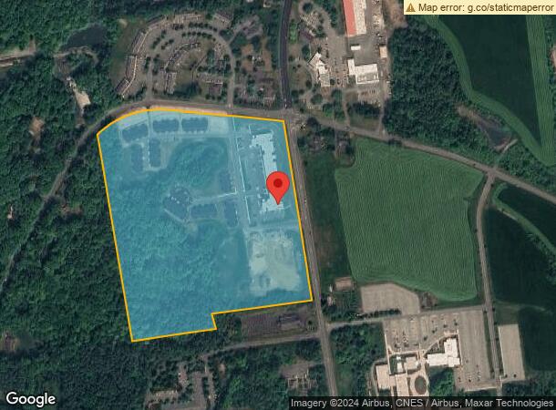
719 Bay Rd
Glens Falls, NY
VAC. REAR LOT 60.-7-1.1
523400-289-019-0001-027-000-0000
Warren
Apartment
New York
2025
27.000
2024
34.05 AC
070603
Warren County
116,357 SF
Albany/Schenectady/Troy
DEMOGRAPHICS near 719 Bay Rd
1 Mile
3 Mile
5 Mile
2024 Total Population
3,067
18,200
48,254
2029 Population
3,079
18,017
47,790
Pop Growth 2024-2029
+ 0.39%
(1.01%)
(0.96%)
Average Age
47
45
43
2024 Total Households
1,339
8,232
21,311
HH Growth 2024-2029
+ 0.45%
(0.96%)
(0.97%)
Median Household Inc
$69,634
$71,160
$72,619
Avg Household Size
2.10
2.10
2.20
2024 Avg HH Vehicles
2.00
2.00
2.00
Median Home Value
$282,380
$240,262
$218,829
Median Year Built
1998
1977
1975
Nearby Places
Map Layers
Map Styles
 Street
 Aerial
- Restaurants
- Banks
- Shops
- Fitness
- Groceries
PUBLIC TRANSPORTATION
COMMUTER RAIL
Fort Edward Amtrak (Adirondack - Amtrak, Ethan Allen Express - Amtrak)
DRIVE
WALK
Distance
Fort Edward Amtrak (Adirondack - Amtrak, Ethan Allen Express - Amtrak)
19 min
8.7 mi
Freight Ports
Albany, NY Port
DRIVE
WALK
Distance
Albany, NY Port
76 min
58.1 mi
Nearby Properties
Address
Land Use
TOTAL SIZE
Lot Size
Zoning
Address
Land Use
TOTAL SIZE
Lot Size
Zoning
27,660 SF
130.13 AC
O
Address
Land Use
TOTAL SIZE
Lot Size
Zoning
154,236 SF
104.60 AC
RR-3A
Address
Land Use
TOTAL SIZE
Lot Size
Zoning
Address
Land Use
TOTAL SIZE
Lot Size
Zoning
216,921 SF
10.76 AC
CI
Address
Land Use
TOTAL SIZE
Lot Size
Zoning
6,112 SF
28.50 AC
O
Address
Land Use
TOTAL SIZE
Lot Size
Zoning
Address
Land Use
TOTAL SIZE
Lot Size
Zoning
29,108 SF
22.48 AC
MDR
Address
Land Use
TOTAL SIZE
Lot Size
Zoning
3,060 SF
129.15 AC
RC
Address
Land Use
TOTAL SIZE
Lot Size
Zoning
27,470 SF
14.76 AC
MDR
Address
Land Use
TOTAL SIZE
Lot Size
Zoning
31,456 SF
15.49 AC
MDR
Address
Land Use
TOTAL SIZE
Lot Size
Zoning
5,440 SF
510.06 AC
CLI
Address
Land Use
TOTAL SIZE
Lot Size
Zoning
89,151 SF
16.53 AC
O
Address
Land Use
TOTAL SIZE
Lot Size
Zoning
Address
Land Use
TOTAL SIZE
Lot Size
Zoning
9.72 AC
CI
Address
Land Use
TOTAL SIZE
Lot Size
Zoning
215,447 SF
17.74 AC
CI
Address
Land Use
TOTAL SIZE
Lot Size
Zoning
130,142 SF
20.71 AC
CI
Address
Land Use
TOTAL SIZE
Lot Size
Zoning
8,042 SF
39.64 AC
O
Address
Land Use
TOTAL SIZE
Lot Size
Zoning
117,258 SF
54.25 AC
MDR
Address
Land Use
TOTAL SIZE
Lot Size
Zoning
Address
Land Use
TOTAL SIZE
Lot Size
Zoning
37,514 SF
4.88 AC
PRD
Address
Land Use
TOTAL SIZE
Lot Size
Zoning
71,996 SF
40.15 AC
RR-3A
Address
Land Use
TOTAL SIZE
Lot Size
Zoning
121,153 SF
24.13 AC
CI
Address
Land Use
TOTAL SIZE
Lot Size
Zoning
86,968 SF
7.05 AC
CI
Address
Land Use
TOTAL SIZE
Lot Size
Zoning
53,853 SF
5.99 AC
CI
Address
Land Use
TOTAL SIZE
Lot Size
Zoning
128,398 SF
12.23 AC
CI
Address
Land Use
TOTAL SIZE
Lot Size
Zoning
87,388 SF
18.79 AC
CI
Address
Land Use
TOTAL SIZE
Lot Size
Zoning
9,678 SF
11.46 AC
O
Address
Land Use
TOTAL SIZE
Lot Size
Zoning
60,597 SF
2.50 AC
ESC
Address
Land Use
TOTAL SIZE
Lot Size
Zoning
49,615 SF
6.21 AC
CI
The World's #1 Commercial Real Estate Marketplace
Connect with us
© 2025 CoStar Group
The information above has been obtained from sources believed reliable. While we do not doubt its accuracy we have not verified it and make no guarantee, warranty or representation about it. It is your responsibility to independently confirm its accuracy and completeness. Any projections, opinions, assumptions, or estimates used are for example only and do not represent the current or future performance of the property. The value of this transaction to you depends on tax and other factors which should be evaluated by your tax, financial, and legal advisors. You and your advisors should conduct a careful, independent investigation of the property to determine to your satisfaction the suitability of the property for your needs.