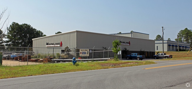
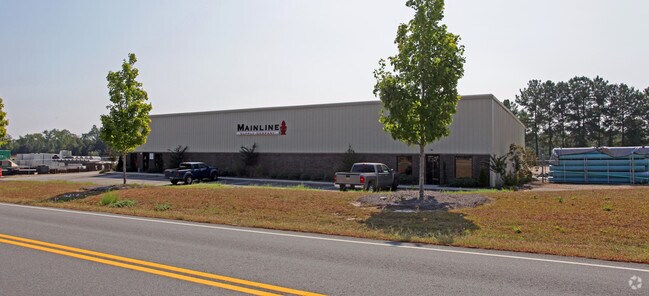
Property Record
719 Industrial Dr, Lexington, SC 29072

NEARBY LISTINGS FOR SALE OR LEASE
Property Detail
719 Industrial Dr
006400-02-047
PT PARCEL B
Commercialnec
Lexington
X
South Carolina
45063C0234J
3 AC
2025
Lexington
2024
Columbia
021029
Columbia, SC
9,932 SF
DEMOGRAPHICS near 719 Industrial Dr
1 Mile
3 Mile
5 Mile
2024 Total Population
1,720
26,451
78,613
2029 Population
1,881
28,939
85,967
Pop Growth 2024-2029
+ 9.36%
+ 9.41%
+ 9.35%
Average Age
37
38
38
2024 Total Households
582
9,873
29,431
HH Growth 2024-2029
+ 9.45%
+ 9.67%
+ 9.55%
Median Household Inc
$96,153
$74,775
$73,129
Avg Household Size
2.90
2.60
2.60
2024 Avg HH Vehicles
3.00
2.00
2.00
Median Home Value
$241,942
$213,872
$206,966
Median Year Built
2004
1999
2000
Nearby Places
Map Layers
Map Styles
 Street
 Aerial
- Restaurants
- Banks
- Shops
- Fitness
- Groceries
PUBLIC TRANSPORTATION
AIRPORT
Columbia Metro
DRIVE
WALK
Distance
Columbia Metro
29 min
10.8 mi
Nearby Properties
Address
Land Use
TOTAL SIZE
Lot Size
Zoning
Address
Land Use
TOTAL SIZE
Lot Size
Zoning
336,700 SF
80.12 AC
ID
Address
Land Use
TOTAL SIZE
Lot Size
Zoning
78,966 SF
10.34 AC
Address
Land Use
TOTAL SIZE
Lot Size
Zoning
4,198 SF
23.54 AC
Address
Land Use
TOTAL SIZE
Lot Size
Zoning
567,464 SF
44.62 AC
ID
Address
Land Use
TOTAL SIZE
Lot Size
Zoning
219,967 SF
23.37 AC
ID
Address
Land Use
TOTAL SIZE
Lot Size
Zoning
97,606 SF
15.92 AC
ID
Address
Land Use
TOTAL SIZE
Lot Size
Zoning
41,883 SF
21.77 AC
ID
Address
Land Use
TOTAL SIZE
Lot Size
Zoning
44,100 SF
67.47 AC
RD
Address
Land Use
TOTAL SIZE
Lot Size
Zoning
55,686 SF
6.42 AC
ID
Address
Land Use
TOTAL SIZE
Lot Size
Zoning
1,572 SF
21.04 AC
GC
Address
Land Use
TOTAL SIZE
Lot Size
Zoning
7,752 SF
28.48 AC
RD
Address
Land Use
TOTAL SIZE
Lot Size
Zoning
60,000 SF
4.77 AC
ID
Address
Land Use
TOTAL SIZE
Lot Size
Zoning
15,319 SF
12.72 AC
ID
Address
Land Use
TOTAL SIZE
Lot Size
Zoning
43,078 SF
4.50 AC
Address
Land Use
TOTAL SIZE
Lot Size
Zoning
79.51 AC
GC
Address
Land Use
TOTAL SIZE
Lot Size
Zoning
1,200 SF
7.16 AC
ID
Address
Land Use
TOTAL SIZE
Lot Size
Zoning
86,573 SF
4.92 AC
Address
Land Use
TOTAL SIZE
Lot Size
Zoning
44,851 SF
8.93 AC
ID
Address
Land Use
TOTAL SIZE
Lot Size
Zoning
86,781 SF
13.16 AC
ID
Address
Land Use
TOTAL SIZE
Lot Size
Zoning
50,982 SF
6.15 AC
GC
Address
Land Use
TOTAL SIZE
Lot Size
Zoning
117,188 SF
15.54 AC
ID
Address
Land Use
TOTAL SIZE
Lot Size
Zoning
65,100 SF
16.25 AC
ID
Address
Land Use
TOTAL SIZE
Lot Size
Zoning
45,285 SF
6.77 AC
ID
Address
Land Use
TOTAL SIZE
Lot Size
Zoning
83,000 SF
8.32 AC
ID
Address
Land Use
TOTAL SIZE
Lot Size
Zoning
5,355 SF
4.93 AC
ID
Address
Land Use
TOTAL SIZE
Lot Size
Zoning
4,850 SF
1.88 AC
ID
Address
Land Use
TOTAL SIZE
Lot Size
Zoning
1,800 SF
1.30 AC
ID
Address
Land Use
TOTAL SIZE
Lot Size
Zoning
121.12 AC
RD
Address
Land Use
TOTAL SIZE
Lot Size
Zoning
10,640 SF
1.47 AC
RD
Address
Land Use
TOTAL SIZE
Lot Size
Zoning
3,318 SF
0.68 AC
The World's #1 Commercial Real Estate Marketplace
Connect with us
© 2025 CoStar Group
The information above has been obtained from sources believed reliable. While we do not doubt its accuracy we have not verified it and make no guarantee, warranty or representation about it. It is your responsibility to independently confirm its accuracy and completeness. Any projections, opinions, assumptions, or estimates used are for example only and do not represent the current or future performance of the property. The value of this transaction to you depends on tax and other factors which should be evaluated by your tax, financial, and legal advisors. You and your advisors should conduct a careful, independent investigation of the property to determine to your satisfaction the suitability of the property for your needs.