Property Record
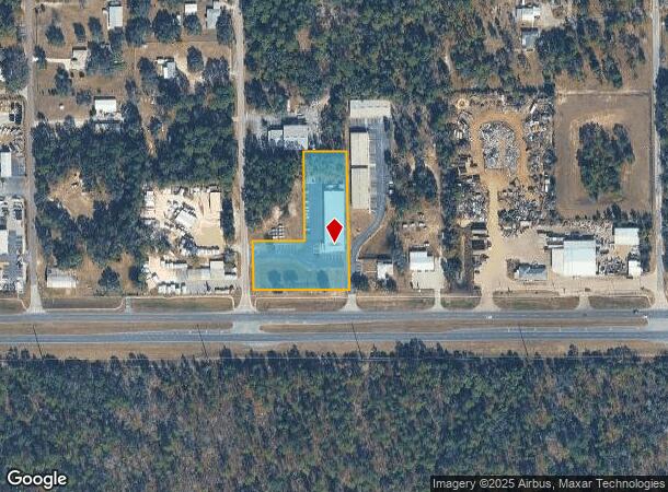
719 S Otis Ave, Lecanto, FL 34461


NEARBY LISTINGS FOR SALE OR LEASE
Property Detail
719 S Otis Ave
18E-19S-02-0000-1A860-00C0
Mayfield Acres Unrecorded
Warehouse
PARCEL C: THAT PART OF W1/2 OF SW1/4 OF NW1/4 OF SW1/4 SEC 2-19-18 LYING N OF R/W ST RD 44 S LESS W 20 FT FOR RD R/W --- LESS PCL A: N 199.30 FT OF W1/2 OF SW1/4 OF NW1/4 OF SW1/4 LESS W 20 FT ---- & ---- LESS PCL B: S 280 FT OF N 479.30 FT OF W 185
X
Citrus
12017C0327D
Florida
2024
1.92 AC
2025
Florida Central North Area
450704
Other Market Areas
11,400 SF
Homosassa Springs, FL
DEMOGRAPHICS near 719 S Otis Ave
1 Mile
3 Mile
5 Mile
2024 Total Population
800
8,139
35,815
2029 Population
900
9,227
40,422
Pop Growth 2024-2029
+ 12.50%
+ 13.37%
+ 12.86%
Average Age
49
57
53
2024 Total Households
308
3,548
15,921
HH Growth 2024-2029
+ 12.01%
+ 13.22%
+ 12.61%
Median Household Inc
$49,062
$56,390
$50,071
Avg Household Size
2.30
2.10
2.10
2024 Avg HH Vehicles
2.00
2.00
2.00
Median Home Value
$252,049
$285,177
$225,876
Median Year Built
1992
1996
1989
Nearby Places
Map Layers
Map Styles
 Street
 Aerial
- Restaurants
- Banks
- Shops
- Fitness
- Groceries
Nearby Properties
Address
Land Use
TOTAL SIZE
Lot Size
Zoning
Address
Land Use
TOTAL SIZE
Lot Size
Zoning
982,616 SF
202.47 AC
PSI
Address
Land Use
TOTAL SIZE
Lot Size
Zoning
198,657 SF
73.75 AC
PSI
Address
Land Use
TOTAL SIZE
Lot Size
Zoning
405,045 SF
18.52 AC
PSI
Address
Land Use
TOTAL SIZE
Lot Size
Zoning
113,920 SF
38.95 AC
PSI
Address
Land Use
TOTAL SIZE
Lot Size
Zoning
198,628 SF
18.19 AC
LDRMH
Address
Land Use
TOTAL SIZE
Lot Size
Zoning
42,396 SF
20.02 AC
PSI
Address
Land Use
TOTAL SIZE
Lot Size
Zoning
84,896 SF
23.49 AC
PSI
Address
Land Use
TOTAL SIZE
Lot Size
Zoning
135,372 SF
4.58 AC
GNC
Address
Land Use
TOTAL SIZE
Lot Size
Zoning
57,652 SF
11.85 AC
GNC
Address
Land Use
TOTAL SIZE
Lot Size
Zoning
345,488 SF
5.87 AC
PDR
Address
Land Use
TOTAL SIZE
Lot Size
Zoning
55,949 SF
4.71 AC
GNC
Address
Land Use
TOTAL SIZE
Lot Size
Zoning
42,134 SF
4.52 AC
GNC
Address
Land Use
TOTAL SIZE
Lot Size
Zoning
78,432 SF
18.88 AC
PSI
Address
Land Use
TOTAL SIZE
Lot Size
Zoning
36,430 SF
14.26 AC
GNC
Address
Land Use
TOTAL SIZE
Lot Size
Zoning
5,526 SF
4.72 AC
GNC
Address
Land Use
TOTAL SIZE
Lot Size
Zoning
23,540 SF
8.97 AC
PSO
Address
Land Use
TOTAL SIZE
Lot Size
Zoning
47,636 SF
8.67 AC
PSO
Address
Land Use
TOTAL SIZE
Lot Size
Zoning
6,807 SF
3.64 AC
GNC
Address
Land Use
TOTAL SIZE
Lot Size
Zoning
33,638 SF
40.09 AC
PSI
Address
Land Use
TOTAL SIZE
Lot Size
Zoning
130,776 SF
15.64 AC
GNC
Address
Land Use
TOTAL SIZE
Lot Size
Zoning
58,114 SF
6.49 AC
MDR
Address
Land Use
TOTAL SIZE
Lot Size
Zoning
18,714 SF
2.62 AC
PSI
Address
Land Use
TOTAL SIZE
Lot Size
Zoning
76,900 SF
4.33 AC
GNC
Address
Land Use
TOTAL SIZE
Lot Size
Zoning
76,959 SF
4.67 AC
GNC
Address
Land Use
TOTAL SIZE
Lot Size
Zoning
16,223 SF
2.29 AC
GNC
Address
Land Use
TOTAL SIZE
Lot Size
Zoning
24,938 SF
7.92 AC
GNC
Address
Land Use
TOTAL SIZE
Lot Size
Zoning
29,002 SF
9.57 AC
GNC
Address
Land Use
TOTAL SIZE
Lot Size
Zoning
4,823 SF
1.98 AC
GNC
Address
Land Use
TOTAL SIZE
Lot Size
Zoning
13,034 SF
2.54 AC
GNC
Address
Land Use
TOTAL SIZE
Lot Size
Zoning
11,770 SF
1.23 AC
PSO
The World's #1 Commercial Real Estate Marketplace
Connect with us
© 2025 CoStar Group
The information above has been obtained from sources believed reliable. While we do not doubt its accuracy we have not verified it and make no guarantee, warranty or representation about it. It is your responsibility to independently confirm its accuracy and completeness. Any projections, opinions, assumptions, or estimates used are for example only and do not represent the current or future performance of the property. The value of this transaction to you depends on tax and other factors which should be evaluated by your tax, financial, and legal advisors. You and your advisors should conduct a careful, independent investigation of the property to determine to your satisfaction the suitability of the property for your needs.