Property Record
719 Scenic Hwy, Lawrenceville, GA 30046


NEARBY LISTINGS FOR SALE OR LEASE
Property Detail
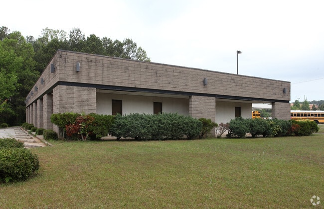
719 Scenic Hwy
Atlanta-Sandy Springs-Roswell, GA
Ga Hwy 124
5-108-023
GA HWY 124
Medicalbuilding
Gwinnett
X
Georgia
13135C0103F
108
0
1.47 AC
2025
Lawrenceville/Lilburn
050589
Atlanta
5,500 SF
DEMOGRAPHICS near 719 Scenic Hwy
1 Mile
3 Mile
5 Mile
2024 Total Population
10,543
75,922
208,299
2029 Population
10,910
79,189
217,240
Pop Growth 2024-2029
+ 3.48%
+ 4.30%
+ 4.29%
Average Age
38
38
37
2024 Total Households
3,481
24,439
66,420
HH Growth 2024-2029
+ 3.48%
+ 4.37%
+ 4.41%
Median Household Inc
$74,307
$83,805
$80,822
Avg Household Size
3.00
3.00
3.00
2024 Avg HH Vehicles
2.00
2.00
2.00
Median Home Value
$285,422
$316,530
$294,420
Median Year Built
1997
1994
1995
Nearby Places
Map Layers
Map Styles
 Street
 Aerial
- Restaurants
- Banks
- Shops
- Fitness
- Groceries
PUBLIC TRANSPORTATION
AIRPORT
Hartsfield - Jackson Atlanta International
DRIVE
WALK
Distance
Hartsfield - Jackson Atlanta International
58 min
41.6 mi
SALE & LEASE HISTORY
LISTING DATE
SALE/LEASE

Jun 28, 2021
For Lease
Jun 01, 2018
For Lease
Jan 11, 2024
For Lease
Dec 22, 2017
For Sale
Dec 14, 2020
For Sale
Nearby Properties
Address
Land Use
TOTAL SIZE
Lot Size
Zoning
Address
Land Use
TOTAL SIZE
Lot Size
Zoning
1,218,930 SF
66.65 AC
OI
Address
Land Use
TOTAL SIZE
Lot Size
Zoning
275,917 SF
13.34 AC
BG
Address
Land Use
TOTAL SIZE
Lot Size
Zoning
484,262 SF
34.27 AC
RM
Address
Land Use
TOTAL SIZE
Lot Size
Zoning
493,520 SF
12.67 AC
BG2
Address
Land Use
TOTAL SIZE
Lot Size
Zoning
16,062 SF
89.78 AC
BG
Address
Land Use
TOTAL SIZE
Lot Size
Zoning
812,946 SF
82.22 AC
BG2
Address
Land Use
TOTAL SIZE
Lot Size
Zoning
352,924 SF
86.43 AC
R100
Address
Land Use
TOTAL SIZE
Lot Size
Zoning
360,279 SF
13.16 AC
RM24
Address
Land Use
TOTAL SIZE
Lot Size
Zoning
333,734 SF
24 AC
BG
Address
Land Use
TOTAL SIZE
Lot Size
Zoning
271,668 SF
20.13 AC
RM13
Address
Land Use
TOTAL SIZE
Lot Size
Zoning
325,459 SF
21.18 AC
HM
Address
Land Use
TOTAL SIZE
Lot Size
Zoning
221,082 SF
12.90 AC
RM24
Address
Land Use
TOTAL SIZE
Lot Size
Zoning
201,000 SF
29.98 AC
R75
Address
Land Use
TOTAL SIZE
Lot Size
Zoning
220,161 SF
9.71 AC
OI
Address
Land Use
TOTAL SIZE
Lot Size
Zoning
286,368 SF
34.55 AC
R75
Address
Land Use
TOTAL SIZE
Lot Size
Zoning
274,964 SF
27.82 AC
BG
Address
Land Use
TOTAL SIZE
Lot Size
Zoning
214,399 SF
29.91 AC
C2
Address
Land Use
TOTAL SIZE
Lot Size
Zoning
175,190 SF
11.17 AC
RM
Address
Land Use
TOTAL SIZE
Lot Size
Zoning
231,373 SF
3.82 AC
OI
Address
Land Use
TOTAL SIZE
Lot Size
Zoning
270,396 SF
4.57 AC
OI
Address
Land Use
TOTAL SIZE
Lot Size
Zoning
309,156 SF
17.39 AC
OI
Address
Land Use
TOTAL SIZE
Lot Size
Zoning
126,160 SF
15.15 AC
BG2
Address
Land Use
TOTAL SIZE
Lot Size
Zoning
127,844 SF
7.76 AC
RM8
Address
Land Use
TOTAL SIZE
Lot Size
Zoning
133,622 SF
Address
Land Use
TOTAL SIZE
Lot Size
Zoning
59,949 SF
71.12 AC
C1
Address
Land Use
TOTAL SIZE
Lot Size
Zoning
188,659 SF
5.03 AC
RM13
Address
Land Use
TOTAL SIZE
Lot Size
Zoning
134,512 SF
5.03 AC
RS150
Address
Land Use
TOTAL SIZE
Lot Size
Zoning
129,151 SF
8.77 AC
OI
Address
Land Use
TOTAL SIZE
Lot Size
Zoning
304,682 SF
10.93 AC
RM24
Address
Land Use
TOTAL SIZE
Lot Size
Zoning
132,916 SF
10.23 AC
BG
The World's #1 Commercial Real Estate Marketplace
Connect with us
© 2025 CoStar Group
The information above has been obtained from sources believed reliable. While we do not doubt its accuracy we have not verified it and make no guarantee, warranty or representation about it. It is your responsibility to independently confirm its accuracy and completeness. Any projections, opinions, assumptions, or estimates used are for example only and do not represent the current or future performance of the property. The value of this transaction to you depends on tax and other factors which should be evaluated by your tax, financial, and legal advisors. You and your advisors should conduct a careful, independent investigation of the property to determine to your satisfaction the suitability of the property for your needs.