Property Record
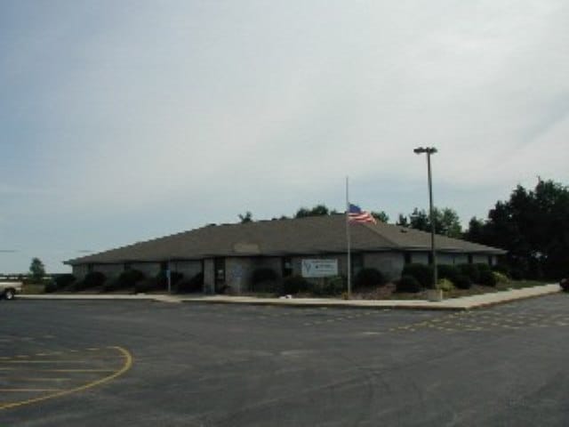
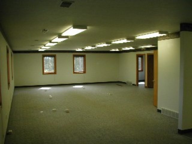
7192 E 34 Rd, Cadillac, MI 49601

Property Detail
7192 E 34 Rd
Other Market Areas
LOTS 4, & 5 WILLANEY PARK HAR. SEC. 29 T22N R9W -CAPS
Cadillac, MI
Wexford
2209-WILP-04
Michigan
Commercialnec
4-5
2024
2.24 AC
2025
Michigan Northwest Area
380500
NEARBY LISTINGS FOR SALE OR LEASE
-
-
View all Cadillac listings for sale on LoopNet.com
DEMOGRAPHICS near 7192 E 34 Rd
1 mile
3 mile
5 mile
2025 Total Population
269
9,510
17,294
2030 Population
269
9,612
17,537
Pop Growth 2025-2030
0.00%
+ 1.07%
+ 1.41%
Average Age
42
40
42
2025 Total Households
103
3,832
7,154
HH Growth 2025-2030
(0.97%)
+ 1.07%
+ 1.45%
Median Household Inc
$69,374
$57,964
$64,242
Avg Household Size
2.50
2.40
2.30
2025 Avg HH Vehicles
2.00
2.00
2.00
Median Home Value
$155,555
$155,560
$185,889
Median Year Built
1979
1965
1973
Nearby Places
Map Layers
Map Styles
 Street
 Aerial
Transit
 Traffic
 Biking
Places
Listings with unknown addresses are not visible on the map
- Restaurants
- Banks
- Shops
- Fitness
- Groceries
Nearby Properties
Address
Land Use
TOTAL SIZE
Lot Size
Zoning
Address
Land Use
TOTAL SIZE
Lot Size
Zoning
36.12 AC
Address
Land Use
TOTAL SIZE
Lot Size
Zoning
40,150 SF
60 AC
Address
Land Use
TOTAL SIZE
Lot Size
Zoning
26.90 AC
Address
Land Use
TOTAL SIZE
Lot Size
Zoning
27.28 AC
Address
Land Use
TOTAL SIZE
Lot Size
Zoning
44.78 AC
Address
Land Use
TOTAL SIZE
Lot Size
Zoning
19.84 AC
Address
Land Use
TOTAL SIZE
Lot Size
Zoning
21.73 AC
Address
Land Use
TOTAL SIZE
Lot Size
Zoning
12.09 AC
Address
Land Use
TOTAL SIZE
Lot Size
Zoning
3.04 AC
Address
Land Use
TOTAL SIZE
Lot Size
Zoning
4.30 AC
Address
Land Use
TOTAL SIZE
Lot Size
Zoning
13.12 AC
Address
Land Use
TOTAL SIZE
Lot Size
Zoning
4.12 AC
Address
Land Use
TOTAL SIZE
Lot Size
Zoning
18.66 AC
Address
Land Use
TOTAL SIZE
Lot Size
Zoning
4.79 AC
Address
Land Use
TOTAL SIZE
Lot Size
Zoning
12.63 AC
Address
Land Use
TOTAL SIZE
Lot Size
Zoning
10.38 AC
Address
Land Use
TOTAL SIZE
Lot Size
Zoning
9.03 AC
Address
Land Use
TOTAL SIZE
Lot Size
Zoning
13.29 AC
Address
Land Use
TOTAL SIZE
Lot Size
Zoning
2.60 AC
Address
Land Use
TOTAL SIZE
Lot Size
Zoning
4.67 AC
Address
Land Use
TOTAL SIZE
Lot Size
Zoning
2.43 AC
Address
Land Use
TOTAL SIZE
Lot Size
Zoning
Address
Land Use
TOTAL SIZE
Lot Size
Zoning
13.48 AC
Address
Land Use
TOTAL SIZE
Lot Size
Zoning
3.97 AC
Address
Land Use
TOTAL SIZE
Lot Size
Zoning
Address
Land Use
TOTAL SIZE
Lot Size
Zoning
7.62 AC
Address
Land Use
TOTAL SIZE
Lot Size
Zoning
2.41 AC
Address
Land Use
TOTAL SIZE
Lot Size
Zoning
Address
Land Use
TOTAL SIZE
Lot Size
Zoning
4.28 AC
Address
Land Use
TOTAL SIZE
Lot Size
Zoning
1.17 AC
The World's #1 Commercial Real Estate Marketplace
Connect with us
© 2026 CoStar Group
The information above has been obtained from sources believed reliable. While we do not doubt its accuracy we have not verified it and make no guarantee, warranty or representation about it. It is your responsibility to independently confirm its accuracy and completeness. Any projections, opinions, assumptions, or estimates used are for example only and do not represent the current or future performance of the property. The value of this transaction to you depends on tax and other factors which should be evaluated by your tax, financial, and legal advisors. You and your advisors should conduct a careful, independent investigation of the property to determine to your satisfaction the suitability of the property for your needs.