Property Record
7193 Brooking Way, Mechanicsville, VA 23111


NEARBY LISTINGS FOR SALE OR LEASE
Property Detail
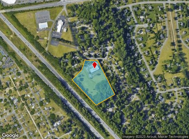
7193 Brooking Way
8714-72-4221
N/E S RT 295 ADJ HIGH POINT FARMS
Commercialnec
Hanover
X
Virginia
51085C0426C
10 AC
2025
Mechanicsville
2025
Richmond VA
321201
Richmond, VA
14,000 SF
DEMOGRAPHICS near 7193 Brooking Way
1 Mile
3 Mile
5 Mile
2024 Total Population
5,847
39,535
109,971
2029 Population
6,251
41,339
113,277
Pop Growth 2024-2029
+ 6.91%
+ 4.56%
+ 3.01%
Average Age
40
42
41
2024 Total Households
2,380
15,801
44,008
HH Growth 2024-2029
+ 7.06%
+ 4.66%
+ 2.97%
Median Household Inc
$75,922
$76,139
$62,630
Avg Household Size
2.40
2.50
2.40
2024 Avg HH Vehicles
2.00
2.00
2.00
Median Home Value
$244,267
$253,605
$238,128
Median Year Built
1983
1987
1979
Nearby Places
Map Layers
Map Styles
 Street
 Aerial
- Restaurants
- Banks
- Shops
- Fitness
- Groceries
PUBLIC TRANSPORTATION
COMMUTER RAIL
Richmond Main Street Amtrak Station (Northeast Regional - Amtrak)
DRIVE
WALK
Distance
Richmond Main Street Amtrak Station (Northeast Regional - Amtrak)
15 min
8.5 mi
AIRPORT
Richmond International
DRIVE
WALK
Distance
Richmond International
20 min
11.8 mi
Freight Ports
Virginia Port Authority - Richmond
DRIVE
WALK
Distance
Virginia Port Authority - Richmond
26 min
14.7 mi
SALE & LEASE HISTORY
LISTING DATE
SALE/LEASE

Jul 31, 2024
For Sale
Dec 06, 2019
For Sale
Dec 03, 2020
For Lease
Nearby Properties
Address
Land Use
TOTAL SIZE
Lot Size
Zoning
Address
Land Use
TOTAL SIZE
Lot Size
Zoning
1.37 AC
A-1
Address
Land Use
TOTAL SIZE
Lot Size
Zoning
23.50 AC
A-1
Address
Land Use
TOTAL SIZE
Lot Size
Zoning
14.41 AC
A-1
Address
Land Use
TOTAL SIZE
Lot Size
Zoning
2,630 SF
39.79 AC
M-2
Address
Land Use
TOTAL SIZE
Lot Size
Zoning
273,822 SF
22.74 AC
R-5
Address
Land Use
TOTAL SIZE
Lot Size
Zoning
18.50 AC
RM
Address
Land Use
TOTAL SIZE
Lot Size
Zoning
331,455 SF
12.75 AC
UMUC
Address
Land Use
TOTAL SIZE
Lot Size
Zoning
29.95 AC
A-1
Address
Land Use
TOTAL SIZE
Lot Size
Zoning
25.10 AC
A-1
Address
Land Use
TOTAL SIZE
Lot Size
Zoning
Address
Land Use
TOTAL SIZE
Lot Size
Zoning
44,891 SF
8.88 AC
R-TH
Address
Land Use
TOTAL SIZE
Lot Size
Zoning
214,583 SF
32.67 AC
B-3
Address
Land Use
TOTAL SIZE
Lot Size
Zoning
133,200 SF
15.50 AC
R-5
Address
Land Use
TOTAL SIZE
Lot Size
Zoning
84,240 SF
18.48 AC
R-4
Address
Land Use
TOTAL SIZE
Lot Size
Zoning
142,560 SF
17.90 AC
R-5
Address
Land Use
TOTAL SIZE
Lot Size
Zoning
91,642 SF
45.95 AC
A-1
Address
Land Use
TOTAL SIZE
Lot Size
Zoning
138,484 SF
12.01 AC
R-5
Address
Land Use
TOTAL SIZE
Lot Size
Zoning
129,887 SF
12.31 AC
B-2
Address
Land Use
TOTAL SIZE
Lot Size
Zoning
130,179 SF
2.88 AC
UMUC
Address
Land Use
TOTAL SIZE
Lot Size
Zoning
Address
Land Use
TOTAL SIZE
Lot Size
Zoning
137,933 SF
14.72 AC
B-3
Address
Land Use
TOTAL SIZE
Lot Size
Zoning
137,280 SF
8.37 AC
R-5
Address
Land Use
TOTAL SIZE
Lot Size
Zoning
354,000 SF
35.70 AC
M-2
Address
Land Use
TOTAL SIZE
Lot Size
Zoning
114,720 SF
16.46 AC
R-4
Address
Land Use
TOTAL SIZE
Lot Size
Zoning
123,985 SF
10.03 AC
B-3
Address
Land Use
TOTAL SIZE
Lot Size
Zoning
85,800 SF
6.11 AC
R-5
Address
Land Use
TOTAL SIZE
Lot Size
Zoning
79,188 SF
19.01 AC
MIXE
Address
Land Use
TOTAL SIZE
Lot Size
Zoning
127,680 SF
10.80 AC
R-5
Address
Land Use
TOTAL SIZE
Lot Size
Zoning
69,192 SF
7.44 AC
B-3
Address
Land Use
TOTAL SIZE
Lot Size
Zoning
116,149 SF
11.38 AC
B-2
The World's #1 Commercial Real Estate Marketplace
Connect with us
© 2025 CoStar Group
The information above has been obtained from sources believed reliable. While we do not doubt its accuracy we have not verified it and make no guarantee, warranty or representation about it. It is your responsibility to independently confirm its accuracy and completeness. Any projections, opinions, assumptions, or estimates used are for example only and do not represent the current or future performance of the property. The value of this transaction to you depends on tax and other factors which should be evaluated by your tax, financial, and legal advisors. You and your advisors should conduct a careful, independent investigation of the property to determine to your satisfaction the suitability of the property for your needs.