Property Record
72 E Hillis St, Youngwood, PA 15697


NEARBY LISTINGS FOR SALE OR LEASE
Property Detail
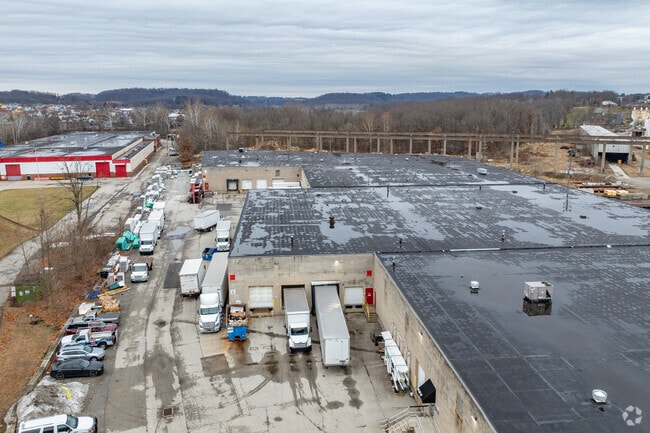
72 E Hillis St
50-37-04-0-012
BLDGS
Industrialgeneral
Westmoreland
AE
Pennsylvania
42129C0627F
4.60 AC
2025
Westmoreland County
2025
Pittsburgh
804200
Pittsburgh, PA
DEMOGRAPHICS near 72 E Hillis St
1 Mile
3 Mile
5 Mile
2024 Total Population
3,918
12,125
41,847
2029 Population
3,883
11,902
41,178
Pop Growth 2024-2029
(0.89%)
(1.84%)
(1.60%)
Average Age
44
45
45
2024 Total Households
1,798
5,037
18,338
HH Growth 2024-2029
(0.89%)
(2.01%)
(1.66%)
Median Household Inc
$68,464
$67,444
$61,658
Avg Household Size
2.10
2.20
2.20
2024 Avg HH Vehicles
2.00
2.00
2.00
Median Home Value
$159,212
$179,046
$175,962
Median Year Built
1959
1970
1968
Nearby Places
Map Layers
Map Styles
 Street
 Aerial
- Restaurants
- Banks
- Shops
- Fitness
- Groceries
PUBLIC TRANSPORTATION
COMMUTER RAIL
DRIVE
WALK
Distance
15 min
6.8 mi
AIRPORT
Arnold Palmer Regional
DRIVE
WALK
Distance
Arnold Palmer Regional
29 min
15.3 mi
Nearby Properties
Address
Land Use
TOTAL SIZE
Lot Size
Zoning
Address
Land Use
TOTAL SIZE
Lot Size
Zoning
Address
Land Use
TOTAL SIZE
Lot Size
Zoning
37.67 AC
Address
Land Use
TOTAL SIZE
Lot Size
Zoning
21.91 AC
Address
Land Use
TOTAL SIZE
Lot Size
Zoning
149,071 SF
5.30 AC
Address
Land Use
TOTAL SIZE
Lot Size
Zoning
208,800 SF
31.20 AC
Address
Land Use
TOTAL SIZE
Lot Size
Zoning
32.50 AC
Address
Land Use
TOTAL SIZE
Lot Size
Zoning
Address
Land Use
TOTAL SIZE
Lot Size
Zoning
14.79 AC
Address
Land Use
TOTAL SIZE
Lot Size
Zoning
13.39 AC
Address
Land Use
TOTAL SIZE
Lot Size
Zoning
326,000 SF
109.40 AC
Address
Land Use
TOTAL SIZE
Lot Size
Zoning
35.40 AC
Address
Land Use
TOTAL SIZE
Lot Size
Zoning
57.96 AC
Address
Land Use
TOTAL SIZE
Lot Size
Zoning
57.80 AC
Address
Land Use
TOTAL SIZE
Lot Size
Zoning
Address
Land Use
TOTAL SIZE
Lot Size
Zoning
9.23 AC
Address
Land Use
TOTAL SIZE
Lot Size
Zoning
Address
Land Use
TOTAL SIZE
Lot Size
Zoning
Address
Land Use
TOTAL SIZE
Lot Size
Zoning
1,924 SF
6.55 AC
Address
Land Use
TOTAL SIZE
Lot Size
Zoning
11.95 AC
Address
Land Use
TOTAL SIZE
Lot Size
Zoning
90,464 SF
21 AC
Address
Land Use
TOTAL SIZE
Lot Size
Zoning
54,542 SF
38.84 AC
Address
Land Use
TOTAL SIZE
Lot Size
Zoning
141.89 AC
Address
Land Use
TOTAL SIZE
Lot Size
Zoning
5.10 AC
Address
Land Use
TOTAL SIZE
Lot Size
Zoning
43,432 SF
4.18 AC
Address
Land Use
TOTAL SIZE
Lot Size
Zoning
82,116 SF
22.17 AC
Address
Land Use
TOTAL SIZE
Lot Size
Zoning
Address
Land Use
TOTAL SIZE
Lot Size
Zoning
5.20 AC
Address
Land Use
TOTAL SIZE
Lot Size
Zoning
33,696 SF
2 AC
Address
Land Use
TOTAL SIZE
Lot Size
Zoning
50,330 SF
12.65 AC
The World's #1 Commercial Real Estate Marketplace
Connect with us
© 2025 CoStar Group
The information above has been obtained from sources believed reliable. While we do not doubt its accuracy we have not verified it and make no guarantee, warranty or representation about it. It is your responsibility to independently confirm its accuracy and completeness. Any projections, opinions, assumptions, or estimates used are for example only and do not represent the current or future performance of the property. The value of this transaction to you depends on tax and other factors which should be evaluated by your tax, financial, and legal advisors. You and your advisors should conduct a careful, independent investigation of the property to determine to your satisfaction the suitability of the property for your needs.