Property Record
72 E Niagara St, Tonawanda, NY 14150
NEARBY LISTINGS FOR SALE OR LEASE
Property Detail
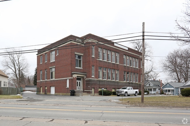
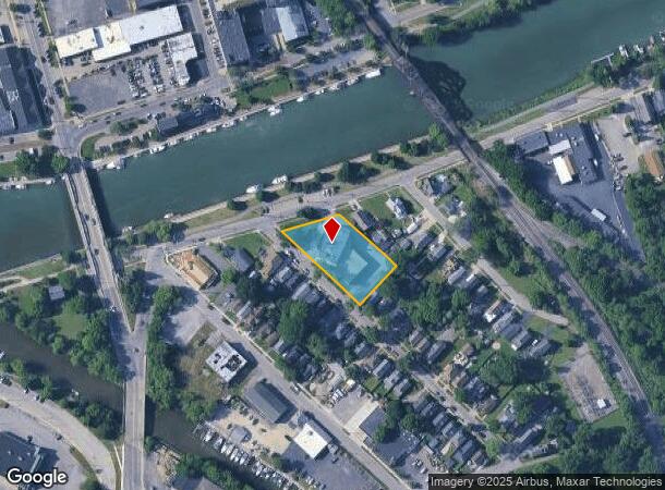
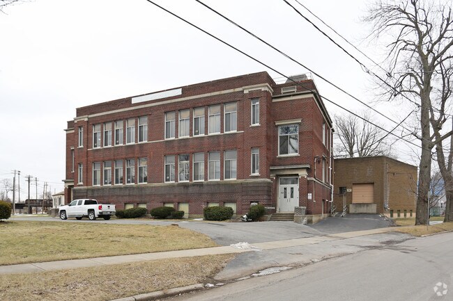
72 E Niagara St
Buffalo-Cheektowaga-Niagara Falls, NY
Nigara River Reservation
141600-039-380-0002-001-100
O E LONGS AVE GL 83 LL 39&40&41 PL38 BL266 158.15X 283.4
Apartment
Erie
X
New York
36029C0063J
1.100
0
1.03 AC
2024
North
017200
Buffalo/Niagara Falls
18,490 SF
DEMOGRAPHICS near 72 E Niagara St
1 Mile
3 Mile
5 Mile
2024 Total Population
11,644
75,108
205,674
2029 Population
11,390
74,320
203,350
Pop Growth 2024-2029
(2.18%)
(1.05%)
(1.13%)
Average Age
42
43
41
2024 Total Households
5,672
34,499
88,415
HH Growth 2024-2029
(2.20%)
(1.14%)
(1.17%)
Median Household Inc
$51,959
$64,353
$64,716
Avg Household Size
2.00
2.10
2.20
2024 Avg HH Vehicles
1.00
2.00
2.00
Median Home Value
$136,961
$163,053
$174,660
Median Year Built
1947
1955
1956
Nearby Places
- Restaurants
- Banks
- Shops
- Fitness
- Groceries
PUBLIC TRANSPORTATION
AIRPORT
Niagara Falls International
DRIVE
WALK
Distance
Niagara Falls International
14 min
7.5 mi
Buffalo Niagara International
DRIVE
WALK
Distance
Buffalo Niagara International
21 min
11.6 mi
Freight Ports
Port of Toledo
DRIVE
WALK
Distance
Port of Toledo
375 min
316.2 mi
SALE & LEASE HISTORY
LISTING DATE
SALE/LEASE

Nov 13, 2018
For Sale
Nearby Properties
Address
Land Use
TOTAL SIZE
Lot Size
Zoning
Address
Land Use
TOTAL SIZE
Lot Size
Zoning
139,224 SF
13.72 AC
WID
Address
Land Use
TOTAL SIZE
Lot Size
Zoning
223,916 SF
8.25 AC
R-C
Address
Land Use
TOTAL SIZE
Lot Size
Zoning
4,707 SF
13.60 AC
WD NT
Address
Land Use
TOTAL SIZE
Lot Size
Zoning
173,303 SF
24.40 AC
R1-2
Address
Land Use
TOTAL SIZE
Lot Size
Zoning
130,412 SF
21.21 AC
Address
Land Use
TOTAL SIZE
Lot Size
Zoning
112,256 SF
38.33 AC
00000
Address
Land Use
TOTAL SIZE
Lot Size
Zoning
96,554 SF
10.90 AC
Address
Land Use
TOTAL SIZE
Lot Size
Zoning
2,474 SF
24.84 AC
Address
Land Use
TOTAL SIZE
Lot Size
Zoning
67,000 SF
6.50 AC
Address
Land Use
TOTAL SIZE
Lot Size
Zoning
137,878 SF
23.60 AC
R1-2
Address
Land Use
TOTAL SIZE
Lot Size
Zoning
356,891 SF
21.33 AC
B
Address
Land Use
TOTAL SIZE
Lot Size
Zoning
107,490 SF
3.55 AC
Address
Land Use
TOTAL SIZE
Lot Size
Zoning
81,224 SF
0.45 AC
Address
Land Use
TOTAL SIZE
Lot Size
Zoning
33,970 SF
9.70 AC
Address
Land Use
TOTAL SIZE
Lot Size
Zoning
72,030 SF
2.70 AC
CTR-5
Address
Land Use
TOTAL SIZE
Lot Size
Zoning
135,140 SF
25.60 AC
Address
Land Use
TOTAL SIZE
Lot Size
Zoning
Address
Land Use
TOTAL SIZE
Lot Size
Zoning
Address
Land Use
TOTAL SIZE
Lot Size
Zoning
34,655 SF
3.68 AC
Address
Land Use
TOTAL SIZE
Lot Size
Zoning
175,793 SF
27.30 AC
M-1
Address
Land Use
TOTAL SIZE
Lot Size
Zoning
Address
Land Use
TOTAL SIZE
Lot Size
Zoning
Address
Land Use
TOTAL SIZE
Lot Size
Zoning
260,199 SF
16.25 AC
Address
Land Use
TOTAL SIZE
Lot Size
Zoning
137,200 SF
3.56 AC
WD
Address
Land Use
TOTAL SIZE
Lot Size
Zoning
28,448 SF
4.30 AC
GB
Address
Land Use
TOTAL SIZE
Lot Size
Zoning
1,323 SF
26.39 AC
R-2
Address
Land Use
TOTAL SIZE
Lot Size
Zoning
96,458 SF
7.94 AC
GB
Address
Land Use
TOTAL SIZE
Lot Size
Zoning
1,588 SF
116.66 AC
Address
Land Use
TOTAL SIZE
Lot Size
Zoning
47,400 SF
10.03 AC
MS
Address
Land Use
TOTAL SIZE
Lot Size
Zoning
34,100 SF
15.75 AC
C-1
The World's #1 Commercial Real Estate Marketplace
Connect with us
© 2025 CoStar Group
The information above has been obtained from sources believed reliable. While we do not doubt its accuracy we have not verified it and make no guarantee, warranty or representation about it. It is your responsibility to independently confirm its accuracy and completeness. Any projections, opinions, assumptions, or estimates used are for example only and do not represent the current or future performance of the property. The value of this transaction to you depends on tax and other factors which should be evaluated by your tax, financial, and legal advisors. You and your advisors should conduct a careful, independent investigation of the property to determine to your satisfaction the suitability of the property for your needs.