Property Record
72 Main Rd, Holden, ME 04429
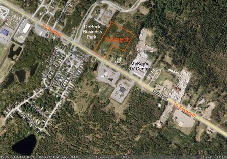

Property Detail
72 Main Rd
Bangor, ME
Penobscot
HOLN-000019-000000-000009
Maine
Residentialacreage
9
B and X Area of moderate flood hazard, usually the area between the limits of the 100-year and 500-year floods.
1.77 AC
2025
Maine North & Bangor
2025
Other Market Areas
009000
NEARBY LISTINGS FOR SALE OR LEASE
DEMOGRAPHICS near 72 Main Rd
1 mile
3 mile
5 mile
2025 Total Population
824
5,091
33,359
2030 Population
840
5,108
33,505
Pop Growth 2025-2030
+ 1.94%
+ 0.33%
+ 0.44%
Average Age
47
46
44
2025 Total Households
357
2,133
15,195
HH Growth 2025-2030
+ 1.96%
+ 0.14%
+ 0.43%
Median Household Inc
$94,821
$82,608
$61,292
Avg Household Size
2.30
2.20
2.10
2025 Avg HH Vehicles
2.00
2.00
2.00
Median Home Value
$356,976
$300,859
$262,793
Median Year Built
1988
1980
1958
Nearby Places
Map Layers
Map Styles
 Street
 Aerial
Layers
 Traffic
 Biking
Places
Listings with unknown addresses are not visible on the map
- Restaurants
- Banks
- Shops
- Fitness
- Groceries
PUBLIC TRANSPORTATION
AIRPORT
Bangor International
Drive
Walk
Distance
Bangor International
15 min
8.4 mi
Freight Ports
Searsport, ME
Drive
Walk
Distance
Searsport, ME
51 min
33.3 mi
Nearby Properties
Address
Land Use
TOTAL SIZE
Lot Size
Zoning
Address
Land Use
TOTAL SIZE
Lot Size
Zoning
Address
Land Use
TOTAL SIZE
Lot Size
Zoning
11,000 SF
188.98 AC
LDR
Address
Land Use
TOTAL SIZE
Lot Size
Zoning
68,708 SF
7.85 AC
PB
Address
Land Use
TOTAL SIZE
Lot Size
Zoning
161,540 SF
23.68 AC
GB
Address
Land Use
TOTAL SIZE
Lot Size
Zoning
34.50 AC
Address
Land Use
TOTAL SIZE
Lot Size
Zoning
139,863 SF
20.68 AC
GB
Address
Land Use
TOTAL SIZE
Lot Size
Zoning
83,231 SF
15.88 AC
HDR-2
Address
Land Use
TOTAL SIZE
Lot Size
Zoning
Address
Land Use
TOTAL SIZE
Lot Size
Zoning
44.17 AC
Address
Land Use
TOTAL SIZE
Lot Size
Zoning
Address
Land Use
TOTAL SIZE
Lot Size
Zoning
96,178 SF
10.63 AC
GB
Address
Land Use
TOTAL SIZE
Lot Size
Zoning
16.63 AC
GB
Address
Land Use
TOTAL SIZE
Lot Size
Zoning
28.15 AC
GB
Address
Land Use
TOTAL SIZE
Lot Size
Zoning
2.50 AC
IND
Address
Land Use
TOTAL SIZE
Lot Size
Zoning
13.98 AC
GB
Address
Land Use
TOTAL SIZE
Lot Size
Zoning
5.48 AC
HDR-2
Address
Land Use
TOTAL SIZE
Lot Size
Zoning
25,400 SF
1 AC
PB
Address
Land Use
TOTAL SIZE
Lot Size
Zoning
28,685 SF
11.15 AC
PB
Address
Land Use
TOTAL SIZE
Lot Size
Zoning
28,244 SF
11.15 AC
PB
Address
Land Use
TOTAL SIZE
Lot Size
Zoning
23,347 SF
1 AC
PB
Address
Land Use
TOTAL SIZE
Lot Size
Zoning
1.48 AC
LDR
Address
Land Use
TOTAL SIZE
Lot Size
Zoning
12,432 SF
5.03 AC
GB
Address
Land Use
TOTAL SIZE
Lot Size
Zoning
27,876 SF
HDR-2
Address
Land Use
TOTAL SIZE
Lot Size
Zoning
32,700 SF
6.07 AC
GB
Address
Land Use
TOTAL SIZE
Lot Size
Zoning
5.25 AC
PB
Address
Land Use
TOTAL SIZE
Lot Size
Zoning
50,000 SF
5 AC
IND
Address
Land Use
TOTAL SIZE
Lot Size
Zoning
1,935 SF
8.42 AC
GB
Address
Land Use
TOTAL SIZE
Lot Size
Zoning
9 AC
HDR-2
Address
Land Use
TOTAL SIZE
Lot Size
Zoning
20.85 AC
IND
Address
Land Use
TOTAL SIZE
Lot Size
Zoning
10.07 AC
HDR-2
The World's #1 Commercial Real Estate Marketplace
Connect with us
© 2026 CoStar Group
The information above has been obtained from sources believed reliable. While we do not doubt its accuracy we have not verified it and make no guarantee, warranty or representation about it. It is your responsibility to independently confirm its accuracy and completeness. Any projections, opinions, assumptions, or estimates used are for example only and do not represent the current or future performance of the property. The value of this transaction to you depends on tax and other factors which should be evaluated by your tax, financial, and legal advisors. You and your advisors should conduct a careful, independent investigation of the property to determine to your satisfaction the suitability of the property for your needs.