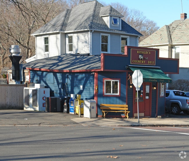
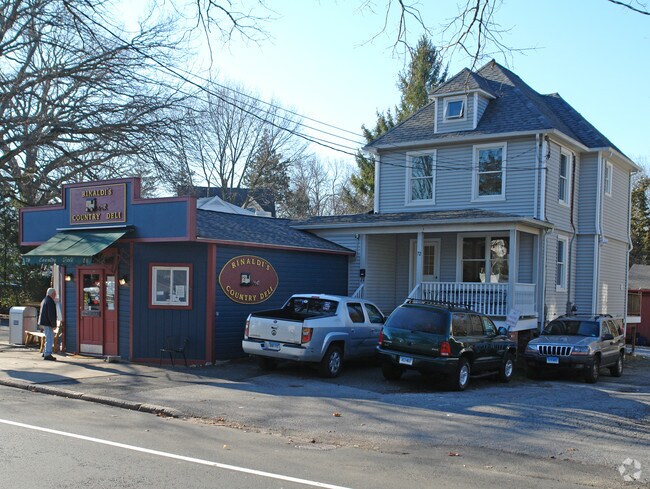
Property Record
72 Orchard St, Cos Cob, CT 06807
NEARBY LISTINGS FOR SALE OR LEASE
Property Detail
72 Orchard St
Commercialofficeresidentialmixeduse
Fairfield
X
Connecticut
09001C0511G
0.64 AC
2025
Greenwich
2025
Westchester/So Connecticut
010800
Bridgeport-Stamford-Norwalk, CT
1,770 SF
GREE-000008-000000-001118-S000000
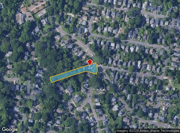
DEMOGRAPHICS near 72 Orchard St
1 Mile
3 Mile
5 Mile
2024 Total Population
8,388
70,863
207,620
2029 Population
8,379
71,027
207,309
Pop Growth 2024-2029
(0.11%)
+ 0.23%
(0.15%)
Average Age
41
40
40
2024 Total Households
3,036
25,500
79,534
HH Growth 2024-2029
(0.23%)
+ 0.25%
+ 0.10%
Median Household Inc
$191,223
$121,550
$110,119
Avg Household Size
2.70
2.70
2.50
2024 Avg HH Vehicles
2.00
2.00
2.00
Median Home Value
$1,062,160
$1,050,704
$775,904
Median Year Built
1958
1966
1968
Nearby Places
Map Layers
Map Styles
 Street
 Aerial
- Restaurants
- Banks
- Shops
- Fitness
- Groceries
PUBLIC TRANSPORTATION
COMMUTER RAIL
Cos Cob Station (New Haven Line - Metro-North Commuter Railroad Company (Metro-North))
DRIVE
WALK
Distance
Cos Cob Station (New Haven Line - Metro-North Commuter Railroad Company (Metro-North))
4 min
1.5 mi
Riverside Station (New Haven Line - Metro-North Commuter Railroad Company (Metro-North))
DRIVE
WALK
Distance
Riverside Station (New Haven Line - Metro-North Commuter Railroad Company (Metro-North))
4 min
1.9 mi
AIRPORT
Westchester County
DRIVE
WALK
Distance
Westchester County
18 min
9.6 mi
LaGuardia
DRIVE
WALK
Distance
LaGuardia
46 min
29.6 mi
John F Kennedy International
DRIVE
WALK
Distance
John F Kennedy International
53 min
37.2 mi
Freight Ports
NY - Red Hook Container Terminal
DRIVE
WALK
Distance
NY - Red Hook Container Terminal
61 min
40.1 mi
Nearby Properties
Address
Land Use
TOTAL SIZE
Lot Size
Zoning
Address
Land Use
TOTAL SIZE
Lot Size
Zoning
244,937 SF
4.20 AC
WB
Address
Land Use
TOTAL SIZE
Lot Size
Zoning
4,179 SF
3.32 AC
GBO
Address
Land Use
TOTAL SIZE
Lot Size
Zoning
7,791 SF
33.47 AC
RA-1
Address
Land Use
TOTAL SIZE
Lot Size
Zoning
175,339 SF
2.12 AC
CGB
Address
Land Use
TOTAL SIZE
Lot Size
Zoning
57,033 SF
33.04 AC
RA-1
Address
Land Use
TOTAL SIZE
Lot Size
Zoning
397,378 SF
4.25 AC
CC
Address
Land Use
TOTAL SIZE
Lot Size
Zoning
411,596 SF
3.30 AC
MZN
Address
Land Use
TOTAL SIZE
Lot Size
Zoning
17.54 AC
DWD
Address
Land Use
TOTAL SIZE
Lot Size
Zoning
80,427 SF
18.06 AC
GBO
Address
Land Use
TOTAL SIZE
Lot Size
Zoning
78,159 SF
4.17 AC
CGB
Address
Land Use
TOTAL SIZE
Lot Size
Zoning
192,254 SF
1.15 AC
GBO
Address
Land Use
TOTAL SIZE
Lot Size
Zoning
9.56 AC
R-6
Address
Land Use
TOTAL SIZE
Lot Size
Zoning
98,106 SF
42.71 AC
RA-2
Address
Land Use
TOTAL SIZE
Lot Size
Zoning
74,446 SF
10.39 AC
R-MF
Address
Land Use
TOTAL SIZE
Lot Size
Zoning
121,807 SF
16.08 AC
R-12
Address
Land Use
TOTAL SIZE
Lot Size
Zoning
377,918 SF
22.42 AC
MZN
Address
Land Use
TOTAL SIZE
Lot Size
Zoning
93,514 SF
5 AC
CGB
Address
Land Use
TOTAL SIZE
Lot Size
Zoning
262,996 SF
1.37 AC
SRDS
Address
Land Use
TOTAL SIZE
Lot Size
Zoning
32,256 SF
2.63 AC
CGB
Address
Land Use
TOTAL SIZE
Lot Size
Zoning
25,834 SF
12.06 AC
R-MF
Address
Land Use
TOTAL SIZE
Lot Size
Zoning
290,603 SF
14.05 AC
GB
Address
Land Use
TOTAL SIZE
Lot Size
Zoning
94,652 SF
2.91 AC
GB
Address
Land Use
TOTAL SIZE
Lot Size
Zoning
229,858 SF
DWD
Address
Land Use
TOTAL SIZE
Lot Size
Zoning
80,054 SF
2.72 AC
CGBR
Address
Land Use
TOTAL SIZE
Lot Size
Zoning
77,136 SF
3.76 AC
GB
Address
Land Use
TOTAL SIZE
Lot Size
Zoning
176,547 SF
9.02 AC
GB
Address
Land Use
TOTAL SIZE
Lot Size
Zoning
133,080 SF
1.01 AC
CGBR
Address
Land Use
TOTAL SIZE
Lot Size
Zoning
276,352 SF
5.15 AC
MD
Address
Land Use
TOTAL SIZE
Lot Size
Zoning
32,784 SF
2.70 AC
CGB
Address
Land Use
TOTAL SIZE
Lot Size
Zoning
30.60 AC
RA-2
The World's #1 Commercial Real Estate Marketplace
Connect with us
© 2025 CoStar Group
The information above has been obtained from sources believed reliable. While we do not doubt its accuracy we have not verified it and make no guarantee, warranty or representation about it. It is your responsibility to independently confirm its accuracy and completeness. Any projections, opinions, assumptions, or estimates used are for example only and do not represent the current or future performance of the property. The value of this transaction to you depends on tax and other factors which should be evaluated by your tax, financial, and legal advisors. You and your advisors should conduct a careful, independent investigation of the property to determine to your satisfaction the suitability of the property for your needs.