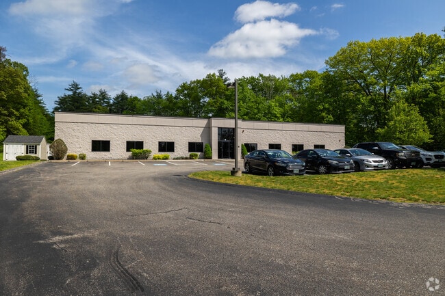
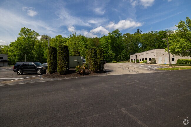
Property Record
72 Route 111, Atkinson, NH 03811

Property Detail
72 Route 111
ATKI-000020-000020-000006
ROCKINGHAM
Industrialgeneral
New Hampshire
RR-3 R
6
B and X Area of moderate flood hazard, usually the area between the limits of the 100-year and 500-year floods.
3 AC
2025
Rockingham
2025
Boston
103100
Boston-Cambridge-Newton, MA-NH
6,000 SF
NEARBY LISTINGS FOR SALE OR LEASE
-
-
View all Atkinson listings for sale on LoopNet.com
DEMOGRAPHICS near 72 Route 111
1 mile
3 mile
5 mile
2025 Total Population
1,579
17,026
51,463
2030 Population
1,595
17,243
51,850
Pop Growth 2025-2030
+ 1.01%
+ 1.27%
+ 0.75%
Average Age
45
45
44
2025 Total Households
591
6,387
19,335
HH Growth 2025-2030
+ 1.02%
+ 1.19%
+ 0.62%
Median Household Inc
$134,000
$125,789
$125,873
Avg Household Size
2.60
2.60
2.60
2025 Avg HH Vehicles
2.00
2.00
2.00
Median Home Value
$550,572
$566,397
$551,506
Median Year Built
1984
1982
1982
Nearby Places
Map Layers
Map Styles
 Street
 Aerial
Layers
 Traffic
 Biking
Places
Listings with unknown addresses are not visible on the map
- Restaurants
- Banks
- Shops
- Fitness
- Groceries
SALE & LEASE HISTORY
LISTING DATE
SALE/LEASE

Jun 30, 2023
For Sale
Jul 27, 2023
For Sale
Jan 25, 2021
For Sale
Apr 26, 2023
For Sale
Nearby Properties
Address
Land Use
TOTAL SIZE
Lot Size
Zoning
Address
Land Use
TOTAL SIZE
Lot Size
Zoning
82,926 SF
40.38 AC
A-RES
Address
Land Use
TOTAL SIZE
Lot Size
Zoning
55,819 SF
382.76 AC
RR2SCR
Address
Land Use
TOTAL SIZE
Lot Size
Zoning
89,227 SF
89.88 AC
A-RES
Address
Land Use
TOTAL SIZE
Lot Size
Zoning
12,187 SF
18.51 AC
A-RES
Address
Land Use
TOTAL SIZE
Lot Size
Zoning
145 AC
IND1
Address
Land Use
TOTAL SIZE
Lot Size
Zoning
58,661 SF
9.53 AC
A-RES
Address
Land Use
TOTAL SIZE
Lot Size
Zoning
863 SF
14.79 AC
B-RES
Address
Land Use
TOTAL SIZE
Lot Size
Zoning
56,632 SF
14.20 AC
RUR
Address
Land Use
TOTAL SIZE
Lot Size
Zoning
26,262 SF
3.75 AC
CDA
Address
Land Use
TOTAL SIZE
Lot Size
Zoning
231.50 AC
B-RES
Address
Land Use
TOTAL SIZE
Lot Size
Zoning
480 SF
A-RES
Address
Land Use
TOTAL SIZE
Lot Size
Zoning
33,757 SF
6.43 AC
C2 C
Address
Land Use
TOTAL SIZE
Lot Size
Zoning
16,368 SF
7.67 AC
C1 C
Address
Land Use
TOTAL SIZE
Lot Size
Zoning
71,420 SF
18.50 AC
C2 C
Address
Land Use
TOTAL SIZE
Lot Size
Zoning
30.36 AC
GC
Address
Land Use
TOTAL SIZE
Lot Size
Zoning
23,160 SF
2.82 AC
GC
Address
Land Use
TOTAL SIZE
Lot Size
Zoning
10,559 SF
1.52 AC
C1 C
Address
Land Use
TOTAL SIZE
Lot Size
Zoning
35,870 SF
4.32 AC
LCSD
Address
Land Use
TOTAL SIZE
Lot Size
Zoning
7,463 SF
3.05 AC
A-RES
Address
Land Use
TOTAL SIZE
Lot Size
Zoning
842 SF
13.30 AC
B-RES
Address
Land Use
TOTAL SIZE
Lot Size
Zoning
57,938 SF
23.60 AC
RUR
Address
Land Use
TOTAL SIZE
Lot Size
Zoning
320 SF
13.40 AC
RUR
Address
Land Use
TOTAL SIZE
Lot Size
Zoning
3,336 SF
15 AC
A-RES
Address
Land Use
TOTAL SIZE
Lot Size
Zoning
5,281 SF
71.16 AC
A-RES
Address
Land Use
TOTAL SIZE
Lot Size
Zoning
61 AC
LDR
Address
Land Use
TOTAL SIZE
Lot Size
Zoning
362.20 AC
RD
Address
Land Use
TOTAL SIZE
Lot Size
Zoning
12,608 SF
8.61 AC
C-I C
Address
Land Use
TOTAL SIZE
Lot Size
Zoning
12,669 SF
5 AC
RUR
Address
Land Use
TOTAL SIZE
Lot Size
Zoning
18,586 SF
16.25 AC
A-RES
Address
Land Use
TOTAL SIZE
Lot Size
Zoning
15,089 SF
5.26 AC
C1 C
The World's #1 Commercial Real Estate Marketplace
Connect with us
© 2026 CoStar Group
The information above has been obtained from sources believed reliable. While we do not doubt its accuracy we have not verified it and make no guarantee, warranty or representation about it. It is your responsibility to independently confirm its accuracy and completeness. Any projections, opinions, assumptions, or estimates used are for example only and do not represent the current or future performance of the property. The value of this transaction to you depends on tax and other factors which should be evaluated by your tax, financial, and legal advisors. You and your advisors should conduct a careful, independent investigation of the property to determine to your satisfaction the suitability of the property for your needs.