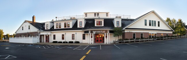
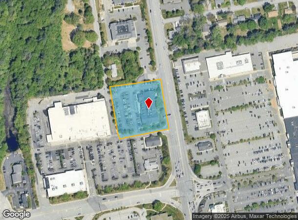
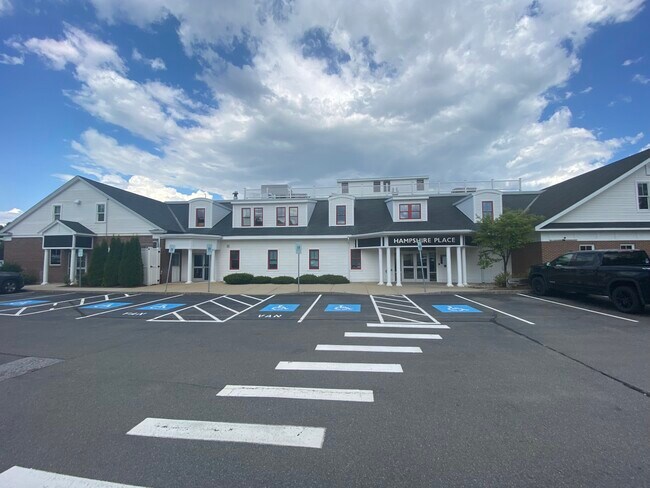
Property Record
72 S River Rd, Bedford, NH 03110
NEARBY LISTINGS FOR SALE OR LEASE
Property Detail
72 S River Rd
BEDD-000012-000018
River Glen
Commercialbuilding
Hillsborough
X
New Hampshire
33011C0378D
2.53 AC
2024
Hillsborough
2024
Boston
002902
Manchester-Nashua, NH
27,791 SF
DEMOGRAPHICS near 72 S River Rd
1 Mile
3 Mile
5 Mile
2024 Total Population
5,398
79,162
144,444
2029 Population
5,540
80,189
146,920
Pop Growth 2024-2029
+ 2.63%
+ 1.30%
+ 1.71%
Average Age
44
39
40
2024 Total Households
2,110
32,642
58,665
HH Growth 2024-2029
+ 2.89%
+ 1.33%
+ 1.77%
Median Household Inc
$80,784
$68,398
$77,993
Avg Household Size
2.30
2.30
2.30
2024 Avg HH Vehicles
2.00
2.00
2.00
Median Home Value
$334,302
$303,611
$332,475
Median Year Built
1975
1957
1971
Nearby Places
- Restaurants
- Banks
- Shops
- Fitness
- Groceries
PUBLIC TRANSPORTATION
AIRPORT
Manchester Boston Regional
DRIVE
WALK
Distance
Manchester Boston Regional
13 min
5.1 mi
Freight Ports
Port of Boston
DRIVE
WALK
Distance
Port of Boston
85 min
57.5 mi
SALE & LEASE HISTORY
LISTING DATE
SALE/LEASE

Sep 25, 2016
For Lease
Dec 02, 2021
For Lease
Aug 10, 2025
For Lease
Nearby Properties
Address
Land Use
TOTAL SIZE
Lot Size
Zoning
Address
Land Use
TOTAL SIZE
Lot Size
Zoning
446,957 SF
24.16 AC
Address
Land Use
TOTAL SIZE
Lot Size
Zoning
383,493 SF
34.51 AC
Address
Land Use
TOTAL SIZE
Lot Size
Zoning
347,230 SF
42.11 AC
RA
Address
Land Use
TOTAL SIZE
Lot Size
Zoning
60,000 SF
144.50 AC
R2
Address
Land Use
TOTAL SIZE
Lot Size
Zoning
256,041 SF
6.69 AC
Address
Land Use
TOTAL SIZE
Lot Size
Zoning
Address
Land Use
TOTAL SIZE
Lot Size
Zoning
46,906 SF
552.35 AC
Address
Land Use
TOTAL SIZE
Lot Size
Zoning
29,803 SF
31.46 AC
PZ
Address
Land Use
TOTAL SIZE
Lot Size
Zoning
3,748 SF
14.69 AC
Address
Land Use
TOTAL SIZE
Lot Size
Zoning
0.60 AC
PZ
Address
Land Use
TOTAL SIZE
Lot Size
Zoning
250,905 SF
1.16 AC
Address
Land Use
TOTAL SIZE
Lot Size
Zoning
217,697 SF
43.25 AC
Address
Land Use
TOTAL SIZE
Lot Size
Zoning
229,089 SF
3.58 AC
Address
Land Use
TOTAL SIZE
Lot Size
Zoning
135,879 SF
2.36 AC
Address
Land Use
TOTAL SIZE
Lot Size
Zoning
43,576 SF
R2
Address
Land Use
TOTAL SIZE
Lot Size
Zoning
398,130 SF
1.68 AC
Address
Land Use
TOTAL SIZE
Lot Size
Zoning
22,101 SF
8.33 AC
Address
Land Use
TOTAL SIZE
Lot Size
Zoning
723,875 SF
38.08 AC
Address
Land Use
TOTAL SIZE
Lot Size
Zoning
221,144 SF
3.77 AC
Address
Land Use
TOTAL SIZE
Lot Size
Zoning
237,634 SF
5.39 AC
Address
Land Use
TOTAL SIZE
Lot Size
Zoning
207,701 SF
4.16 AC
Address
Land Use
TOTAL SIZE
Lot Size
Zoning
44,878 SF
12.89 AC
CO
Address
Land Use
TOTAL SIZE
Lot Size
Zoning
116,763 SF
7 AC
PZ
Address
Land Use
TOTAL SIZE
Lot Size
Zoning
181,610 SF
0.58 AC
Address
Land Use
TOTAL SIZE
Lot Size
Zoning
2,656 SF
16.01 AC
Address
Land Use
TOTAL SIZE
Lot Size
Zoning
151,002 SF
6.95 AC
PZ
Address
Land Use
TOTAL SIZE
Lot Size
Zoning
139,616 SF
18.47 AC
PZ
Address
Land Use
TOTAL SIZE
Lot Size
Zoning
165,000 SF
3.38 AC
Address
Land Use
TOTAL SIZE
Lot Size
Zoning
180,474 SF
18.60 AC
Address
Land Use
TOTAL SIZE
Lot Size
Zoning
230,582 SF
0.31 AC
The World's #1 Commercial Real Estate Marketplace
Connect with us
© 2025 CoStar Group
The information above has been obtained from sources believed reliable. While we do not doubt its accuracy we have not verified it and make no guarantee, warranty or representation about it. It is your responsibility to independently confirm its accuracy and completeness. Any projections, opinions, assumptions, or estimates used are for example only and do not represent the current or future performance of the property. The value of this transaction to you depends on tax and other factors which should be evaluated by your tax, financial, and legal advisors. You and your advisors should conduct a careful, independent investigation of the property to determine to your satisfaction the suitability of the property for your needs.