Property Record
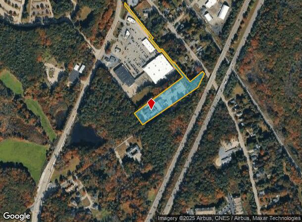
72 Walnut St, Foxboro, MA 02035


NEARBY LISTINGS FOR SALE OR LEASE
Property Detail
72 Walnut St
FOXB-000121-000000-003140
Norfolk
Hospitalprivate
Massachusetts
AE
38
25021C0361E
6.64 AC
2025
I-95 Corridor South
2025
Boston
410400
Boston-Cambridge-Newton, MA-NH
34,347 SF
DEMOGRAPHICS near 72 Walnut St
1 mile
3 mile
5 mile
2024 Total Population
3,918
30,668
70,250
2029 Population
3,869
30,453
69,845
Pop Growth 2024-2029
(1.25%)
(0.70%)
(0.58%)
Average Age
41
41
41
2024 Total Households
1,757
12,253
26,404
HH Growth 2024-2029
(1.25%)
(0.76%)
(0.63%)
Median Household Inc
$91,343
$100,152
$120,471
Avg Household Size
2.20
2.50
2.60
2024 Avg HH Vehicles
2.00
2.00
2.00
Median Home Value
$566,705
$561,418
$562,990
Median Year Built
1974
1973
1977
Nearby Places
Map Layers
Map Styles
 Street
 Aerial
Transit
 Traffic
 Biking
Places
Listings with unknown addresses are not visible on the map
- Restaurants
- Banks
- Shops
- Fitness
- Groceries
PUBLIC TRANSPORTATION
COMMUTER RAIL
Mansfield (Foxboro Line (Special Events Only) - Massachusetts Bay Transportation Authority Commuter Rail (Purple Line), Providence/Stoughton Line - Massachusetts Bay Transportation Authority Commuter Rail (Purple Line))
Drive
Walk
Distance
Mansfield (Foxboro Line (Special Events Only) - Massachusetts Bay Transportation Authority Commuter Rail (Purple Line), Providence/Stoughton Line - Massachusetts Bay Transportation Authority Commuter Rail (Purple Line))
7 min
2.7 mi
Foxboro (Special Events Only) (Foxboro Line (Special Events Only) - Massachusetts Bay Transportation Authority Commuter Rail (Purple Line))
Drive
Walk
Distance
Foxboro (Special Events Only) (Foxboro Line (Special Events Only) - Massachusetts Bay Transportation Authority Commuter Rail (Purple Line))
11 min
5.3 mi
AIRPORT
Rhode Island Tf Green International
Drive
Walk
Distance
Rhode Island Tf Green International
43 min
28.4 mi
General Edward Lawrence Logan International
Drive
Walk
Distance
General Edward Lawrence Logan International
48 min
33.9 mi
Freight Ports
Port of Boston
Drive
Walk
Distance
Port of Boston
46 min
28.5 mi
Nearby Properties
Address
Land Use
TOTAL SIZE
Lot Size
Zoning
Address
Land Use
TOTAL SIZE
Lot Size
Zoning
204,502 SF
40.65 AC
Address
Land Use
TOTAL SIZE
Lot Size
Zoning
205,897 SF
37.36 AC
Address
Land Use
TOTAL SIZE
Lot Size
Zoning
17.60 AC
Address
Land Use
TOTAL SIZE
Lot Size
Zoning
22.81 AC
Address
Land Use
TOTAL SIZE
Lot Size
Zoning
Address
Land Use
TOTAL SIZE
Lot Size
Zoning
Address
Land Use
TOTAL SIZE
Lot Size
Zoning
25.68 AC
Address
Land Use
TOTAL SIZE
Lot Size
Zoning
Address
Land Use
TOTAL SIZE
Lot Size
Zoning
4,752 SF
20 AC
Address
Land Use
TOTAL SIZE
Lot Size
Zoning
350,067 SF
20.20 AC
Address
Land Use
TOTAL SIZE
Lot Size
Zoning
442,756 SF
31.18 AC
Address
Land Use
TOTAL SIZE
Lot Size
Zoning
41.28 AC
Address
Land Use
TOTAL SIZE
Lot Size
Zoning
113,788 SF
1.67 AC
Address
Land Use
TOTAL SIZE
Lot Size
Zoning
202,987 SF
25.95 AC
Address
Land Use
TOTAL SIZE
Lot Size
Zoning
33.31 AC
Address
Land Use
TOTAL SIZE
Lot Size
Zoning
83,014 SF
129.67 AC
Address
Land Use
TOTAL SIZE
Lot Size
Zoning
3,330 SF
1.37 AC
Address
Land Use
TOTAL SIZE
Lot Size
Zoning
14.75 AC
Address
Land Use
TOTAL SIZE
Lot Size
Zoning
14.20 AC
Address
Land Use
TOTAL SIZE
Lot Size
Zoning
86,116 SF
22.50 AC
Address
Land Use
TOTAL SIZE
Lot Size
Zoning
349,000 SF
61.70 AC
Address
Land Use
TOTAL SIZE
Lot Size
Zoning
205,400 SF
10 AC
Address
Land Use
TOTAL SIZE
Lot Size
Zoning
174,103 SF
12.40 AC
Address
Land Use
TOTAL SIZE
Lot Size
Zoning
24.50 AC
Address
Land Use
TOTAL SIZE
Lot Size
Zoning
113,750 SF
10.50 AC
Address
Land Use
TOTAL SIZE
Lot Size
Zoning
7.86 AC
Address
Land Use
TOTAL SIZE
Lot Size
Zoning
230,394 SF
19.77 AC
Address
Land Use
TOTAL SIZE
Lot Size
Zoning
73,468 SF
9.40 AC
Address
Land Use
TOTAL SIZE
Lot Size
Zoning
93,685 SF
8 AC
Address
Land Use
TOTAL SIZE
Lot Size
Zoning
105,166 SF
5.93 AC
The World's #1 Commercial Real Estate Marketplace
Connect with us
© 2026 CoStar Group
The information above has been obtained from sources believed reliable. While we do not doubt its accuracy we have not verified it and make no guarantee, warranty or representation about it. It is your responsibility to independently confirm its accuracy and completeness. Any projections, opinions, assumptions, or estimates used are for example only and do not represent the current or future performance of the property. The value of this transaction to you depends on tax and other factors which should be evaluated by your tax, financial, and legal advisors. You and your advisors should conduct a careful, independent investigation of the property to determine to your satisfaction the suitability of the property for your needs.