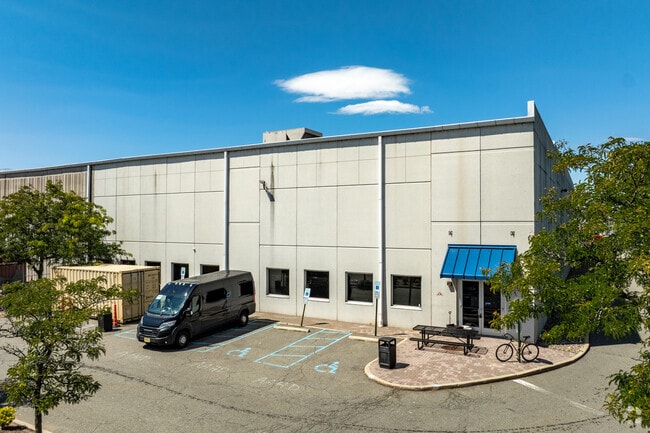
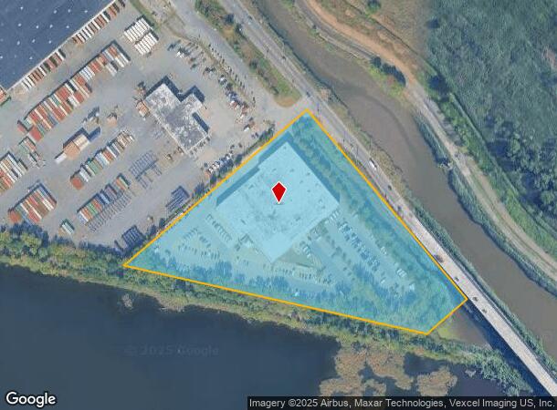
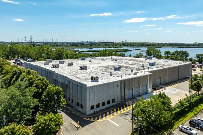
Property Record
720 Belleville Tpke, Kearny, NJ 07032
NEARBY LISTINGS FOR SALE OR LEASE
Property Detail
720 Belleville Tpke
07-00150-01-00064-02-HM
Hudson
Industrialgeneral
New Jersey
AE
64.2
34003C0263H
9.06 AC
2024
Lyndhurst/Harrison
2025
Northern New Jersey
012700
New York-Jersey City-White Plains, NY-NJ
DEMOGRAPHICS near 720 Belleville Tpke
1 Mile
3 Mile
5 Mile
2024 Total Population
3,854
164,075
791,009
2029 Population
3,611
157,281
762,533
Pop Growth 2024-2029
(6.31%)
(4.14%)
(3.60%)
Average Age
41
38
38
2024 Total Households
1,102
61,012
301,593
HH Growth 2024-2029
(8.08%)
(4.26%)
(3.78%)
Median Household Inc
$81,804
$65,788
$66,765
Avg Household Size
2.50
2.60
2.50
2024 Avg HH Vehicles
2.00
1.00
1.00
Median Home Value
$345,951
$384,451
$418,899
Median Year Built
1966
1961
1960
Nearby Places
Map Layers
Map Styles
 Street
 Aerial
- Restaurants
- Banks
- Shops
- Fitness
- Groceries
PUBLIC TRANSPORTATION
COMMUTER RAIL
Kingsland (Main/Port Jervis Line - NJ Transit Commuter Rail (NJ Transit))
DRIVE
WALK
Distance
Kingsland (Main/Port Jervis Line - NJ Transit Commuter Rail (NJ Transit))
7 min
3.8 mi
Harrison (Newark Penn Station-World Trade Center - Port Authority Trans-Hudson (PATH))
DRIVE
WALK
Distance
Harrison (Newark Penn Station-World Trade Center - Port Authority Trans-Hudson (PATH))
9 min
4.4 mi
AIRPORT
Newark Liberty International
DRIVE
WALK
Distance
Newark Liberty International
12 min
8.9 mi
LaGuardia
DRIVE
WALK
Distance
LaGuardia
39 min
17.6 mi
John F Kennedy International
DRIVE
WALK
Distance
John F Kennedy International
48 min
25.9 mi
Freight Ports
Maher Terminal
DRIVE
WALK
Distance
Maher Terminal
20 min
11.0 mi
SALE & LEASE HISTORY
LISTING DATE
SALE/LEASE

Nov 02, 2018
For Lease
Nearby Properties
Address
Land Use
TOTAL SIZE
Lot Size
Zoning
Address
Land Use
TOTAL SIZE
Lot Size
Zoning
25.69 AC
Address
Land Use
TOTAL SIZE
Lot Size
Zoning
Address
Land Use
TOTAL SIZE
Lot Size
Zoning
3,956 SF
250 AC
C2
Address
Land Use
TOTAL SIZE
Lot Size
Zoning
2,500 SF
43.35 AC
Address
Land Use
TOTAL SIZE
Lot Size
Zoning
169.40 AC
Address
Land Use
TOTAL SIZE
Lot Size
Zoning
Address
Land Use
TOTAL SIZE
Lot Size
Zoning
710 SF
39.32 AC
Address
Land Use
TOTAL SIZE
Lot Size
Zoning
Address
Land Use
TOTAL SIZE
Lot Size
Zoning
Address
Land Use
TOTAL SIZE
Lot Size
Zoning
41.21 AC
Address
Land Use
TOTAL SIZE
Lot Size
Zoning
74.77 AC
Address
Land Use
TOTAL SIZE
Lot Size
Zoning
Address
Land Use
TOTAL SIZE
Lot Size
Zoning
877 SF
1.95 AC
Address
Land Use
TOTAL SIZE
Lot Size
Zoning
62.49 AC
Address
Land Use
TOTAL SIZE
Lot Size
Zoning
100,014 SF
8.80 AC
M2
Address
Land Use
TOTAL SIZE
Lot Size
Zoning
Address
Land Use
TOTAL SIZE
Lot Size
Zoning
0.58 AC
Address
Land Use
TOTAL SIZE
Lot Size
Zoning
313,868 SF
3.30 AC
Address
Land Use
TOTAL SIZE
Lot Size
Zoning
647,082 SF
Address
Land Use
TOTAL SIZE
Lot Size
Zoning
29.10 AC
Address
Land Use
TOTAL SIZE
Lot Size
Zoning
378,751 SF
2.64 AC
Address
Land Use
TOTAL SIZE
Lot Size
Zoning
0.75 AC
Address
Land Use
TOTAL SIZE
Lot Size
Zoning
13 AC
LIA
Address
Land Use
TOTAL SIZE
Lot Size
Zoning
0.76 AC
Address
Land Use
TOTAL SIZE
Lot Size
Zoning
449,701 SF
Address
Land Use
TOTAL SIZE
Lot Size
Zoning
877 SF
6.70 AC
Address
Land Use
TOTAL SIZE
Lot Size
Zoning
395,286 SF
Address
Land Use
TOTAL SIZE
Lot Size
Zoning
275,260 SF
11.88 AC
Address
Land Use
TOTAL SIZE
Lot Size
Zoning
2.54 AC
RA
Address
Land Use
TOTAL SIZE
Lot Size
Zoning
19 AC
LIA
The World's #1 Commercial Real Estate Marketplace
Connect with us
© 2025 CoStar Group
The information above has been obtained from sources believed reliable. While we do not doubt its accuracy we have not verified it and make no guarantee, warranty or representation about it. It is your responsibility to independently confirm its accuracy and completeness. Any projections, opinions, assumptions, or estimates used are for example only and do not represent the current or future performance of the property. The value of this transaction to you depends on tax and other factors which should be evaluated by your tax, financial, and legal advisors. You and your advisors should conduct a careful, independent investigation of the property to determine to your satisfaction the suitability of the property for your needs.