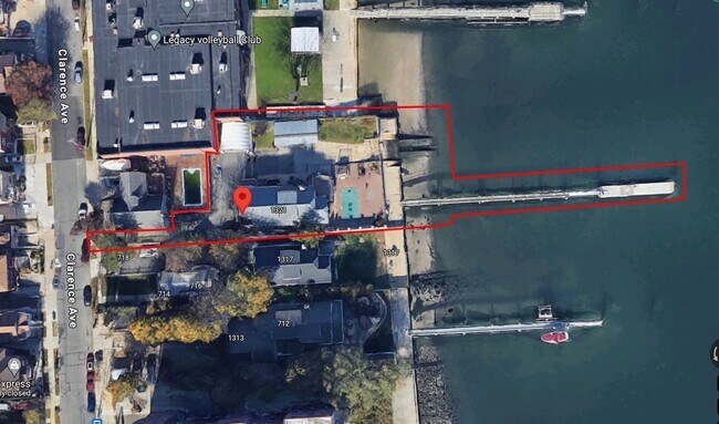
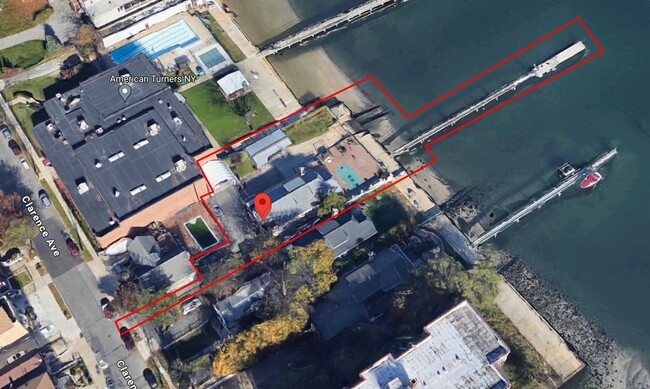
Property Record
720B Clarence Ave, Bronx, NY 10465
NEARBY LISTINGS FOR SALE OR LEASE
Property Detail
720B Clarence Ave
05481-0029
Bronx
Duplex
New York
AE
27
3604970104F
0.43 AC
2024
Throgs Neck-Edgewater Park
2025
Westchester/So Connecticut
015800
New York-Jersey City-White Plains, NY-NJ
3,065 SF
DEMOGRAPHICS near 720B Clarence Ave
1 Mile
3 Mile
5 Mile
2024 Total Population
28,044
265,765
1,109,205
2029 Population
24,527
237,866
1,023,799
Pop Growth 2024-2029
(12.54%)
(10.50%)
(7.70%)
Average Age
42
40
39
2024 Total Households
10,336
95,706
390,599
HH Growth 2024-2029
(13.41%)
(11.18%)
(8.37%)
Median Household Inc
$73,230
$58,960
$48,160
Avg Household Size
2.60
2.60
2.70
2024 Avg HH Vehicles
1.00
1.00
1.00
Median Home Value
$660,854
$612,130
$622,425
Median Year Built
1956
1954
1954
Nearby Places
Map Layers
Map Styles
 Street
 Aerial
- Restaurants
- Banks
- Shops
- Fitness
- Groceries
PUBLIC TRANSPORTATION
COMMUTER RAIL
Williams Bridge Station (Harlem Line - Metro-North Commuter Railroad Company (Metro-North))
DRIVE
WALK
Distance
Williams Bridge Station (Harlem Line - Metro-North Commuter Railroad Company (Metro-North))
11 min
5.1 mi
Botanical Garden Station (Harlem Line - Metro-North Commuter Railroad Company (Metro-North))
DRIVE
WALK
Distance
Botanical Garden Station (Harlem Line - Metro-North Commuter Railroad Company (Metro-North))
12 min
6.2 mi
AIRPORT
LaGuardia
DRIVE
WALK
Distance
LaGuardia
18 min
8.6 mi
John F Kennedy International
DRIVE
WALK
Distance
John F Kennedy International
25 min
16.2 mi
Westchester County
DRIVE
WALK
Distance
Westchester County
34 min
22.2 mi
Freight Ports
NY - Red Hook Container Terminal
DRIVE
WALK
Distance
NY - Red Hook Container Terminal
33 min
19.2 mi
SALE & LEASE HISTORY
LISTING DATE
SALE/LEASE

Dec 14, 2023
For Sale
Nearby Properties
Address
Land Use
TOTAL SIZE
Lot Size
Zoning
Address
Land Use
TOTAL SIZE
Lot Size
Zoning
550,000 SF
8.75 AC
M1-1
Address
Land Use
TOTAL SIZE
Lot Size
Zoning
1,427,393 SF
39.94 AC
R4
Address
Land Use
TOTAL SIZE
Lot Size
Zoning
119,980 SF
1,704.55 AC
PARK
Address
Land Use
TOTAL SIZE
Lot Size
Zoning
5,000 SF
363.58 AC
PARK
Address
Land Use
TOTAL SIZE
Lot Size
Zoning
1,012,000 SF
7.79 AC
R6
Address
Land Use
TOTAL SIZE
Lot Size
Zoning
485,484 SF
39.63 AC
R5
Address
Land Use
TOTAL SIZE
Lot Size
Zoning
667,405 SF
5.51 AC
R6
Address
Land Use
TOTAL SIZE
Lot Size
Zoning
703,265 SF
83.45 AC
R4
Address
Land Use
TOTAL SIZE
Lot Size
Zoning
537,208 SF
4.73 AC
C4-3
Address
Land Use
TOTAL SIZE
Lot Size
Zoning
545,388 SF
29.07 AC
C4-3
Address
Land Use
TOTAL SIZE
Lot Size
Zoning
851,821 SF
7.95 AC
R4
Address
Land Use
TOTAL SIZE
Lot Size
Zoning
14,681 SF
97 AC
PARK
Address
Land Use
TOTAL SIZE
Lot Size
Zoning
489,326 SF
19.18 AC
C8-1
Address
Land Use
TOTAL SIZE
Lot Size
Zoning
361,354 SF
C4-2
Address
Land Use
TOTAL SIZE
Lot Size
Zoning
510 SF
68.73 AC
PARK
Address
Land Use
TOTAL SIZE
Lot Size
Zoning
601,260 SF
3.27 AC
R4
Address
Land Use
TOTAL SIZE
Lot Size
Zoning
191,800 SF
13.39 AC
C4-3
Address
Land Use
TOTAL SIZE
Lot Size
Zoning
450,879 SF
9.10 AC
M1-1
Address
Land Use
TOTAL SIZE
Lot Size
Zoning
450,000 SF
5.59 AC
R6
Address
Land Use
TOTAL SIZE
Lot Size
Zoning
726,051 SF
33.66 AC
R5
Address
Land Use
TOTAL SIZE
Lot Size
Zoning
274,840 SF
2.80 AC
M1-1
Address
Land Use
TOTAL SIZE
Lot Size
Zoning
464,700 SF
5.07 AC
R4
Address
Land Use
TOTAL SIZE
Lot Size
Zoning
262,716 SF
2.80 AC
M1-1
Address
Land Use
TOTAL SIZE
Lot Size
Zoning
1,172,800 SF
19.66 AC
R4
Address
Land Use
TOTAL SIZE
Lot Size
Zoning
10,181 SF
30.72 AC
M1-1
Address
Land Use
TOTAL SIZE
Lot Size
Zoning
164,110 SF
8.07 AC
M1-2
Address
Land Use
TOTAL SIZE
Lot Size
Zoning
239,223 SF
2.66 AC
R4
Address
Land Use
TOTAL SIZE
Lot Size
Zoning
172,268 SF
2.03 AC
M1-1
Address
Land Use
TOTAL SIZE
Lot Size
Zoning
105,000 SF
0.85 AC
R5
Address
Land Use
TOTAL SIZE
Lot Size
Zoning
330,240 SF
13.62 AC
C4-1
The World's #1 Commercial Real Estate Marketplace
Connect with us
© 2026 CoStar Group
The information above has been obtained from sources believed reliable. While we do not doubt its accuracy we have not verified it and make no guarantee, warranty or representation about it. It is your responsibility to independently confirm its accuracy and completeness. Any projections, opinions, assumptions, or estimates used are for example only and do not represent the current or future performance of the property. The value of this transaction to you depends on tax and other factors which should be evaluated by your tax, financial, and legal advisors. You and your advisors should conduct a careful, independent investigation of the property to determine to your satisfaction the suitability of the property for your needs.