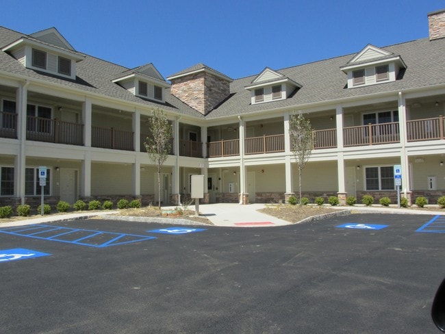
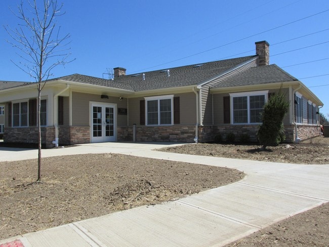
Property Record
720 Denow Rd, Pennington, NJ 08534
NEARBY LISTINGS FOR SALE OR LEASE
-
-
View all Pennington listings for sale on LoopNet.com
Property Detail
720 Denow Rd
Trenton, NJ
Hopewell Grant Ph 1
06-00078-0000-00010-04
FACILITY NAME: RESIDENCE
Taxexempt
Mercer
X
New Jersey
34021C0117F
10.4
0
22.37 AC
2025
Pennington/Hopewell
003903
Northern New Jersey
DEMOGRAPHICS near 720 Denow Rd
1 Mile
3 Mile
5 Mile
2024 Total Population
4,503
34,757
104,685
2029 Population
4,488
34,697
105,010
Pop Growth 2024-2029
(0.33%)
(0.17%)
+ 0.31%
Average Age
44
42
42
2024 Total Households
1,811
12,774
40,042
HH Growth 2024-2029
(0.55%)
(0.12%)
+ 0.33%
Median Household Inc
$121,281
$115,306
$91,773
Avg Household Size
2.50
2.40
2.40
2024 Avg HH Vehicles
2.00
2.00
2.00
Median Home Value
$436,501
$370,651
$311,763
Median Year Built
1993
1980
1964
Nearby Places
Map Layers
Map Styles
 Street
 Aerial
- Restaurants
- Banks
- Shops
- Fitness
- Groceries
PUBLIC TRANSPORTATION
COMMUTER RAIL
West Trenton (R3 - Southeastern Pennsylvania Transportation Authority Regional Rail (SEPTA Regional Rail))
DRIVE
WALK
Distance
West Trenton (R3 - Southeastern Pennsylvania Transportation Authority Regional Rail (SEPTA Regional Rail))
10 min
5.7 mi
Hamilton (Northeast Corridor Line - NJ Transit Commuter Rail (NJ Transit))
DRIVE
WALK
Distance
Hamilton (Northeast Corridor Line - NJ Transit Commuter Rail (NJ Transit))
14 min
9.0 mi
AIRPORT
Trenton Mercer
DRIVE
WALK
Distance
Trenton Mercer
10 min
5.1 mi
Freight Ports
Port of Philadelphia
DRIVE
WALK
Distance
Port of Philadelphia
46 min
32.6 mi
Nearby Properties
Address
Land Use
TOTAL SIZE
Lot Size
Zoning
Address
Land Use
TOTAL SIZE
Lot Size
Zoning
67.65 AC
R-1
Address
Land Use
TOTAL SIZE
Lot Size
Zoning
141.90 AC
EGI
Address
Land Use
TOTAL SIZE
Lot Size
Zoning
42 AC
R03
Address
Land Use
TOTAL SIZE
Lot Size
Zoning
2,050 SF
292 AC
EGI
Address
Land Use
TOTAL SIZE
Lot Size
Zoning
5.97 AC
R-1
Address
Land Use
TOTAL SIZE
Lot Size
Zoning
13.86 AC
OP
Address
Land Use
TOTAL SIZE
Lot Size
Zoning
156.92 AC
R03
Address
Land Use
TOTAL SIZE
Lot Size
Zoning
Address
Land Use
TOTAL SIZE
Lot Size
Zoning
13.36 AC
OP
Address
Land Use
TOTAL SIZE
Lot Size
Zoning
0.35 AC
OP
Address
Land Use
TOTAL SIZE
Lot Size
Zoning
6.11 AC
R-1
Address
Land Use
TOTAL SIZE
Lot Size
Zoning
104.60 AC
IP-1
Address
Land Use
TOTAL SIZE
Lot Size
Zoning
7.85 AC
OP
Address
Land Use
TOTAL SIZE
Lot Size
Zoning
24.44 AC
AT
Address
Land Use
TOTAL SIZE
Lot Size
Zoning
6.09 AC
OP
Address
Land Use
TOTAL SIZE
Lot Size
Zoning
8.73 AC
OP
Address
Land Use
TOTAL SIZE
Lot Size
Zoning
Address
Land Use
TOTAL SIZE
Lot Size
Zoning
Address
Land Use
TOTAL SIZE
Lot Size
Zoning
38.82 AC
R100
Address
Land Use
TOTAL SIZE
Lot Size
Zoning
0.32 AC
OP
Address
Land Use
TOTAL SIZE
Lot Size
Zoning
4.23 AC
R-1
Address
Land Use
TOTAL SIZE
Lot Size
Zoning
Address
Land Use
TOTAL SIZE
Lot Size
Zoning
6.37 AC
OP
Address
Land Use
TOTAL SIZE
Lot Size
Zoning
34.70 AC
R-1
Address
Land Use
TOTAL SIZE
Lot Size
Zoning
8.35 AC
OP
Address
Land Use
TOTAL SIZE
Lot Size
Zoning
6.01 AC
OP
Address
Land Use
TOTAL SIZE
Lot Size
Zoning
69.56 AC
EGI
Address
Land Use
TOTAL SIZE
Lot Size
Zoning
11,885 SF
20.25 AC
R-2
Address
Land Use
TOTAL SIZE
Lot Size
Zoning
20.93 AC
HBO
Address
Land Use
TOTAL SIZE
Lot Size
Zoning
36,490 SF
71.33 AC
IP1
The World's #1 Commercial Real Estate Marketplace
Connect with us
© 2025 CoStar Group
The information above has been obtained from sources believed reliable. While we do not doubt its accuracy we have not verified it and make no guarantee, warranty or representation about it. It is your responsibility to independently confirm its accuracy and completeness. Any projections, opinions, assumptions, or estimates used are for example only and do not represent the current or future performance of the property. The value of this transaction to you depends on tax and other factors which should be evaluated by your tax, financial, and legal advisors. You and your advisors should conduct a careful, independent investigation of the property to determine to your satisfaction the suitability of the property for your needs.