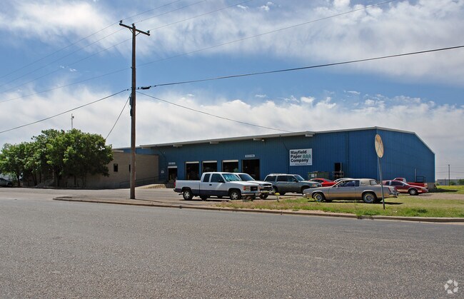
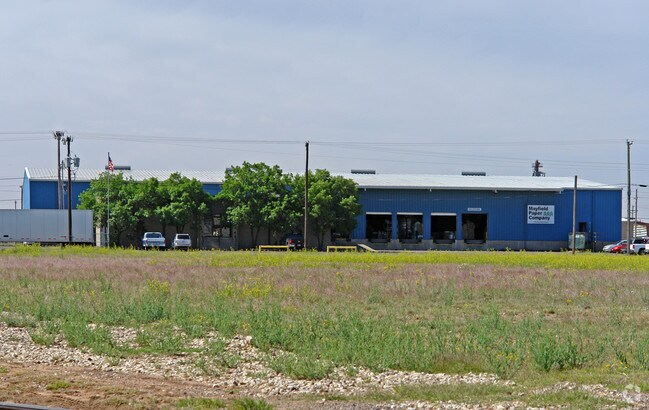
Property Record
720 E 42Nd St, Lubbock, TX 79404

Property Detail
720 E 42Nd St
Lubbock, TX
BURLINGTON IND #2 BLK 10 L 8
R58829
Lubbock
Distributionwarehouseregional
Texas
AE The base floodplain where base flood elevations are provided. AE Zones are now used on new format FIRMs instead of A1-A30 Zones.
8
2024
2.07 AC
2025
Southeast Inner Loop
002500
Lubbock
35,980 SF
NEARBY LISTINGS FOR SALE OR LEASE
DEMOGRAPHICS near 720 E 42Nd St
1 mile
3 mile
5 mile
2024 Total Population
3,276
48,995
128,995
2029 Population
3,499
51,428
134,222
Pop Growth 2024-2029
+ 6.81%
+ 4.97%
+ 4.05%
Average Age
37
36
35
2024 Total Households
1,180
18,335
48,205
HH Growth 2024-2029
+ 7.12%
+ 5.30%
+ 4.59%
Median Household Inc
$46,316
$43,956
$47,966
Avg Household Size
2.70
2.50
2.40
2024 Avg HH Vehicles
1.00
2.00
2.00
Median Home Value
$82,856
$114,845
$155,229
Median Year Built
1977
1967
1972
Nearby Places
Map Layers
Map Styles
 Street
 Aerial
Transit
 Traffic
 Biking
Places
Listings with unknown addresses are not visible on the map
- Restaurants
- Banks
- Shops
- Fitness
- Groceries
PUBLIC TRANSPORTATION
AIRPORT
Lubbock Preston Smith International
Drive
Walk
Distance
Lubbock Preston Smith International
27 min
13.7 mi
Nearby Properties
Address
Land Use
TOTAL SIZE
Lot Size
Zoning
Address
Land Use
TOTAL SIZE
Lot Size
Zoning
281,000 SF
6.19 AC
Address
Land Use
TOTAL SIZE
Lot Size
Zoning
15,506 SF
18.67 AC
Address
Land Use
TOTAL SIZE
Lot Size
Zoning
353,616 SF
5.24 AC
Address
Land Use
TOTAL SIZE
Lot Size
Zoning
709,350 SF
98.60 AC
Address
Land Use
TOTAL SIZE
Lot Size
Zoning
120,867 SF
3.41 AC
Address
Land Use
TOTAL SIZE
Lot Size
Zoning
122,016 SF
1.13 AC
Address
Land Use
TOTAL SIZE
Lot Size
Zoning
176,165 SF
36.61 AC
Address
Land Use
TOTAL SIZE
Lot Size
Zoning
219,352 SF
21.90 AC
Address
Land Use
TOTAL SIZE
Lot Size
Zoning
92,624 SF
2.77 AC
Address
Land Use
TOTAL SIZE
Lot Size
Zoning
7.68 AC
Address
Land Use
TOTAL SIZE
Lot Size
Zoning
64,317 SF
4.50 AC
Address
Land Use
TOTAL SIZE
Lot Size
Zoning
157,644 SF
9.69 AC
Address
Land Use
TOTAL SIZE
Lot Size
Zoning
115,670 SF
2.28 AC
Address
Land Use
TOTAL SIZE
Lot Size
Zoning
76,680 SF
4.95 AC
Address
Land Use
TOTAL SIZE
Lot Size
Zoning
279,143 SF
26.32 AC
Address
Land Use
TOTAL SIZE
Lot Size
Zoning
253,852 SF
17.98 AC
Address
Land Use
TOTAL SIZE
Lot Size
Zoning
421,200 SF
43.22 AC
Address
Land Use
TOTAL SIZE
Lot Size
Zoning
119,200 SF
8.44 AC
Address
Land Use
TOTAL SIZE
Lot Size
Zoning
175,122 SF
1.44 AC
Address
Land Use
TOTAL SIZE
Lot Size
Zoning
77,344 SF
4.76 AC
Address
Land Use
TOTAL SIZE
Lot Size
Zoning
150,000 SF
216.67 AC
Address
Land Use
TOTAL SIZE
Lot Size
Zoning
80,599 SF
1.64 AC
Address
Land Use
TOTAL SIZE
Lot Size
Zoning
105,908 SF
9.78 AC
Address
Land Use
TOTAL SIZE
Lot Size
Zoning
192,128 SF
9.87 AC
Address
Land Use
TOTAL SIZE
Lot Size
Zoning
212,701 SF
5.09 AC
Address
Land Use
TOTAL SIZE
Lot Size
Zoning
61,081 SF
7.25 AC
Address
Land Use
TOTAL SIZE
Lot Size
Zoning
53,816 SF
1.32 AC
Address
Land Use
TOTAL SIZE
Lot Size
Zoning
42,288 SF
5.30 AC
Address
Land Use
TOTAL SIZE
Lot Size
Zoning
189,737 SF
31 AC
Address
Land Use
TOTAL SIZE
Lot Size
Zoning
88,310 SF
9.95 AC
The World's #1 Commercial Real Estate Marketplace
Connect with us
© 2026 CoStar Group
The information above has been obtained from sources believed reliable. While we do not doubt its accuracy we have not verified it and make no guarantee, warranty or representation about it. It is your responsibility to independently confirm its accuracy and completeness. Any projections, opinions, assumptions, or estimates used are for example only and do not represent the current or future performance of the property. The value of this transaction to you depends on tax and other factors which should be evaluated by your tax, financial, and legal advisors. You and your advisors should conduct a careful, independent investigation of the property to determine to your satisfaction the suitability of the property for your needs.