Property Record
720 E Central Rd, Des Plaines, IL 60016
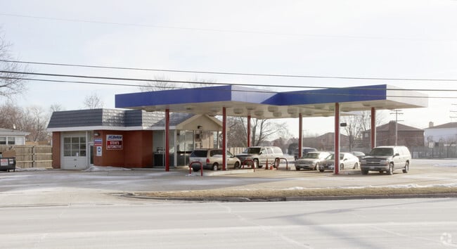

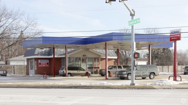
Property Detail
720 E Central Rd
Chicago-Naperville-Elgin, IL-IN
(UNIT1) OF JOSEPH H (ANDERSONS) (CRAIG) MANOR SUB OF PT OF SW SW SEC 36-42-11
03-36-304-008-0000
Cook
Parkingstructure
Illinois
B and X Area of moderate flood hazard, usually the area between the limits of the 100-year and 500-year floods.
8
2023
0.64 AC
2025
O'Hare
802702
Chicago
1,338 SF
NEARBY LISTINGS FOR SALE OR LEASE
DEMOGRAPHICS near 720 E Central Rd
1 mile
3 mile
5 mile
2025 Total Population
9,802
133,490
338,711
2030 Population
9,812
134,827
341,251
Pop Growth 2025-2030
+ 0.10%
+ 1.00%
+ 0.75%
Average Age
45
43
43
2025 Total Households
3,606
51,796
129,278
HH Growth 2025-2030
(0.08%)
+ 0.83%
+ 0.59%
Median Household Inc
$110,710
$92,374
$98,776
Avg Household Size
2.60
2.50
2.50
2025 Avg HH Vehicles
2.00
2.00
2.00
Median Home Value
$396,659
$348,386
$378,559
Median Year Built
1966
1970
1970
Nearby Places
Map Layers
Map Styles
 Street
 Aerial
Transit
 Traffic
 Biking
Places
Listings with unknown addresses are not visible on the map
- Restaurants
- Banks
- Shops
- Fitness
- Groceries
PUBLIC TRANSPORTATION
COMMUTER RAIL
Cumberland Station (Union Pacific Northwest Line - Northeast Illinois Regional Commuter Railroad (Metra))
Drive
Walk
Distance
Cumberland Station (Union Pacific Northwest Line - Northeast Illinois Regional Commuter Railroad (Metra))
5 min
1.6 mi
Prospect Heights Station (North Central Service - Northeast Illinois Regional Commuter Railroad (Metra))
Drive
Walk
Distance
Prospect Heights Station (North Central Service - Northeast Illinois Regional Commuter Railroad (Metra))
4 min
1.9 mi
AIRPORT
Chicago O'Hare International
Drive
Walk
Distance
Chicago O'Hare International
36 min
13.0 mi
Chicago Midway International
Drive
Walk
Distance
Chicago Midway International
48 min
25.9 mi
Nearby Properties
Address
Land Use
TOTAL SIZE
Lot Size
Zoning
Address
Land Use
TOTAL SIZE
Lot Size
Zoning
6.53 AC
Address
Land Use
TOTAL SIZE
Lot Size
Zoning
22.72 AC
Address
Land Use
TOTAL SIZE
Lot Size
Zoning
20.79 AC
Address
Land Use
TOTAL SIZE
Lot Size
Zoning
206,160 SF
9.44 AC
Address
Land Use
TOTAL SIZE
Lot Size
Zoning
Address
Land Use
TOTAL SIZE
Lot Size
Zoning
690,195 SF
39.48 AC
Address
Land Use
TOTAL SIZE
Lot Size
Zoning
611,799 SF
17.61 AC
Address
Land Use
TOTAL SIZE
Lot Size
Zoning
234,337 SF
23.59 AC
Address
Land Use
TOTAL SIZE
Lot Size
Zoning
449,568 SF
22.73 AC
Address
Land Use
TOTAL SIZE
Lot Size
Zoning
508,246 SF
32.81 AC
Address
Land Use
TOTAL SIZE
Lot Size
Zoning
642,049 SF
33.14 AC
Address
Land Use
TOTAL SIZE
Lot Size
Zoning
405,484 SF
Address
Land Use
TOTAL SIZE
Lot Size
Zoning
85,014 SF
2.38 AC
Address
Land Use
TOTAL SIZE
Lot Size
Zoning
Address
Land Use
TOTAL SIZE
Lot Size
Zoning
667,821 SF
20.55 AC
Address
Land Use
TOTAL SIZE
Lot Size
Zoning
146,650 SF
8.98 AC
Address
Land Use
TOTAL SIZE
Lot Size
Zoning
262,533 SF
32.21 AC
Address
Land Use
TOTAL SIZE
Lot Size
Zoning
489,538 SF
5.94 AC
Address
Land Use
TOTAL SIZE
Lot Size
Zoning
73,815 SF
4.35 AC
Address
Land Use
TOTAL SIZE
Lot Size
Zoning
10,404 SF
45.11 AC
Address
Land Use
TOTAL SIZE
Lot Size
Zoning
Address
Land Use
TOTAL SIZE
Lot Size
Zoning
91,505 SF
4.86 AC
Address
Land Use
TOTAL SIZE
Lot Size
Zoning
72,916 SF
5.69 AC
Address
Land Use
TOTAL SIZE
Lot Size
Zoning
65,401 SF
5.05 AC
Address
Land Use
TOTAL SIZE
Lot Size
Zoning
186,173 SF
5.86 AC
Address
Land Use
TOTAL SIZE
Lot Size
Zoning
143,002 SF
14.58 AC
Address
Land Use
TOTAL SIZE
Lot Size
Zoning
312,281 SF
11.66 AC
Address
Land Use
TOTAL SIZE
Lot Size
Zoning
197,191 SF
7.20 AC
Address
Land Use
TOTAL SIZE
Lot Size
Zoning
274,289 SF
1.56 AC
Address
Land Use
TOTAL SIZE
Lot Size
Zoning
31.61 AC
The World's #1 Commercial Real Estate Marketplace
Connect with us
© 2026 CoStar Group
The information above has been obtained from sources believed reliable. While we do not doubt its accuracy we have not verified it and make no guarantee, warranty or representation about it. It is your responsibility to independently confirm its accuracy and completeness. Any projections, opinions, assumptions, or estimates used are for example only and do not represent the current or future performance of the property. The value of this transaction to you depends on tax and other factors which should be evaluated by your tax, financial, and legal advisors. You and your advisors should conduct a careful, independent investigation of the property to determine to your satisfaction the suitability of the property for your needs.