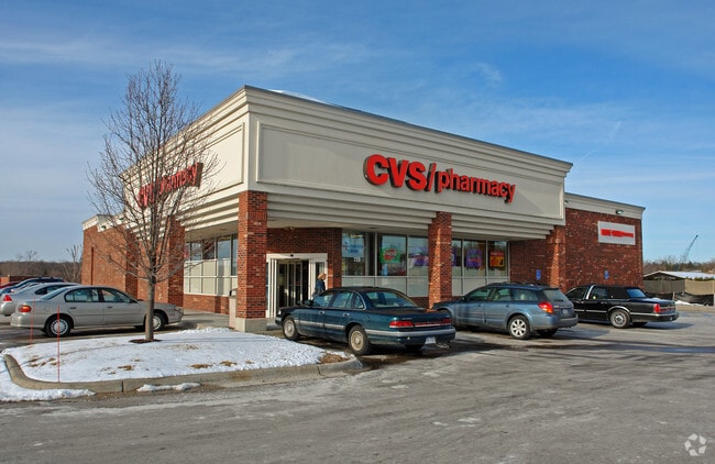
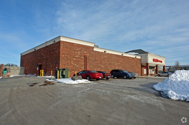
Property Record
720 General Motors Rd, Milford, MI 48381

NEARBY LISTINGS FOR SALE OR LEASE
Property Detail
720 General Motors Rd
16-10-301-009
T2N, R7E, SEC 10 PART OF S 1/2 OF SEC BEG AT PT DIST N 86-20-52 E 42.72 FT & N 62-46-22 E 1388.47 FT & N 64-59-22 E 1239.26
Wholesaleoutletdiscountstore
Oakland
X
Michigan
26125C0453F
1.69 AC
2024
Central I-96 Corridor
2025
Detroit
132700
Detroit-Warren-Dearborn, MI
10,856 SF
DEMOGRAPHICS near 720 General Motors Rd
1 Mile
3 Mile
5 Mile
2024 Total Population
4,457
15,653
41,111
2029 Population
4,416
15,494
40,869
Pop Growth 2024-2029
(0.92%)
(1.02%)
(0.59%)
Average Age
44
44
42
2024 Total Households
1,863
6,200
15,450
HH Growth 2024-2029
(0.97%)
(1.05%)
(0.67%)
Median Household Inc
$103,094
$109,433
$109,991
Avg Household Size
2.30
2.50
2.60
2024 Avg HH Vehicles
2.00
2.00
2.00
Median Home Value
$364,446
$388,596
$366,937
Median Year Built
1983
1985
1991
Nearby Places
Map Layers
Map Styles
 Street
 Aerial
- Restaurants
- Banks
- Shops
- Fitness
- Groceries
PUBLIC TRANSPORTATION
AIRPORT
Bishop International
DRIVE
WALK
Distance
Bishop International
55 min
36.9 mi
Detroit Metro Wayne County
DRIVE
WALK
Distance
Detroit Metro Wayne County
47 min
39.2 mi
Freight Ports
Port of Toledo
DRIVE
WALK
Distance
Port of Toledo
97 min
80.8 mi
Nearby Properties
Address
Land Use
TOTAL SIZE
Lot Size
Zoning
Address
Land Use
TOTAL SIZE
Lot Size
Zoning
1,569,676 SF
499.90 AC
II
Address
Land Use
TOTAL SIZE
Lot Size
Zoning
117,504 SF
12.57 AC
BI
Address
Land Use
TOTAL SIZE
Lot Size
Zoning
89,974 SF
Address
Land Use
TOTAL SIZE
Lot Size
Zoning
1,569,676 SF
Address
Land Use
TOTAL SIZE
Lot Size
Zoning
70,308 SF
2.43 AC
Address
Land Use
TOTAL SIZE
Lot Size
Zoning
77,287 SF
1.62 AC
Address
Land Use
TOTAL SIZE
Lot Size
Zoning
70,463 SF
7.98 AC
AI
Address
Land Use
TOTAL SIZE
Lot Size
Zoning
38,453 SF
5.05 AC
Address
Land Use
TOTAL SIZE
Lot Size
Zoning
55,844 SF
5.90 AC
AI
Address
Land Use
TOTAL SIZE
Lot Size
Zoning
72,727 SF
10.51 AC
Address
Land Use
TOTAL SIZE
Lot Size
Zoning
603.37 AC
FC
Address
Land Use
TOTAL SIZE
Lot Size
Zoning
71,793 SF
5.06 AC
II
Address
Land Use
TOTAL SIZE
Lot Size
Zoning
26,054 SF
7.90 AC
AV
Address
Land Use
TOTAL SIZE
Lot Size
Zoning
19,596 SF
3.78 AC
Address
Land Use
TOTAL SIZE
Lot Size
Zoning
25,641 SF
4.89 AC
AI
Address
Land Use
TOTAL SIZE
Lot Size
Zoning
22,609 SF
5.06 AC
BI
Address
Land Use
TOTAL SIZE
Lot Size
Zoning
14,689 SF
2.05 AC
BI
Address
Land Use
TOTAL SIZE
Lot Size
Zoning
67,936 SF
9.68 AC
BI
Address
Land Use
TOTAL SIZE
Lot Size
Zoning
41,748 SF
2.20 AC
AI
Address
Land Use
TOTAL SIZE
Lot Size
Zoning
31,676 SF
3.59 AC
BI
Address
Land Use
TOTAL SIZE
Lot Size
Zoning
45,600 SF
3.44 AC
BI
Address
Land Use
TOTAL SIZE
Lot Size
Zoning
12,544 SF
0.18 AC
Address
Land Use
TOTAL SIZE
Lot Size
Zoning
27,854 SF
2.08 AC
AI
Address
Land Use
TOTAL SIZE
Lot Size
Zoning
22,605 SF
3.79 AC
BI
Address
Land Use
TOTAL SIZE
Lot Size
Zoning
5,471 SF
1.65 AC
BI
Address
Land Use
TOTAL SIZE
Lot Size
Zoning
9,891 SF
1.13 AC
BI
Address
Land Use
TOTAL SIZE
Lot Size
Zoning
13,470 SF
0.85 AC
BI
Address
Land Use
TOTAL SIZE
Lot Size
Zoning
9,959 SF
1.88 AC
BI
Address
Land Use
TOTAL SIZE
Lot Size
Zoning
44,893 SF
22.58 AC
MM
The World's #1 Commercial Real Estate Marketplace
Connect with us
© 2026 CoStar Group
The information above has been obtained from sources believed reliable. While we do not doubt its accuracy we have not verified it and make no guarantee, warranty or representation about it. It is your responsibility to independently confirm its accuracy and completeness. Any projections, opinions, assumptions, or estimates used are for example only and do not represent the current or future performance of the property. The value of this transaction to you depends on tax and other factors which should be evaluated by your tax, financial, and legal advisors. You and your advisors should conduct a careful, independent investigation of the property to determine to your satisfaction the suitability of the property for your needs.