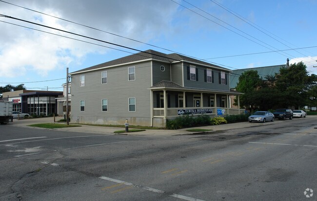
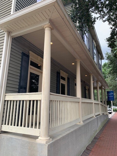
Property Record
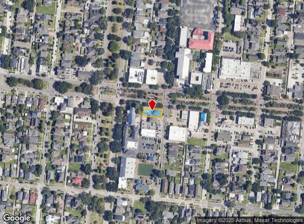
720 Harrison Ave, New Orleans, LA 70124
NEARBY LISTINGS FOR SALE OR LEASE
Property Detail
720 Harrison Ave
New Orleans-Metairie, LA
SQ 271 LOTS 45 46 HARRISON AND 6272 VICKSBURG ST 55X122
2-06-4-006-12
Orleans
Officebuilding
Louisiana
AE
45
22051C0140F
0.15 AC
2025
Lakeview
2025
New Orleans/Metairie/Kenner
005604
DEMOGRAPHICS near 720 Harrison Ave
1 Mile
3 Mile
5 Mile
2024 Total Population
12,636
112,126
293,535
2029 Population
11,915
107,140
282,943
Pop Growth 2024-2029
(5.71%)
(4.45%)
(3.61%)
Average Age
38
42
41
2024 Total Households
4,968
49,831
132,673
HH Growth 2024-2029
(5.88%)
(4.63%)
(3.59%)
Median Household Inc
$112,361
$59,311
$53,038
Avg Household Size
2.50
2.10
2.10
2024 Avg HH Vehicles
2.00
1.00
1.00
Median Home Value
$480,787
$359,285
$325,722
Median Year Built
1970
1959
1957
Nearby Places
Map Layers
Map Styles
 Street
 Aerial
- Restaurants
- Banks
- Shops
- Fitness
- Groceries
PUBLIC TRANSPORTATION
COMMUTER RAIL
DRIVE
WALK
Distance
11 min
6.1 mi
AIRPORT
Louis Armstrong New Orleans International
DRIVE
WALK
Distance
Louis Armstrong New Orleans International
17 min
11.4 mi
SALE & LEASE HISTORY
LISTING DATE
SALE/LEASE

May 17, 2022
For Lease
Jul 01, 2025
For Lease
Nearby Properties
Address
Land Use
TOTAL SIZE
Lot Size
Zoning
Address
Land Use
TOTAL SIZE
Lot Size
Zoning
725,677 SF
54.19 AC
EC
Address
Land Use
TOTAL SIZE
Lot Size
Zoning
225,284 SF
16.83 AC
S-RD
Address
Land Use
TOTAL SIZE
Lot Size
Zoning
4.31 AC
BC2
Address
Land Use
TOTAL SIZE
Lot Size
Zoning
224,374 SF
92.67 AC
HU-RD1
Address
Land Use
TOTAL SIZE
Lot Size
Zoning
7.56 AC
S-LRS1
Address
Land Use
TOTAL SIZE
Lot Size
Zoning
2.20 AC
EC
Address
Land Use
TOTAL SIZE
Lot Size
Zoning
63.72 AC
OS-N
Address
Land Use
TOTAL SIZE
Lot Size
Zoning
14.83 AC
EC
Address
Land Use
TOTAL SIZE
Lot Size
Zoning
173,008 SF
4.03 AC
S-RS
Address
Land Use
TOTAL SIZE
Lot Size
Zoning
Address
Land Use
TOTAL SIZE
Lot Size
Zoning
20.49 AC
S-RS
Address
Land Use
TOTAL SIZE
Lot Size
Zoning
Address
Land Use
TOTAL SIZE
Lot Size
Zoning
Address
Land Use
TOTAL SIZE
Lot Size
Zoning
Address
Land Use
TOTAL SIZE
Lot Size
Zoning
98,642 SF
7.30 AC
HU-RS
Address
Land Use
TOTAL SIZE
Lot Size
Zoning
1.14 AC
S-B2
Address
Land Use
TOTAL SIZE
Lot Size
Zoning
108,104 SF
8.98 AC
S-LRS1
Address
Land Use
TOTAL SIZE
Lot Size
Zoning
39,963 SF
110.36 AC
OS-N
Address
Land Use
TOTAL SIZE
Lot Size
Zoning
4.90 AC
R2
Address
Land Use
TOTAL SIZE
Lot Size
Zoning
13,496 SF
3.01 AC
HU-RD2
Address
Land Use
TOTAL SIZE
Lot Size
Zoning
2.27 AC
HU-RD2
Address
Land Use
TOTAL SIZE
Lot Size
Zoning
7.32 AC
S-RS
Address
Land Use
TOTAL SIZE
Lot Size
Zoning
93,152 SF
2.21 AC
HU-RD2
Address
Land Use
TOTAL SIZE
Lot Size
Zoning
114,454 SF
3.05 AC
MU-1
Address
Land Use
TOTAL SIZE
Lot Size
Zoning
0.12 AC
Address
Land Use
TOTAL SIZE
Lot Size
Zoning
92,133 SF
1.89 AC
EC
Address
Land Use
TOTAL SIZE
Lot Size
Zoning
372,300 SF
2.03 AC
LI
Address
Land Use
TOTAL SIZE
Lot Size
Zoning
3.64 AC
HU-RD2
Address
Land Use
TOTAL SIZE
Lot Size
Zoning
95,728 SF
5.01 AC
S-RS
The World's #1 Commercial Real Estate Marketplace
Connect with us
© 2025 CoStar Group
The information above has been obtained from sources believed reliable. While we do not doubt its accuracy we have not verified it and make no guarantee, warranty or representation about it. It is your responsibility to independently confirm its accuracy and completeness. Any projections, opinions, assumptions, or estimates used are for example only and do not represent the current or future performance of the property. The value of this transaction to you depends on tax and other factors which should be evaluated by your tax, financial, and legal advisors. You and your advisors should conduct a careful, independent investigation of the property to determine to your satisfaction the suitability of the property for your needs.