Property Record
720 N Main St, Lawton, MI 49065


NEARBY LISTINGS FOR SALE OR LEASE
-
-
View all Lawton listings for sale on LoopNet.com
Property Detail
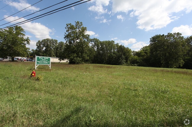
720 N Main St
West Michigan
Bakers Add
80-45-700-050-10
962-A 29-3-13 855-966,967 557-634 1300-337 1324-228 1428-497 1453-419 1729-527 *** COM AT W 1/4 POST OF SEC, TH N 89 DEG
Commercialacreage
Van Buren
X
Michigan
26077C0275D
2-3,25
2024
14.65 AC
2025
Van Buren County
011004
DEMOGRAPHICS near 720 N Main St
1 mile
3 mile
5 mile
2024 Total Population
2,211
5,594
16,896
2029 Population
2,162
5,496
16,628
Pop Growth 2024-2029
(2.22%)
(1.75%)
(1.59%)
Average Age
40
41
40
2024 Total Households
818
2,071
6,502
HH Growth 2024-2029
(2.57%)
(2.03%)
(1.83%)
Median Household Inc
$63,158
$74,105
$75,446
Avg Household Size
2.60
2.60
2.50
2024 Avg HH Vehicles
2.00
2.00
2.00
Median Home Value
$167,597
$203,923
$191,179
Median Year Built
1979
1982
1979
Nearby Places
Map Layers
Map Styles
 Street
 Aerial
Transit
 Traffic
 Biking
Places
Listings with unknown addresses are not visible on the map
- Restaurants
- Banks
- Shops
- Fitness
- Groceries
PUBLIC TRANSPORTATION
AIRPORT
Kalamazoo/Battle Creek International
Drive
Walk
Distance
Kalamazoo/Battle Creek International
31 min
22.5 mi
Freight Ports
Port Milwaukee
Drive
Walk
Distance
Port Milwaukee
255 min
215.5 mi
Nearby Properties
Address
Land Use
TOTAL SIZE
Lot Size
Zoning
Address
Land Use
TOTAL SIZE
Lot Size
Zoning
119,245 SF
19.53 AC
VILLAGE
Address
Land Use
TOTAL SIZE
Lot Size
Zoning
320,181 SF
6 AC
CALL VILLA
Address
Land Use
TOTAL SIZE
Lot Size
Zoning
194,742 SF
38.50 AC
IND
Address
Land Use
TOTAL SIZE
Lot Size
Zoning
46,885 SF
4 AC
CALL VILLA
Address
Land Use
TOTAL SIZE
Lot Size
Zoning
151,938 SF
30.15 AC
COMM
Address
Land Use
TOTAL SIZE
Lot Size
Zoning
7,552 SF
4.20 AC
AG
Address
Land Use
TOTAL SIZE
Lot Size
Zoning
45,124 SF
Address
Land Use
TOTAL SIZE
Lot Size
Zoning
4,056 SF
81 AC
AG
Address
Land Use
TOTAL SIZE
Lot Size
Zoning
32.71 AC
VILLAGE
Address
Land Use
TOTAL SIZE
Lot Size
Zoning
27,456 SF
5.09 AC
VILLAGE
Address
Land Use
TOTAL SIZE
Lot Size
Zoning
3,205 SF
56.80 AC
AG
Address
Land Use
TOTAL SIZE
Lot Size
Zoning
18.01 AC
VILLAGE
Address
Land Use
TOTAL SIZE
Lot Size
Zoning
2,526 SF
57.72 AC
AG
Address
Land Use
TOTAL SIZE
Lot Size
Zoning
2,945 SF
27.86 AC
AG
Address
Land Use
TOTAL SIZE
Lot Size
Zoning
4,771 SF
40 AC
AG
Address
Land Use
TOTAL SIZE
Lot Size
Zoning
135.20 AC
AG
Address
Land Use
TOTAL SIZE
Lot Size
Zoning
4,692 SF
20.20 AC
AG
Address
Land Use
TOTAL SIZE
Lot Size
Zoning
5,868 SF
2.77 AC
VILLAGE
Address
Land Use
TOTAL SIZE
Lot Size
Zoning
3,938 SF
25.70 AC
AG
Address
Land Use
TOTAL SIZE
Lot Size
Zoning
3,188 SF
1 AC
AG
Address
Land Use
TOTAL SIZE
Lot Size
Zoning
18.99 AC
VILLAGE
Address
Land Use
TOTAL SIZE
Lot Size
Zoning
3,596 SF
10.97 AC
AG
Address
Land Use
TOTAL SIZE
Lot Size
Zoning
2,194 SF
16.86 AC
AG
Address
Land Use
TOTAL SIZE
Lot Size
Zoning
1,386 SF
118.60 AC
AG
Address
Land Use
TOTAL SIZE
Lot Size
Zoning
89,316 SF
39.60 AC
CALL VILLA
Address
Land Use
TOTAL SIZE
Lot Size
Zoning
2,829 SF
9.80 AC
ARR
Address
Land Use
TOTAL SIZE
Lot Size
Zoning
2,928 SF
29 AC
AG
Address
Land Use
TOTAL SIZE
Lot Size
Zoning
26,676 SF
4.74 AC
VILLAGE
Address
Land Use
TOTAL SIZE
Lot Size
Zoning
4,990 SF
11.30 AC
R2
Address
Land Use
TOTAL SIZE
Lot Size
Zoning
3,378 SF
1 AC
AG
The World's #1 Commercial Real Estate Marketplace
Connect with us
© 2026 CoStar Group
The information above has been obtained from sources believed reliable. While we do not doubt its accuracy we have not verified it and make no guarantee, warranty or representation about it. It is your responsibility to independently confirm its accuracy and completeness. Any projections, opinions, assumptions, or estimates used are for example only and do not represent the current or future performance of the property. The value of this transaction to you depends on tax and other factors which should be evaluated by your tax, financial, and legal advisors. You and your advisors should conduct a careful, independent investigation of the property to determine to your satisfaction the suitability of the property for your needs.