Property Record
720 Nw Walnut St, Grain Valley, MO 64029
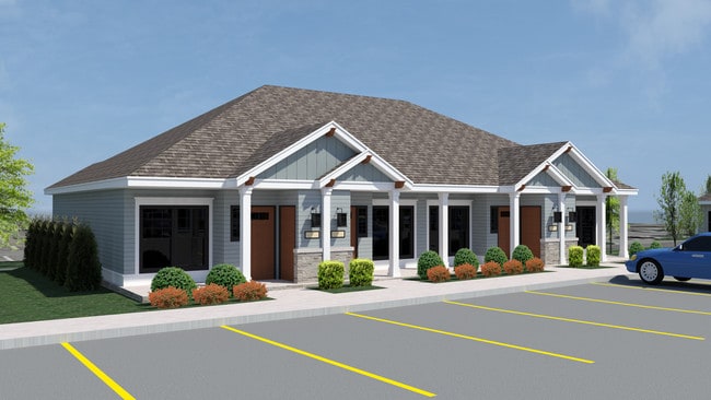


Property Detail
720 Nw Walnut St
Kansas City, MO-KS
HARMONY MEADOWS---TRACT B
37-910-05-20-00-0-00-000
JACKSON
Recreationalacreage
Missouri
B and X Area of moderate flood hazard, usually the area between the limits of the 100-year and 500-year floods.
4.22 AC
2024
Outer Jackson County
2025
Kansas City
014008
NEARBY LISTINGS FOR SALE OR LEASE
-
-
View all Grain Valley listings for sale on LoopNet.com
DEMOGRAPHICS near 720 Nw Walnut St
1 mile
3 mile
5 mile
2025 Total Population
6,764
26,942
75,418
2030 Population
6,909
27,281
76,056
Pop Growth 2025-2030
+ 2.14%
+ 1.26%
+ 0.85%
Average Age
36
38
39
2025 Total Households
2,600
9,770
27,731
HH Growth 2025-2030
+ 2.04%
+ 1.23%
+ 0.84%
Median Household Inc
$75,139
$91,813
$87,340
Avg Household Size
2.60
2.70
2.70
2025 Avg HH Vehicles
2.00
2.00
2.00
Median Home Value
$235,359
$289,038
$272,222
Median Year Built
2000
1998
1989
Nearby Places
Map Layers
Map Styles
 Street
 Aerial
Layers
 Traffic
 Biking
Places
Listings with unknown addresses are not visible on the map
- Restaurants
- Banks
- Shops
- Fitness
- Groceries
PUBLIC TRANSPORTATION
AIRPORT
Kansas City International
Drive
Walk
Distance
Kansas City International
56 min
43.2 mi
SALE & LEASE HISTORY
LISTING DATE
SALE/LEASE

Mar 27, 2019
For Sale
Nearby Properties
Address
Land Use
TOTAL SIZE
Lot Size
Zoning
Address
Land Use
TOTAL SIZE
Lot Size
Zoning
292,760 SF
32.17 AC
Address
Land Use
TOTAL SIZE
Lot Size
Zoning
584,820 SF
38 AC
Address
Land Use
TOTAL SIZE
Lot Size
Zoning
255,288 SF
25.67 AC
Address
Land Use
TOTAL SIZE
Lot Size
Zoning
321,331 SF
55.69 AC
Address
Land Use
TOTAL SIZE
Lot Size
Zoning
214,518 SF
22.16 AC
Address
Land Use
TOTAL SIZE
Lot Size
Zoning
430,717 SF
69.75 AC
Address
Land Use
TOTAL SIZE
Lot Size
Zoning
74,031 SF
0.02 AC
Address
Land Use
TOTAL SIZE
Lot Size
Zoning
98,523 SF
9.48 AC
Address
Land Use
TOTAL SIZE
Lot Size
Zoning
42,176 SF
22.04 AC
Address
Land Use
TOTAL SIZE
Lot Size
Zoning
93,336 SF
11.67 AC
Address
Land Use
TOTAL SIZE
Lot Size
Zoning
89,766 SF
16.50 AC
Address
Land Use
TOTAL SIZE
Lot Size
Zoning
80,458 SF
0.40 AC
Address
Land Use
TOTAL SIZE
Lot Size
Zoning
82,602 SF
8.80 AC
Address
Land Use
TOTAL SIZE
Lot Size
Zoning
58,390 SF
10.10 AC
Address
Land Use
TOTAL SIZE
Lot Size
Zoning
98,600 SF
4.50 AC
Address
Land Use
TOTAL SIZE
Lot Size
Zoning
130,178 SF
10.25 AC
Address
Land Use
TOTAL SIZE
Lot Size
Zoning
67,986 SF
9.88 AC
Address
Land Use
TOTAL SIZE
Lot Size
Zoning
36,000 SF
5.22 AC
Address
Land Use
TOTAL SIZE
Lot Size
Zoning
110,829 SF
20.78 AC
Address
Land Use
TOTAL SIZE
Lot Size
Zoning
53,384 SF
6.24 AC
Address
Land Use
TOTAL SIZE
Lot Size
Zoning
59,584 SF
4.44 AC
Address
Land Use
TOTAL SIZE
Lot Size
Zoning
95,342 SF
11.02 AC
Address
Land Use
TOTAL SIZE
Lot Size
Zoning
137,347 SF
9.43 AC
Address
Land Use
TOTAL SIZE
Lot Size
Zoning
26,869 SF
3.08 AC
Address
Land Use
TOTAL SIZE
Lot Size
Zoning
70,158 SF
4.74 AC
Address
Land Use
TOTAL SIZE
Lot Size
Zoning
18,400 SF
18.42 AC
Address
Land Use
TOTAL SIZE
Lot Size
Zoning
1,154 SF
160 AC
Address
Land Use
TOTAL SIZE
Lot Size
Zoning
27,585 SF
3.94 AC
Address
Land Use
TOTAL SIZE
Lot Size
Zoning
20,396 SF
9.41 AC
Address
Land Use
TOTAL SIZE
Lot Size
Zoning
166,923 SF
87 AC
The World's #1 Commercial Real Estate Marketplace
Connect with us
© 2026 CoStar Group
The information above has been obtained from sources believed reliable. While we do not doubt its accuracy we have not verified it and make no guarantee, warranty or representation about it. It is your responsibility to independently confirm its accuracy and completeness. Any projections, opinions, assumptions, or estimates used are for example only and do not represent the current or future performance of the property. The value of this transaction to you depends on tax and other factors which should be evaluated by your tax, financial, and legal advisors. You and your advisors should conduct a careful, independent investigation of the property to determine to your satisfaction the suitability of the property for your needs.