Property Record
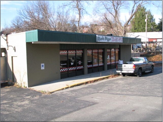
720 Robbins Station Rd, Irwin, PA 15642


NEARBY LISTINGS FOR SALE OR LEASE
Property Detail
720 Robbins Station Rd
54-06-16-0-282
BLDG 147 X 96.95 X IR
Commercialofficeresidentialmixeduse
Westmoreland
X
Pennsylvania
42129C0378F
0.33 AC
2025
Westmoreland County
2025
Pittsburgh
803302
Pittsburgh, PA
2,166 SF
DEMOGRAPHICS near 720 Robbins Station Rd
1 Mile
3 Mile
5 Mile
2024 Total Population
6,659
34,070
77,569
2029 Population
6,561
33,771
76,491
Pop Growth 2024-2029
(1.47%)
(0.88%)
(1.39%)
Average Age
44
44
45
2024 Total Households
2,682
14,601
33,516
HH Growth 2024-2029
(1.45%)
(0.76%)
(1.40%)
Median Household Inc
$95,264
$77,402
$72,676
Avg Household Size
2.40
2.30
2.30
2024 Avg HH Vehicles
2.00
2.00
2.00
Median Home Value
$218,416
$194,847
$179,704
Median Year Built
1967
1966
1963
Nearby Places
Map Layers
Map Styles
 Street
 Aerial
- Restaurants
- Banks
- Shops
- Fitness
- Groceries
PUBLIC TRANSPORTATION
AIRPORT
Arnold Palmer Regional
DRIVE
WALK
Distance
Arnold Palmer Regional
39 min
21.0 mi
Pittsburgh International
DRIVE
WALK
Distance
Pittsburgh International
58 min
35.8 mi
Nearby Properties
Address
Land Use
TOTAL SIZE
Lot Size
Zoning
Address
Land Use
TOTAL SIZE
Lot Size
Zoning
47.90 AC
Address
Land Use
TOTAL SIZE
Lot Size
Zoning
13.93 AC
Address
Land Use
TOTAL SIZE
Lot Size
Zoning
803.63 AC
Address
Land Use
TOTAL SIZE
Lot Size
Zoning
12,794 SF
22.60 AC
Address
Land Use
TOTAL SIZE
Lot Size
Zoning
49.80 AC
Address
Land Use
TOTAL SIZE
Lot Size
Zoning
13.80 AC
Address
Land Use
TOTAL SIZE
Lot Size
Zoning
124,512 SF
4.27 AC
Address
Land Use
TOTAL SIZE
Lot Size
Zoning
8.43 AC
Address
Land Use
TOTAL SIZE
Lot Size
Zoning
40,117 SF
3.90 AC
Address
Land Use
TOTAL SIZE
Lot Size
Zoning
0.96 AC
Address
Land Use
TOTAL SIZE
Lot Size
Zoning
Address
Land Use
TOTAL SIZE
Lot Size
Zoning
7.30 AC
Address
Land Use
TOTAL SIZE
Lot Size
Zoning
74,485 SF
5.72 AC
Address
Land Use
TOTAL SIZE
Lot Size
Zoning
3,306 SF
22.10 AC
Address
Land Use
TOTAL SIZE
Lot Size
Zoning
Address
Land Use
TOTAL SIZE
Lot Size
Zoning
Address
Land Use
TOTAL SIZE
Lot Size
Zoning
Address
Land Use
TOTAL SIZE
Lot Size
Zoning
1.03 AC
Address
Land Use
TOTAL SIZE
Lot Size
Zoning
7.22 AC
Address
Land Use
TOTAL SIZE
Lot Size
Zoning
15.83 AC
Address
Land Use
TOTAL SIZE
Lot Size
Zoning
26.79 AC
Address
Land Use
TOTAL SIZE
Lot Size
Zoning
56.84 AC
Address
Land Use
TOTAL SIZE
Lot Size
Zoning
15.80 AC
Address
Land Use
TOTAL SIZE
Lot Size
Zoning
37,285 SF
2.38 AC
Address
Land Use
TOTAL SIZE
Lot Size
Zoning
38,828 SF
4.90 AC
Address
Land Use
TOTAL SIZE
Lot Size
Zoning
3.79 AC
Address
Land Use
TOTAL SIZE
Lot Size
Zoning
52,259 SF
31.50 AC
Address
Land Use
TOTAL SIZE
Lot Size
Zoning
6 AC
Address
Land Use
TOTAL SIZE
Lot Size
Zoning
4.30 AC
Address
Land Use
TOTAL SIZE
Lot Size
Zoning
28,774 SF
3.34 AC
The World's #1 Commercial Real Estate Marketplace
Connect with us
© 2026 CoStar Group
The information above has been obtained from sources believed reliable. While we do not doubt its accuracy we have not verified it and make no guarantee, warranty or representation about it. It is your responsibility to independently confirm its accuracy and completeness. Any projections, opinions, assumptions, or estimates used are for example only and do not represent the current or future performance of the property. The value of this transaction to you depends on tax and other factors which should be evaluated by your tax, financial, and legal advisors. You and your advisors should conduct a careful, independent investigation of the property to determine to your satisfaction the suitability of the property for your needs.