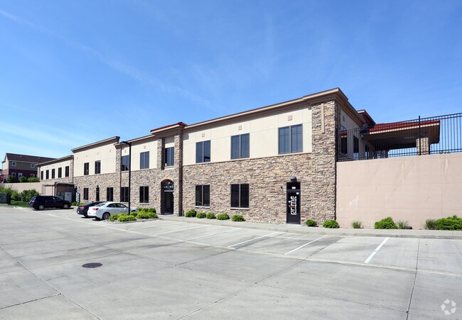
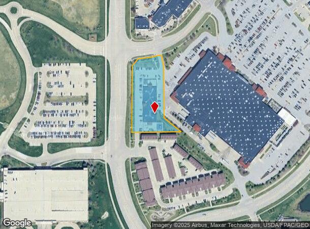
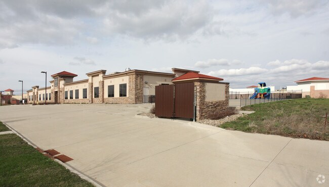
Property Record
720 S 68Th St, West Des Moines, IA 50266
NEARBY LISTINGS FOR SALE OR LEASE
Property Detail
720 S 68Th St
Des Moines-West Des Moines, IA
Galleria At Jordan Creek Plat 5
16-13-402-017
GALLERIA AT JORDAN CREEK PLAT 5 LOT 8 & 9
Daycare
Dallas
X
Iowa
19049C0366G
8,9
2023
1.87 AC
2024
Western Suburbs
050816
Des Moines
10,070 SF
DEMOGRAPHICS near 720 S 68Th St
1 Mile
3 Mile
5 Mile
2024 Total Population
6,320
49,185
111,464
2029 Population
7,433
55,339
125,161
Pop Growth 2024-2029
+ 17.61%
+ 12.51%
+ 12.29%
Average Age
38
38
38
2024 Total Households
3,195
21,533
46,405
HH Growth 2024-2029
+ 18.90%
+ 13.19%
+ 12.53%
Median Household Inc
$77,455
$77,368
$83,250
Avg Household Size
2.00
2.30
2.40
2024 Avg HH Vehicles
2.00
2.00
2.00
Median Home Value
$379,354
$292,446
$285,613
Median Year Built
2010
1998
1997
Nearby Places
Map Layers
Map Styles
 Street
 Aerial
- Restaurants
- Banks
- Shops
- Fitness
- Groceries
PUBLIC TRANSPORTATION
AIRPORT
Des Moines International
DRIVE
WALK
Distance
Des Moines International
21 min
9.8 mi
Freight Ports
Port Milwaukee
DRIVE
WALK
Distance
Port Milwaukee
429 min
385.7 mi
SALE & LEASE HISTORY
LISTING DATE
SALE/LEASE

Oct 16, 2023
For Lease
Jul 29, 2022
For Lease
Aug 06, 2019
For Lease
Nearby Properties
Address
Land Use
TOTAL SIZE
Lot Size
Zoning
Address
Land Use
TOTAL SIZE
Lot Size
Zoning
33,479 SF
41.80 AC
Address
Land Use
TOTAL SIZE
Lot Size
Zoning
756,649 SF
67.99 AC
Address
Land Use
TOTAL SIZE
Lot Size
Zoning
31,075 SF
157.44 AC
Address
Land Use
TOTAL SIZE
Lot Size
Zoning
472,476 SF
12.48 AC
PUD OFFICE
Address
Land Use
TOTAL SIZE
Lot Size
Zoning
18,093 SF
38.92 AC
Address
Land Use
TOTAL SIZE
Lot Size
Zoning
73,854 SF
54.86 AC
Address
Land Use
TOTAL SIZE
Lot Size
Zoning
52,016 SF
46.87 AC
Address
Land Use
TOTAL SIZE
Lot Size
Zoning
6,178 SF
39.89 AC
Address
Land Use
TOTAL SIZE
Lot Size
Zoning
18,951 SF
29.34 AC
Address
Land Use
TOTAL SIZE
Lot Size
Zoning
422,683 SF
46.57 AC
PCP
Address
Land Use
TOTAL SIZE
Lot Size
Zoning
189,660 SF
19.84 AC
Address
Land Use
TOTAL SIZE
Lot Size
Zoning
231,695 SF
4.29 AC
Address
Land Use
TOTAL SIZE
Lot Size
Zoning
275,227 SF
18.31 AC
PCP
Address
Land Use
TOTAL SIZE
Lot Size
Zoning
38,400 SF
13.12 AC
Address
Land Use
TOTAL SIZE
Lot Size
Zoning
269,353 SF
36.28 AC
Address
Land Use
TOTAL SIZE
Lot Size
Zoning
387,456 SF
15.72 AC
PUD HD
Address
Land Use
TOTAL SIZE
Lot Size
Zoning
39,229 SF
22.75 AC
Address
Land Use
TOTAL SIZE
Lot Size
Zoning
46,250 SF
27.02 AC
Address
Land Use
TOTAL SIZE
Lot Size
Zoning
22,093 SF
12.26 AC
Address
Land Use
TOTAL SIZE
Lot Size
Zoning
172,627 SF
8.30 AC
Address
Land Use
TOTAL SIZE
Lot Size
Zoning
182,866 SF
10.21 AC
Address
Land Use
TOTAL SIZE
Lot Size
Zoning
5,635 SF
15.06 AC
Address
Land Use
TOTAL SIZE
Lot Size
Zoning
243,217 SF
16.31 AC
PUD HD
Address
Land Use
TOTAL SIZE
Lot Size
Zoning
189,691 SF
27.03 AC
PCP
Address
Land Use
TOTAL SIZE
Lot Size
Zoning
2,168 SF
15.68 AC
Address
Land Use
TOTAL SIZE
Lot Size
Zoning
341,024 SF
12.15 AC
RH
Address
Land Use
TOTAL SIZE
Lot Size
Zoning
4,590 SF
10.50 AC
Address
Land Use
TOTAL SIZE
Lot Size
Zoning
20,388 SF
8.69 AC
Address
Land Use
TOTAL SIZE
Lot Size
Zoning
228,243 SF
19.64 AC
PUD HD
The World's #1 Commercial Real Estate Marketplace
Connect with us
© 2025 CoStar Group
The information above has been obtained from sources believed reliable. While we do not doubt its accuracy we have not verified it and make no guarantee, warranty or representation about it. It is your responsibility to independently confirm its accuracy and completeness. Any projections, opinions, assumptions, or estimates used are for example only and do not represent the current or future performance of the property. The value of this transaction to you depends on tax and other factors which should be evaluated by your tax, financial, and legal advisors. You and your advisors should conduct a careful, independent investigation of the property to determine to your satisfaction the suitability of the property for your needs.