Property Record
720 W Polo Rd, Grand Prairie, TX 75052

NEARBY LISTINGS FOR SALE OR LEASE
Property Detail
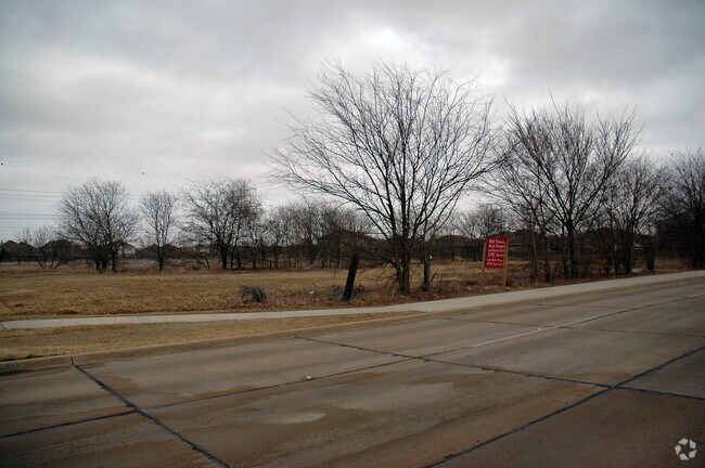
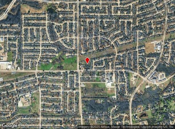
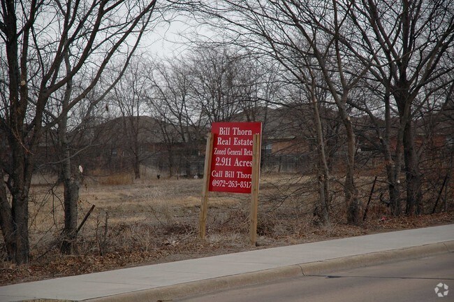
720 W Polo Rd
Dallas-Fort Worth-Arlington, TX
Thomas J Tone
65146024010110300
THOMAS J TONE ABST 1460 PG 240 TR 11.3 ACS 2.911 126803 SF INT202100083236 DD03222021 CO-DC 1460240101103 5CP14602401
Commercialacreage
Dallas
X
Texas
48439C0370L
2.91 AC
2023
Grand Prairie
2023
Dallas/Ft Worth
016415
DEMOGRAPHICS near 720 W Polo Rd
1 Mile
3 Mile
5 Mile
2024 Total Population
15,162
77,476
207,678
2029 Population
14,957
78,586
211,300
Pop Growth 2024-2029
(1.35%)
+ 1.43%
+ 1.74%
Average Age
37
37
35
2024 Total Households
4,854
24,751
66,224
HH Growth 2024-2029
(1.44%)
+ 1.39%
+ 1.74%
Median Household Inc
$105,381
$88,313
$71,733
Avg Household Size
3.10
3.00
3.00
2024 Avg HH Vehicles
2.00
2.00
2.00
Median Home Value
$262,386
$249,274
$232,424
Median Year Built
1996
1995
1990
Nearby Places
Map Layers
Map Styles
 Street
 Aerial
- Restaurants
- Banks
- Shops
- Fitness
- Groceries
PUBLIC TRANSPORTATION
AIRPORT
Dallas-Fort Worth International
DRIVE
WALK
Distance
Dallas-Fort Worth International
27 min
19.3 mi
Dallas Love Field
DRIVE
WALK
Distance
Dallas Love Field
34 min
22.3 mi
Freight Ports
Port of Shreveport
DRIVE
WALK
Distance
Port of Shreveport
225 min
210.1 mi
SALE & LEASE HISTORY
LISTING DATE
SALE/LEASE

Sep 24, 2016
For Sale
Mar 28, 2018
For Sale
Nearby Properties
Address
Land Use
TOTAL SIZE
Lot Size
Zoning
Address
Land Use
TOTAL SIZE
Lot Size
Zoning
456,473 SF
32.79 AC
Address
Land Use
TOTAL SIZE
Lot Size
Zoning
343,158 SF
18.42 AC
Z236
Address
Land Use
TOTAL SIZE
Lot Size
Zoning
485,300 SF
16.51 AC
Z312
Address
Land Use
TOTAL SIZE
Lot Size
Zoning
428,147 SF
14.45 AC
Z313
Address
Land Use
TOTAL SIZE
Lot Size
Zoning
368,004 SF
13.89 AC
Address
Land Use
TOTAL SIZE
Lot Size
Zoning
301,120 SF
14.23 AC
Z313
Address
Land Use
TOTAL SIZE
Lot Size
Zoning
875,800 SF
82.21 AC
Z239
Address
Land Use
TOTAL SIZE
Lot Size
Zoning
266,460 SF
12 AC
Z313
Address
Land Use
TOTAL SIZE
Lot Size
Zoning
478,110 SF
11.74 AC
Z313
Address
Land Use
TOTAL SIZE
Lot Size
Zoning
247,880 SF
20.93 AC
Z236
Address
Land Use
TOTAL SIZE
Lot Size
Zoning
206,650 SF
18.92 AC
Address
Land Use
TOTAL SIZE
Lot Size
Zoning
375,213 SF
17.77 AC
Address
Land Use
TOTAL SIZE
Lot Size
Zoning
298,234 SF
23.39 AC
Address
Land Use
TOTAL SIZE
Lot Size
Zoning
276,567 SF
14.52 AC
Z236
Address
Land Use
TOTAL SIZE
Lot Size
Zoning
315,359 SF
15 AC
Address
Land Use
TOTAL SIZE
Lot Size
Zoning
229,000 SF
8.01 AC
Address
Land Use
TOTAL SIZE
Lot Size
Zoning
387,500 SF
13.54 AC
Z313
Address
Land Use
TOTAL SIZE
Lot Size
Zoning
297,393 SF
13.83 AC
Z236
Address
Land Use
TOTAL SIZE
Lot Size
Zoning
252,800 SF
21.59 AC
Z236
Address
Land Use
TOTAL SIZE
Lot Size
Zoning
193,680 SF
8.25 AC
Address
Land Use
TOTAL SIZE
Lot Size
Zoning
272,000 SF
8.07 AC
Z313
Address
Land Use
TOTAL SIZE
Lot Size
Zoning
337,690 SF
20.71 AC
Address
Land Use
TOTAL SIZE
Lot Size
Zoning
214,047 SF
13.78 AC
Z236
Address
Land Use
TOTAL SIZE
Lot Size
Zoning
460,400 SF
28.09 AC
Z236
Address
Land Use
TOTAL SIZE
Lot Size
Zoning
239,050 SF
8.64 AC
Z313
Address
Land Use
TOTAL SIZE
Lot Size
Zoning
0.05 AC
Z109
Address
Land Use
TOTAL SIZE
Lot Size
Zoning
260,816 SF
11.52 AC
Address
Land Use
TOTAL SIZE
Lot Size
Zoning
175,484 SF
18.99 AC
Address
Land Use
TOTAL SIZE
Lot Size
Zoning
193,851 SF
8.48 AC
Z312
Address
Land Use
TOTAL SIZE
Lot Size
Zoning
165,539 SF
14.49 AC
The World's #1 Commercial Real Estate Marketplace
Connect with us
© 2025 CoStar Group
The information above has been obtained from sources believed reliable. While we do not doubt its accuracy we have not verified it and make no guarantee, warranty or representation about it. It is your responsibility to independently confirm its accuracy and completeness. Any projections, opinions, assumptions, or estimates used are for example only and do not represent the current or future performance of the property. The value of this transaction to you depends on tax and other factors which should be evaluated by your tax, financial, and legal advisors. You and your advisors should conduct a careful, independent investigation of the property to determine to your satisfaction the suitability of the property for your needs.