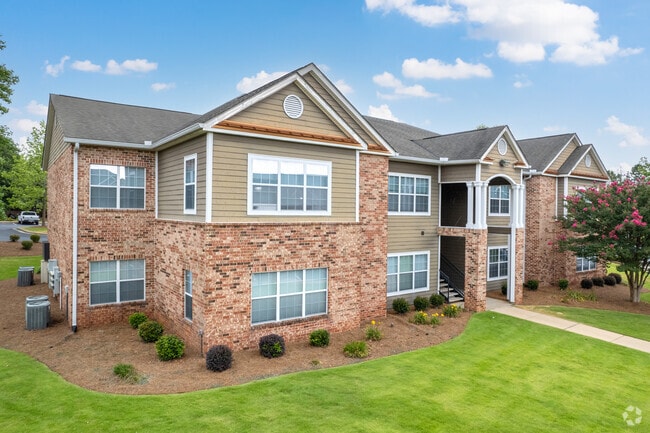
Property Record
7200 Blackmon Rd, Columbus, GA 31909

Property Detail
7200 Blackmon Rd
Columbus, GA-AL
PT LL 30 & 31 9TH DISTRICT
101-024-002
MUSCOGEE
Governmentalpublicusegeneral
Georgia
B and X Area of moderate flood hazard, usually the area between the limits of the 100-year and 500-year floods.
30&31
0
28.62 AC
2025
North Columbus
010205
Columbus GA
6,005 SF
NEARBY LISTINGS FOR SALE OR LEASE
-
-
View all Columbus listings for sale on LoopNet.com
DEMOGRAPHICS near 7200 Blackmon Rd
1 mile
3 mile
5 mile
2025 Total Population
6,397
34,988
78,258
2030 Population
6,198
33,612
75,595
Pop Growth 2025-2030
(3.11%)
(3.93%)
(3.40%)
Average Age
37
38
39
2025 Total Households
2,572
15,041
32,215
HH Growth 2025-2030
(3.03%)
(3.72%)
(3.28%)
Median Household Inc
$70,545
$62,783
$64,346
Avg Household Size
2.50
2.30
2.40
2025 Avg HH Vehicles
2.00
2.00
2.00
Median Home Value
$260,483
$247,544
$236,802
Median Year Built
1998
1991
1988
Nearby Places
Map Layers
Map Styles
 Street
 Aerial
Layers
 Traffic
 Biking
Places
Listings with unknown addresses are not visible on the map
- Restaurants
- Banks
- Shops
- Fitness
- Groceries
PUBLIC TRANSPORTATION
AIRPORT
Columbus
Drive
Walk
Distance
Columbus
12 min
5.0 mi
Freight Ports
Port of Panama City
Drive
Walk
Distance
Port of Panama City
250 min
195.8 mi
Nearby Properties
Address
Land Use
TOTAL SIZE
Lot Size
Zoning
Address
Land Use
TOTAL SIZE
Lot Size
Zoning
Address
Land Use
TOTAL SIZE
Lot Size
Zoning
4,030 SF
22.41 AC
Address
Land Use
TOTAL SIZE
Lot Size
Zoning
83,300 SF
72.37 AC
Address
Land Use
TOTAL SIZE
Lot Size
Zoning
134,620 SF
46.32 AC
Address
Land Use
TOTAL SIZE
Lot Size
Zoning
5,963 SF
23.90 AC
Address
Land Use
TOTAL SIZE
Lot Size
Zoning
6,032 SF
50.72 AC
Address
Land Use
TOTAL SIZE
Lot Size
Zoning
87,985 SF
38.53 AC
Address
Land Use
TOTAL SIZE
Lot Size
Zoning
6,162 SF
58.29 AC
Address
Land Use
TOTAL SIZE
Lot Size
Zoning
248,961 SF
35.15 AC
Address
Land Use
TOTAL SIZE
Lot Size
Zoning
Address
Land Use
TOTAL SIZE
Lot Size
Zoning
Address
Land Use
TOTAL SIZE
Lot Size
Zoning
413,817 SF
102.42 AC
Address
Land Use
TOTAL SIZE
Lot Size
Zoning
33.30 AC
Address
Land Use
TOTAL SIZE
Lot Size
Zoning
4,360 SF
25.18 AC
Address
Land Use
TOTAL SIZE
Lot Size
Zoning
5,708 SF
30 AC
Address
Land Use
TOTAL SIZE
Lot Size
Zoning
48,883 SF
7.76 AC
Address
Land Use
TOTAL SIZE
Lot Size
Zoning
8,829 SF
28.49 AC
Address
Land Use
TOTAL SIZE
Lot Size
Zoning
Address
Land Use
TOTAL SIZE
Lot Size
Zoning
52,756 SF
11.40 AC
Address
Land Use
TOTAL SIZE
Lot Size
Zoning
6,324 SF
26.40 AC
Address
Land Use
TOTAL SIZE
Lot Size
Zoning
5,766 SF
19.67 AC
Address
Land Use
TOTAL SIZE
Lot Size
Zoning
47,849 SF
22.26 AC
Address
Land Use
TOTAL SIZE
Lot Size
Zoning
1,887 SF
10.37 AC
Address
Land Use
TOTAL SIZE
Lot Size
Zoning
Address
Land Use
TOTAL SIZE
Lot Size
Zoning
200,045 SF
21.11 AC
Address
Land Use
TOTAL SIZE
Lot Size
Zoning
48,415 SF
9.53 AC
Address
Land Use
TOTAL SIZE
Lot Size
Zoning
5,859 SF
33.02 AC
Address
Land Use
TOTAL SIZE
Lot Size
Zoning
185.11 AC
Address
Land Use
TOTAL SIZE
Lot Size
Zoning
92,035 SF
22.71 AC
The World's #1 Commercial Real Estate Marketplace
Connect with us
© 2026 CoStar Group
The information above has been obtained from sources believed reliable. While we do not doubt its accuracy we have not verified it and make no guarantee, warranty or representation about it. It is your responsibility to independently confirm its accuracy and completeness. Any projections, opinions, assumptions, or estimates used are for example only and do not represent the current or future performance of the property. The value of this transaction to you depends on tax and other factors which should be evaluated by your tax, financial, and legal advisors. You and your advisors should conduct a careful, independent investigation of the property to determine to your satisfaction the suitability of the property for your needs.