Property Record
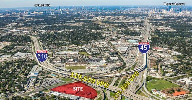
7200 Gulf Fwy, Houston, TX 77017


NEARBY LISTINGS FOR SALE OR LEASE
Property Detail
7200 Gulf Fwy
0410120000012
Abst 56 H B Prentiss
Vehiclerentalsvehiclesales
TR 8 ABST 56 H B PRENTISS
AE
Harris
48201C0885N
Texas
2024
3.74 AC
2025
Near Southeast
332900
Houston
78,250 SF
Houston-The Woodlands-Sugar Land, TX
DEMOGRAPHICS near 7200 Gulf Fwy
1 Mile
3 Mile
5 Mile
2024 Total Population
25,514
133,629
318,563
2029 Population
26,373
137,204
328,015
Pop Growth 2024-2029
+ 3.37%
+ 2.68%
+ 2.97%
Average Age
35
36
36
2024 Total Households
8,468
44,978
106,366
HH Growth 2024-2029
+ 3.53%
+ 2.77%
+ 3.11%
Median Household Inc
$38,974
$40,708
$41,103
Avg Household Size
2.90
2.90
2.80
2024 Avg HH Vehicles
2.00
2.00
2.00
Median Home Value
$142,776
$145,293
$147,240
Median Year Built
1968
1962
1961
Nearby Places
Map Layers
Map Styles
 Street
 Aerial
- Restaurants
- Banks
- Shops
- Fitness
- Groceries
PUBLIC TRANSPORTATION
COMMUTER RAIL
Houston (Sunset Limited - Amtrak)
DRIVE
WALK
Distance
Houston (Sunset Limited - Amtrak)
13 min
8.0 mi
AIRPORT
William P Hobby
DRIVE
WALK
Distance
William P Hobby
14 min
5.8 mi
George Bush Intcntl/Houston
DRIVE
WALK
Distance
George Bush Intcntl/Houston
35 min
27.7 mi
Freight Ports
Port of Houston
DRIVE
WALK
Distance
Port of Houston
12 min
6.0 mi
SALE & LEASE HISTORY
LISTING DATE
SALE/LEASE

Nov 01, 2019
For Sale
Nov 01, 2019
For Sale
Nov 01, 2019
For Sale
Nearby Properties
Address
Land Use
TOTAL SIZE
Lot Size
Zoning
Address
Land Use
TOTAL SIZE
Lot Size
Zoning
65.22 AC
Address
Land Use
TOTAL SIZE
Lot Size
Zoning
256.70 AC
Address
Land Use
TOTAL SIZE
Lot Size
Zoning
108.84 AC
Address
Land Use
TOTAL SIZE
Lot Size
Zoning
4.26 AC
Address
Land Use
TOTAL SIZE
Lot Size
Zoning
453,987 SF
4.33 AC
Address
Land Use
TOTAL SIZE
Lot Size
Zoning
2,275,058 SF
24.47 AC
Address
Land Use
TOTAL SIZE
Lot Size
Zoning
403,242 SF
46.18 AC
Address
Land Use
TOTAL SIZE
Lot Size
Zoning
1,171,276 SF
44.19 AC
Address
Land Use
TOTAL SIZE
Lot Size
Zoning
115.83 AC
Address
Land Use
TOTAL SIZE
Lot Size
Zoning
389,108 SF
37.39 AC
Address
Land Use
TOTAL SIZE
Lot Size
Zoning
198,023 SF
17.87 AC
Address
Land Use
TOTAL SIZE
Lot Size
Zoning
33.97 AC
Address
Land Use
TOTAL SIZE
Lot Size
Zoning
504,018 SF
37.16 AC
Address
Land Use
TOTAL SIZE
Lot Size
Zoning
419,760 SF
15.27 AC
Address
Land Use
TOTAL SIZE
Lot Size
Zoning
261.10 AC
Address
Land Use
TOTAL SIZE
Lot Size
Zoning
107.07 AC
Address
Land Use
TOTAL SIZE
Lot Size
Zoning
985,528 SF
22.64 AC
Address
Land Use
TOTAL SIZE
Lot Size
Zoning
232,915 SF
7.89 AC
Address
Land Use
TOTAL SIZE
Lot Size
Zoning
260,972 SF
23.45 AC
Address
Land Use
TOTAL SIZE
Lot Size
Zoning
267,844 SF
10.98 AC
Address
Land Use
TOTAL SIZE
Lot Size
Zoning
194,296 SF
15.13 AC
Address
Land Use
TOTAL SIZE
Lot Size
Zoning
210,476 SF
9.60 AC
Address
Land Use
TOTAL SIZE
Lot Size
Zoning
224,084 SF
72.45 AC
Address
Land Use
TOTAL SIZE
Lot Size
Zoning
308,748 SF
11.34 AC
Address
Land Use
TOTAL SIZE
Lot Size
Zoning
113,688 SF
4 AC
Address
Land Use
TOTAL SIZE
Lot Size
Zoning
257,481 SF
9.28 AC
Address
Land Use
TOTAL SIZE
Lot Size
Zoning
78,073 SF
5.45 AC
Address
Land Use
TOTAL SIZE
Lot Size
Zoning
228,900 SF
3.85 AC
Address
Land Use
TOTAL SIZE
Lot Size
Zoning
244,134 SF
9.44 AC
Address
Land Use
TOTAL SIZE
Lot Size
Zoning
241,999 SF
8.46 AC
The World's #1 Commercial Real Estate Marketplace
Connect with us
© 2025 CoStar Group
The information above has been obtained from sources believed reliable. While we do not doubt its accuracy we have not verified it and make no guarantee, warranty or representation about it. It is your responsibility to independently confirm its accuracy and completeness. Any projections, opinions, assumptions, or estimates used are for example only and do not represent the current or future performance of the property. The value of this transaction to you depends on tax and other factors which should be evaluated by your tax, financial, and legal advisors. You and your advisors should conduct a careful, independent investigation of the property to determine to your satisfaction the suitability of the property for your needs.